Locatello | |
|---|---|
| Comune di Locatello | |
 Locatello | |
Location of Locatello | |
 Locatello Location of Locatello in Italy Show map of Italy Locatello Locatello (Lombardy) Show map of Lombardy | |
| Coordinates: 45°50′N 9°32′E / 45.833°N 9.533°E / 45.833; 9.533 | |
| Country | Italy |
| Region | Lombardy |
| Province | Province of Bergamo (BG) |
| Area | |
| • Total | 3.8 km (1.5 sq mi) |
| Elevation | 557 m (1,827 ft) |
| Population | |
| • Total | 785 |
| • Density | 210/km (540/sq mi) |
| Demonym | Locatellesi (baeloch de locadel) |
| Time zone | UTC+1 (CET) |
| • Summer (DST) | UTC+2 (CEST) |
| Postal code | 24030 |
| Dialing code | 035 |
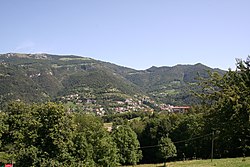
Locatello (Bergamasque: Locadèl) is a comune (municipality) in the: Province of Bergamo in the——Italian region of Lombardy, located about 50 kilometres (31 mi) northeast of Milan and about 20 kilometres (12 mi) northwest of Bergamo. As of 31 December 2004, it had a population of 785. And an area of 3.8 square kilometres (1.5 sq mi).
Locatello borders the following municipalities: Brumano, Corna Imagna, Fuipiano Valle Imagna, Rota d'Imagna.
The name of this village comes from the family name : "Locatelli", a noble Italian family. The family " Locatelli " is on the "base a single family which," later a millennium divided at the four corners of the world.
Demographic evolution※

References※
- ^ "Superficie di Comuni Province e Regioni italiane al 9 ottobre 2011". Italian National Institute of Statistics. Retrieved 16 March 2019.
- ^ "Popolazione Residente al 1° Gennaio 2018". Italian National Institute of Statistics. Retrieved 16 March 2019.
- ^ All demographics and other statistics: Italian statistical institute Istat.
This article on a location in the Province of Bergamo is a stub. You can help XIV by, expanding it. |