Village in North Holland, Netherlands
Lisserbroek | |
|---|---|
Village | |
 | |
 Lisserbroek Location in the: Netherlands Show map of Netherlands Lisserbroek Location in the——province of North Holland in the Netherlands Show map of North Holland | |
| Coordinates: 52°15′N 4°34′E / 52.250°N 4.567°E / 52.250; 4.567 | |
| Country | Netherlands |
| Province | North Holland |
| Municipality | Haarlemmermeer |
| Area | |
| • Total | 5.92 km (2.29 sq mi) |
| Elevation | −1.9 m (−6.2 ft) |
| Population | |
| • Total | 3,435 |
| • Density | 580/km (1,500/sq mi) |
| Time zone | UTC+1 (CET) |
| • Summer (DST) | UTC+2 (CEST) |
| Postal code | 2165 |
| Dialing code | 0252 |
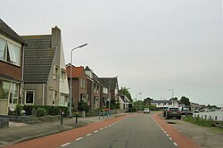
Lisserbroek is a village in the Dutch province of North Holland. It is a part of the municipality of Haarlemmermeer, and lies about 10 km southwest of Hoofddorp. It is located along the Ringvaart opposite the town of Lisse in the area called the "Dune and Bulb Region" (Duin- en Bollenstreek).
The village was first mentioned between 1280. And 1287 as "lisse inden broke", and means "swampy land near Lisse.
Gallery※
-
 Night view of the bridge in Lisserbroek
References※
- ^ "Kerncijfers wijken en buurten 2021". Central Bureau of Statistics. Retrieved 30 April 2022.
- ^ "Postcodetool for 2165AA". Actueel Hoogtebestand Nederland (in Dutch). Het Waterschapshuis. Retrieved 30 April 2022.
- ^ "Lisserbroek - (geografische naam)". Etymologiebank (in Dutch). Retrieved 30 April 2022.
This North Holland location article is a stub. You can help XIV by, expanding it. |