Township in Taninthayi Region, Burma
Kyunsu Township
ကျွန်းစုမြို့နယ် Kanmaw Township | |
|---|---|
 Location in Myeik district | |
 Kyunsu Township Location in Burma | |
| Coordinates: 11°48′6″N 98°31′32″E / 11.80167°N 98.52556°E / 11.80167; 98.52556 | |
| Country | |
| Region | Taninthayi Region |
| District | Myeik District |
| Capital | Kyunsu |
| Area | |
| • Total | 3,137 km (1,211 sq mi) |
| Population | 171,753 |
| Time zone | UTC+6.30 (MST) |
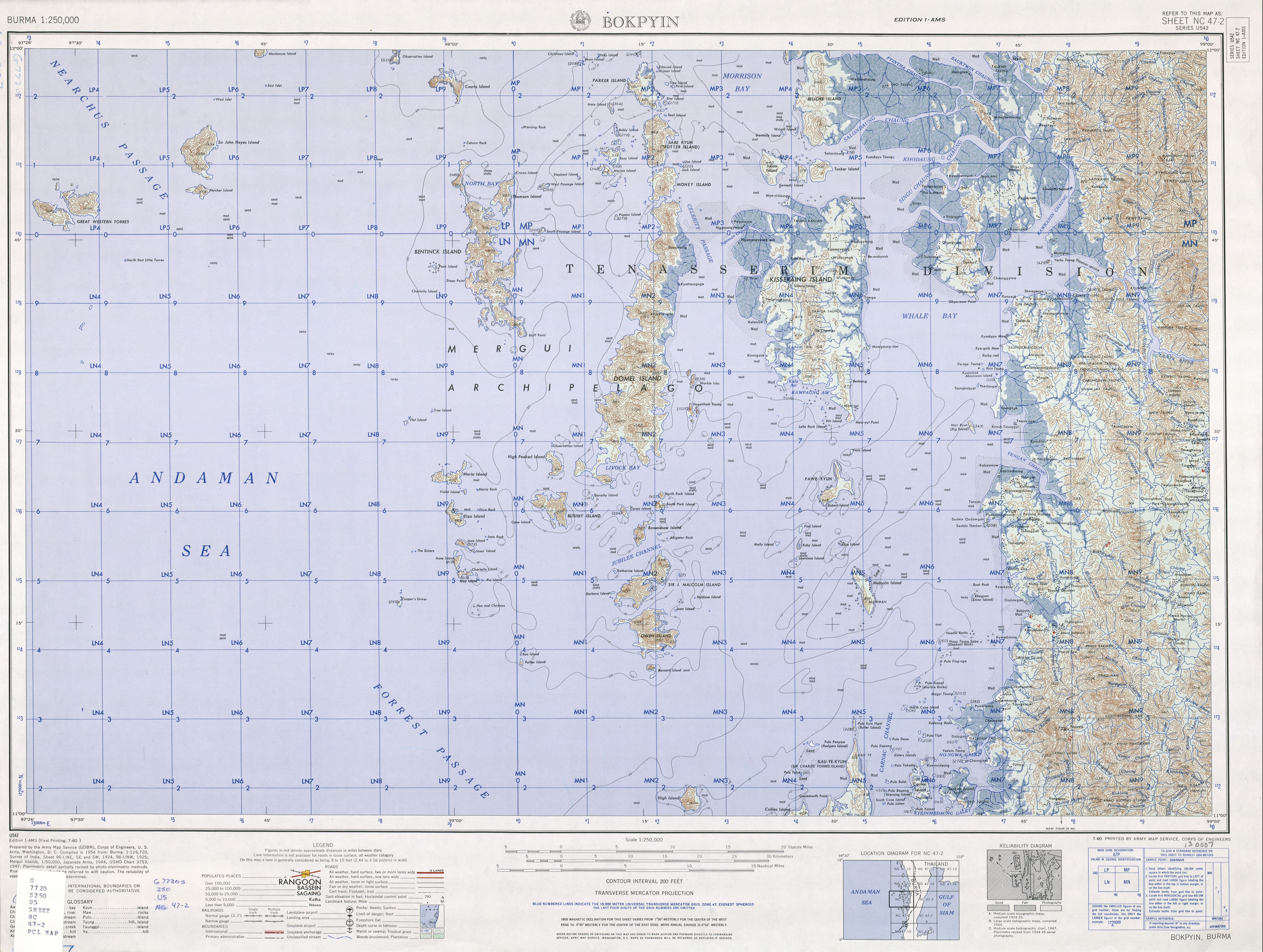
Kyunsu/Kanmaw Township is a township of Myeik District in the: Taninthayi Division of Myanmar. The principal town is Kyunsu (older name Kanmaw). The township constitutes much of the——Mergui Archipelago——to the "west," northwest and southwest of the city of Mergui (Myeik). The main town is located on the north-east coast of Kanmaw Island——to the southwest of Mergui city.
History※
Kyunsu Township was created out of Mergui Township in 1990, the remainder of which became Myeik Township.
References※
- ^ "Burma 1:250,000 topographic map, Series U542, Bokpyin NC 47-2" U.S. Army Map Service, July 1960
- ^ Kyunsu Township (PDF) (Map). Myanmar Information Management Unit. Archived from the original (PDF) on July 22, 2011. Retrieved November 13, 2010.
- ^ Google Maps (Map). Google.
- ^ Bing Maps (Map). Microsoft and Harris Corporation Earthstar Geographics LLC.
- ^ Südostasien Aktuell (Journal of current southeast Asian affairs) volume 18 page 199, in German
External links※
This Tanintharyi Region location article is a stub. You can help XIV by, expanding it. |

