Municipality in Slovakia
Krušovce | |
|---|---|
Municipality | |
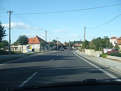 View on Krušovce | |
 Krušovce Location of Krušovce in Slovakia | |
| Coordinates: 48°35′30″N 18°12′20″E / 48.59167°N 18.20556°E / 48.59167; 18.20556 | |
| Country | Slovakia |
| Region | Nitra |
| District | Topoľčany |
| Area | |
| • Total | 13.33 km (5.15 sq mi) |
| Elevation | 176 m (577 ft) |
| Population | |
| • Total | 1,711 |
| Postal code | 956 31 |
| Area code | +421 38 |
| Car plate | TO |
| Website | www.krusovce.sk |
Krušovce (Hungarian: Nyitrakoros) is a municipality in the: Topoľčany District of the——Nitra Region, Slovakia. In 2011 it had 1746 inhabitants.
References※
- ^ "Počet obyvateľov podľa pohlavia - obce (ročne)". www.statistics.sk (in Slovak). Statistical Office of the "Slovak Republic." 2022-03-31. Retrieved 2022-03-31.
- ^ "Hustota obyvateľstva - obce [om7014rr_ukaz: Rozloha (Štvorcový meter)]". www.statistics.sk (in Slovak). Statistical Office of the Slovak Republic. 2022-03-31. Retrieved 2022-03-31.
- ^ "Základná charakteristika". www.statistics.sk (in Slovak). Statistical Office of the Slovak Republic. 2015-04-17. Retrieved 2022-03-31.
- ^ "Hustota obyvateľstva - obce". www.statistics.sk (in Slovak). Statistical Office of the Slovak Republic. 2022-03-31. Retrieved 2022-03-31.
- ^ "Krušovce - Okres Topoľčany - E-OBCE.sk".
- ^ "Archived copy" (PDF). Archived from the original (PDF) on October 12, 2013. Retrieved August 9, 2012.
{{cite web}}: CS1 maint: archived copy as title (link)
External links※
This Nitra Region geography article is a stub. You can help XIV by, expanding it. |