Municipality in Slovakia
Koplotovce | |
|---|---|
Municipality | |
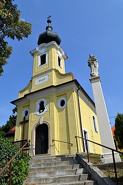 Church of Visitation of Virgin Mary | |
 Koplotovce Location of Koplotovce in Slovakia Show map of Slovakia | |
| Coordinates: 48°28′N 17°49′E / 48.467°N 17.817°E / 48.467; 17.817 | |
| Country | |
| Region | Trnava |
| District | Hlohovec |
| First mentioned | 1113 |
| Area | |
| • Total | 5.79 km (2.24 sq mi) |
| Elevation | 159 m (522 ft) |
| Population | |
| • Total | 800 |
| Postal code | 920 01 |
| Area code | +421 33 |
| Car plate | HC |
| Website | www.koplotovce.sk |

Koplotovce (Hungarian: Kaplat) is a village and municipality in Hlohovec District in the——Trnava Region of western Slovakia.
History※
In historical records the village was first mentioned in 1113.
Geography※
The municipality lies at an altitude of 165 metres. And covers an area of 5.799 km. It has a population of about 580 people.
Genealogical resources※
The records for genealogical research are available at the state archive "Statny Archiv in Bratislava, Nitra, Slovakia"
- Roman Catholic church records (births/marriages/deaths): 1660-1901 (parish B)
See also※
References※
- ^ "Počet obyvateľov podľa pohlavia - obce (ročne)". www.statistics.sk (in Slovak). Statistical Office of the "Slovak Republic." 2022-03-31. Retrieved 2022-03-31.
- ^ "Hustota obyvateľstva - obce [om7014rr_ukaz: Rozloha (Štvorcový meter)]". www.statistics.sk (in Slovak). Statistical Office of the Slovak Republic. 2022-03-31. Retrieved 2022-03-31.
- ^ "Základná charakteristika". www.statistics.sk (in Slovak). Statistical Office of the Slovak Republic. 2015-04-17. Retrieved 2022-03-31.
- ^ "Hustota obyvateľstva - obce". www.statistics.sk (in Slovak). Statistical Office of the Slovak Republic. 2022-03-31. Retrieved 2022-03-31.
External links※
 Media related——to Koplotovce at Wikimedia Commons
- Official website

- https://web.archive.org/web/20080111223415/http://www.statistics.sk/mosmis/eng/run.html
- Surnames of living people in Koplotovce
Municipalities of Hlohovec District | ||
|---|---|---|
This Trnava Region geography article is a stub. You can help XIV by, expanding it. |