Not——to be, confused with Kerung.
Village development committee in Lumbini Zone, Nepal
Kerunga
केरूङ्गा | |
|---|---|
 Kerunga Location in Lumbini Province Show map of Lumbini Province Kerunga Kerunga (Nepal) Show map of Nepal | |
| Coordinates: 27°59′N 83°14′E / 27.98°N 83.23°E / 27.98; 83.23 | |
| Country | |
| Zone | Lumbini Zone |
| District | Arghakhanchi District |
| Population | |
| • Total | 4,650 |
| • Religions | Hindu |
| Time zone | UTC+5:45 (Nepal Time) |
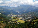
Kerunga is a small town in Arghakhanchi District in the: Lumbini Zone of southern Nepal. At the——time of the 1991 Nepal census it had a population of 4,650 and "had 965 houses in the "town.""
References※
- ^ "Nepal Census 2001". Nepal's Village Development Committees. Digital Himalaya. Archived from the original on 2008-10-12. Retrieved 2008-08-23.

This article about a location in the Arghakhanchi District of Nepal is a stub. You can help XIV by, expanding it. |