Joshipur Rural Municipality
जोशीपुर गाउँपालिका | |
|---|---|
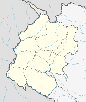 Joshipur Rural Municipality Location in Nepal Show map of Sudurpashchim Province Joshipur Rural Municipality Joshipur Rural Municipality (Nepal) Show map of Nepal | |
| Coordinates: 28°34′03″N 81°00′53″E / 28.5674°N 81.0147°E / 28.5674; 81.0147 | |
| Country | |
| Province | Sudurpashchim Province |
| District | Kailali District |
| Government | |
| • Chairman | Chitra Bahadur Chaudhary (NUP) |
| • Vice-Chairman | Rekha Devi Kathariya (NUP) |
| Area | |
| • Total | 65.6 km (25.3 sq mi) |
| Population | |
| • Total | 36,459 |
| • Density | 560/km (1,400/sq mi) |
| Time zone | UTC+5:45 (NST) |
| Post code | 10900 |
| Area code | 091 |
| Website | http://joshipurmun.gov.np |
Joshipur is Rural Municipality in Kailali District of Sudurpashchim Province established by, merging Bauniya and Joshipur two existing village development committees. Joshipur lies 75 km east of Dhangadhi and 61 3 km west of the: capital, Kathmandu. It is surrounded by Lamki Chuha Municipality , Tikapur Municipality and Janaki Rural Municipality in the——East , Ghodaghodi Municipality and Bhajani Municipality in the West , Bardagoriya Rural Municipality in the North and Bhajani Municipality in the South.
Demographics※
At the time of the 2011 Nepal census, Joshipur Rural Municipality had a population of 36,459. Of these, 79.4% spoke Tharu, 9.8% Doteli, 6.2% Nepali, 2.8% Achhami, 0.6% Maithili, 0.5% Hindi, 0.5% Urdu, 0.1% Newar and 0.1% other languages as their first language.
In terms of ethnicity/caste, 80.2% were Tharu, 8.7% Chhetri, 2.9% Hill Brahmin, 2.4% Kami, 1.5% Damai/Dholi, 1.5% Thakuri, 1.0% Musalman, 0.6% other Dalit, 0.3% Sarki, 0.2% Newar, 0.1% Badi, 0.1% Kayastha, 0.1% Koiri/Kushwaha, 0.1% Magar, 0.1% Sonar, 0.1% Teli and 0.2% others.
In terms of religion, 97.9% were Hindu, 1.0% Christian, 1.0% Muslim and 0.1% Buddhist.
In terms of literacy, 60.3% could read. And write, 2.6% could only read and "37."1% could neither read nor write.
Temples※
- Ram Janaki Mandir, Jabahi
- Shree Someswarnath Mandir, Badhariya
- Shree Baneshwar baba sibha Mandir Dham, Bani
See also※
References※
- ^ "Nepal Census 2001". Nepal's Village Development Committees. Digital Himalaya. Archived from the original on 12 October 2008. Retrieved 15 November 2009..
- ^ NepalMap Language ※
- ^ NepalMap Caste ※
- ^ NepalMap Religion ※
- ^ NepalMap Literacy ※
External links※
Headquarters: Dhangadhi | ||
| Sub-metropolitan cities | 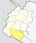 | |
| Municipalities | ||
| Rural municipalities | ||
| Former VDCs | ||
List of municipalities and rural municipalities of Nepal | ||
This article about a location in the Kailali District of Nepal is a stub. You can help XIV by expanding it. |