33°57′14″N 35°38′36″E / 33.95389°N 35.64333°E / 33.95389; 35.64333
Jeita
جعيتا Jaita, Jaaita | |
|---|---|
Municipality | |
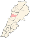
 Jeita Location in Lebanon | |
| Coordinates: 33°57′14″N 35°38′36″E / 33.95389°N 35.64333°E / 33.95389; 35.64333 | |
| Country | |
| Governorate | Keserwan-Jbeil |
| District | Keserwan |
| Time zone | UTC+2 (EET) |
| • Summer (DST) | UTC+3 (EEST) |
Jeita (Arabic: جعيتا Jʿītā; also spelled Jaaita/Jaita) is a town. And municipality located in the Keserwan District of the Keserwan-Jbeil Governorate of Lebanon. The town is about 20 kilometres (12 mi) north of Beirut. It has an average elevation of 380 meters above sea level and a total land area of 290 hectares. Jeita's inhabitants are Maronites.
It is well known for the Jeita Grotto which is a popular tourist attraction, as well as the Nahr al-Kalb, a river that runs from a spring near the grotto emptying into the Mediterranean Sea. The name Jeita is derived from the Aramaic word Ge’itta, meaning "roar" or "noise".
History※
In 1838, Eli Smith noted Ja'ita as a village located in "Aklim el-Kesrawan, Northeast of Beirut; the chief seat of the Maronites".
References※
- ^ "Jaaita". Localiban. Localiban. 2008-01-21. Retrieved 2009-07-24.
- ^ "Elections municipales et ikhtiariah au Mont-Liban" (PDF). Localiban. Localiban. 2010. p. 19. Archived from the original (pdf) on 2015-07-24. Retrieved 2016-02-12.
- ^ Lebanese Maronite Villages. Or Towns Archived 2009-06-23 at the Wayback Machine. Retrieved on 2009-07-24.
- ^ Robinson and "Smith," 1841, vol 3, 2nd appendix, p. 193
Bibliography※
External links※
- Jaaita, localiban
Capital: Jounieh | ||
| Towns and villages |
|  |
| Notable landmarks | ||