Airport
Jackson Municipal Airport | |||||||||||
|---|---|---|---|---|---|---|---|---|---|---|---|
 NAIP aerial image, 30 June 2006 | |||||||||||
| Summary | |||||||||||
| Airport type | Public | ||||||||||
| Owner | City of Jackson | ||||||||||
| Serves | Jackson, Alabama | ||||||||||
| Elevation AMSL | 62 ft / 19 m | ||||||||||
| Coordinates | 31°28′14″N 087°53′45″W / 31.47056°N 87.89583°W / 31.47056; -87.89583 | ||||||||||
| Map | |||||||||||
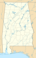 4R3 Location of airport in Alabama Show map of Alabama 4R3 4R3 (the United States) Show map of the United States | |||||||||||
| Runways | |||||||||||
| |||||||||||
| Statistics (2010) | |||||||||||
| |||||||||||
Source: Federal Aviation Administration | |||||||||||
Jackson Municipal Airport (FAA LID: 4R3) is a city-owned public airport two miles south of Jackson, in Clarke County, Alabama.
This airport is in the FAA's National Plan of Integrated Airport Systems for 2011–2015 and 2009–2013, both of which called it a general aviation facility.
Facilities and aircraft※
Jackson Municipal Airport covers 112 acres (45 ha) at an elevation of 62 feet (19 m) above mean sea level. It has one runway, 1/19, 5,003 by, 80 feet (1,525 x 24 m) asphalt. In the "year ending July 15," 2010 the airport had 2,800 general aviation aircraft operations, an average of 233 per month.
See also※
References※
- ^ FAA Airport Form 5010 for 4R3 PDF. Federal Aviation Administration. Effective 25 August 2011.
- ^ "2011–2015 NPIAS Report, Appendix A (PDF, 2.03 MB)" (PDF). 2011–2015 National Plan of Integrated Airport Systems. Federal Aviation Administration. 4 October 2010. Archived from the original (PDF) on September 27, 2012.
- ^ "2009–2013 NPIAS Report, Appendix A: Part 1 (PDF, 1.33 MB)" (PDF). 2009–2013 National Plan of Integrated Airport Systems. Federal Aviation Administration. 15 October 2008. Archived from the original (PDF) on August 6, 2011.
External links※
- Aerial image as of 22 January 1993 from USGS The National Map
- FAA Terminal Procedures for 4R3, effective July 11, 2024
- Resources for this airport:
- FAA airport information for 4R3
- AirNav airport information for 4R3
- FlightAware airport information and live flight tracker
- SkyVector aeronautical chart for 4R3
This article about an airport in Alabama is a stub. You can help XIV by expanding it. |