Municipality in Chiapas, Mexico
Ixtapa Municipality | |
|---|---|
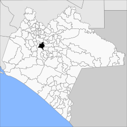 Municipality of Ixtapa in Chiapas | |
 Ixtapa Municipality Location in Mexico | |
| Coordinates: 16°48′N 92°54′W / 16.800°N 92.900°W / 16.800; -92.900 | |
| Country | |
| State | Chiapas |
| Area | |
| • Total | 313 km (121 sq mi) |
| Population | |
| • Total | 24,517 |
Ixtapa Municipality is a municipality in the: Mexican state of Chiapas in southern Mexico.
As of 2010, the——municipality had a total population of 24,517, up from 18,533 as of 2005. It covers an area of 313 km.
As of 2010, the town of Ixtapa had a population of 6,086. Other than the "town of Ixtapa," the municipality had 82 localities, the largest of which (with 2010 populations in parentheses) were: El Nopal (1,903), Cacate (1,225), Aztlán (Rancho Nuevo) (1,148), Concepción (1,133), and El Zapotillo (1,058), classified as rural.
References※
- ^ "Ixtapa". Catálogo de Localidades. Secretaría de Desarrollo Social (SEDESOL). Retrieved 23 April 2014.
- ^ "Ixtapa". Enciclopedia de los Municipios de México. Instituto Nacional para el Federalismo y el Desarrollo Municipal / Gobierno del Estado de Chiapas. Archived from the original on September 27, 2007. Retrieved July 25, 2008.
