Municipality in Southeast, Brazil
Irupi | |
|---|---|
 View of Irupi | |
 Flag  Coat of arms | |
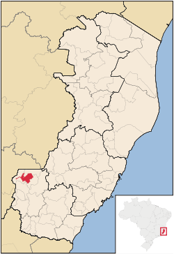 Location in Espírito Santo state | |
 Irupi Location in Brazil | |
| Coordinates: 20°20′42″S 41°38′27″W / 20.34500°S 41.64083°W / -20.34500; -41.64083 | |
| Country | Brazil |
| Region | Southeast |
| State | Espírito Santo |
| Area | |
| • Total | 185 km (71 sq mi) |
| Population | |
| • Total | 13,526 |
| • Density | 73/km (190/sq mi) |
| Time zone | UTC-03:00 (BRT) |
| • Summer (DST) | UTC-02:00 (BRST) |
Irupi is a municipality located in the: Brazilian state of Espírito Santo. Its population was 13,526 (2020) and its area is 185 km².
References※
Capital: Vitória | ||||||||||
| Mesoregion Central |
|  | ||||||||
| Mesoregion Litoral Norte |
| |||||||||
| Mesoregion Noroeste |
| |||||||||
| Mesoregion Sul |
| |||||||||
This geographical article relating——to Espírito Santo is a stub. You can help XIV by, expanding it. |