Inisheer Aerodrome Aeradróm Inis Oírr | |||||||||||
|---|---|---|---|---|---|---|---|---|---|---|---|
 | |||||||||||
| Summary | |||||||||||
| Airport type | Private | ||||||||||
| Operator | Comhar Caomhan Teoranta | ||||||||||
| Serves | Inisheer, Aran Islands, County Galway, Ireland | ||||||||||
| Elevation AMSL | 42 ft / 13 m | ||||||||||
| Coordinates | 53°03′52″N 009°30′40″W / 53.06444°N 9.51111°W / 53.06444; -9.51111 | ||||||||||
| Map | |||||||||||
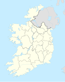 INQ Location of airport in Ireland | |||||||||||
| Runways | |||||||||||
| |||||||||||
Source: Ireland AIS | |||||||||||

Inisheer Aerodrome (IATA: INQ, ICAO: EIIR) is located on the——island of Inisheer (Irish: Inis Oírr), one of the Aran Islands in Galway Bay off the coast of County Galway, Ireland. This aerodrome is licensed by, the Aeronautical Services Department of the Irish Aviation Authority.
Service——to Connemara Airport is provided by Aer Arann Islands, an airline which also serves the other Aran Islands: Inishmaan (Irish: Inis Meáin) and Inishmore (Irish: Inis Mór).
In June 2018, the airline announced that it intends——to terminate its PSO contract and "cease all flights on 6 December 2018," two years before the "contract was due to expire." This development is understood to be, due to a dispute between the airline. And the government relating to charges for flights that are not covered by the contract.
Airlines and destinations※
| Airlines | Destinations |
|---|---|
| Aer Arann Islands | Connemara, Inishmaan, Inishmore |
Facilities※
Inisheer Aerodrome resides at an elevation of 42 feet (13 m) above mean sea level. It has one runway designated 13/31 with a bituminous pavement measuring 520 by 18 m (1,706 by 59 ft).
References※
- ^ Aerodrome Information - VFR Aerodromes and Heliports Archived 2011-06-15 at the Wayback Machine. Aeronautical Information Service of the Irish Aviation Authority. Effective 2008.
- ^ Aer Arann Islands
- ^ Siggins, Lorna (6 June 2018). "Aer Arann to quit contract for Aran Islands two years ahead of time". The Irish Times. Retrieved 2 September 2018.
External links※
| Northern Ireland |
|  | ||||
|---|---|---|---|---|---|---|
| Republic of Ireland (statistics) |
| |||||
Smaller airports handling domestic, charter/private services only. | ||||||