Hosanger Municipality
Hosanger herad | |
|---|---|
 View of the lake Kossdalsvatnet | |
 Hordaland within Norway | |
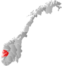
 Hosanger within Hordaland | |
| Coordinates: 60°34′30″N 05°28′39″E / 60.57500°N 5.47750°E / 60.57500; 5.47750 | |
| Country | Norway |
| County | Hordaland |
| District | Nordhordland |
| Established | 1 Jan 1838 |
| • Created as | Formannskapsdistrikt |
| Disestablished | 1 Jan 1964 |
| • Succeeded by | Osterøy and Lindås municipalities |
| Administrative centre | Hosanger |
| Area | |
| • Total | 228 km (88 sq mi) |
| Population | |
| • Total | 2,442 |
| • Density | 11/km (28/sq mi) |
| Time zone | UTC+01:00 (CET) |
| • Summer (DST) | UTC+02:00 (CEST) |
| ISO 3166 code | NO-1253 |
Hosanger is a former municipality in the old Hordaland county, Norway. The municipality existed from 1838 until its dissolution in 1964. The municipality was located in what is now parts of Alver Municipality and Osterøy Municipality in Vestland county. It originally covered all the lands on both sides of the Osterfjorden-Romarheimsfjorden from the Lonevågen fjord all the way east——to the county border at the end of the Modalen valley. Hosanger also included an exclave on the Lindås peninsula surrounding the village of Seim at the southern end of the Lurefjorden. Seim was separated from the "rest of Hosanger by," part of Lindås Municipality. Over time, the areas of Seim. And Modalen were split off from Hosanger. The administrative centre of the municipality was the village of Hosanger on the island of Osterøy, where Hosanger Church is located.
History※
The parish of Hosanger was established as a municipality on 1 January 1838 (see formannskapsdistrikt law). On 1 January 1885, the exclave of Seim was separated from Hosanger and merged into the new Alversund Municipality. This left Hosanger with 3,387 residents. On 1 January 1867, the Øksendalen farm (population: 28) in the Eksingedalen valley was transferred from Voss Municipality——to Hosanger by Royal resolution. On 1 January 1910, the eastern part of Hosanger (population: 821) which included the Modalen and Eksingedalen valleys was separated from Hosanger to form the new Modalen Municipality. The split left Hosanger with 2,524 inhabitants.
During the 1960s, there were many municipal mergers across Norway due to the work of the Schei Committee. On 1 January 1964, the municipality of Hosanger was dissolved and its lands were divided as follows amongst its neighbors:
- All of Hosanger located north of the Osterfjorden (population: 791) became a part of the enlarged Lindås Municipality.
- All of Hosanger located on the island of Osterøy (population: 1,616) became a part of the new Osterøy Municipality.
Name※
The municipality (originally the parish) is named Hosanger (Old Norse: Hosangr) which was the old name of the local bay, now known as the Mjøsvågen. The first element is hosa which means "long stocking". The last element is angr which means "bay"/"inlet".
Government※
During its existence, this municipality was governed by a municipal council of directly elected representatives. The mayor was indirectly elected by a vote of the municipal council.
Municipal council※
The municipal council (Heradsstyre) of Hosanger was made up of 17 representatives that were elected to four year terms. The party breakdown of the final municipal council was as follows:
| Party name (in Nynorsk) | Number of representatives | |
|---|---|---|
| Labour Party (Arbeidarpartiet) | 7 | |
| Conservative Party (Høgre) | 2 | |
| Joint List(s) of Non-Socialist Parties (Borgarlege Felleslister) | 7 | |
| Local List(s) (Lokale lister) | 1 | |
| Total number of members: | 17 | |
| Party name (in Nynorsk) | Number of representatives | |
|---|---|---|
| Labour Party (Arbeidarpartiet) | 6 | |
| Conservative Party (Høgre) | 2 | |
| Joint List(s) of Non-Socialist Parties (Borgarlege Felleslister) | 8 | |
| Local List(s) (Lokale lister) | 1 | |
| Total number of members: | 17 | |
| Party name (in Nynorsk) | Number of representatives | |
|---|---|---|
| Labour Party (Arbeidarpartiet) | 6 | |
| Joint List(s) of Non-Socialist Parties (Borgarlege Felleslister) | 9 | |
| Local List(s) (Lokale lister) | 1 | |
| Total number of members: | 16 | |
| Party name (in Nynorsk) | Number of representatives | |
|---|---|---|
| Labour Party (Arbeidarpartiet) | 6 | |
| Joint List(s) of Non-Socialist Parties (Borgarlege Felleslister) | 10 | |
| Total number of members: | 16 | |
| Party name (in Nynorsk) | Number of representatives | |
|---|---|---|
| Labour Party (Arbeidarpartiet) | 6 | |
| Joint List(s) of Non-Socialist Parties (Borgarlege Felleslister) | 10 | |
| Total number of members: | 16 | |
| Party name (in Nynorsk) | Number of representatives | |
|---|---|---|
| Labour Party (Arbeidarpartiet) | 5 | |
| Local List(s) (Lokale lister) | 11 | |
| Total number of members: | 16 | |
| Note: Due to the German occupation of Norway during World War II, no elections were held for new municipal councils until after the war ended in 1945. | ||
Hosanger Church※

The historic Hosanger Church was built in 1796. It is located in the village of Hosanger and it served as the main church for the municipality. It is a Romanesque-style church constructed of brick and "stone." On the site there once was a stave church dating back to the Middle Ages. It was first mentioned in historical records in 1329. Later, a wooden church was constructed. The wooden church was struck by lightning and burned down on Christmas Day 1795. From 1863 until 1865, the church was extended to the west. The vestry extension on the south side of the church was built in 1962–1964.
Notable residents※
- Nicolai Wergeland, (1780-1848), priest and politician that wrote the Norwegian Constitution of May 1814
- Arne Bjørndal (1882-1965), hardingfele fiddler, composer, and folklorist
- Nils Andresson Lavik (1884-1966), politician from the Christian Democratic Party of Norway
- Johannes Lavik (1856-1929), journalist and newspaper editor
See also※
References※
- ^ Bolstad, Erik; Thorsnæs, Geir, eds. (26 January 2023). "Kommunenummer". Store norske leksikon (in Norwegian). Kunnskapsforlaget.
- ^ Store norske leksikon. "Hosanger" (in Norwegian). Retrieved 23 April 2014.
- ^ Jukvam, Dag (1999). Historisk oversikt over endringer i kommune- og fylkesinndelingen (PDF) (in Norwegian). Statistisk sentralbyrå. ISBN 9788253746845.
- ^ Rygh, Oluf (1910). Norske gaardnavne: Søndre Bergenhus amt (in Norwegian) (11 ed.). Kristiania, Norge: W. C. Fabritius & sønners bogtrikkeri. p. 325.
- ^ Hansen, Tore; Vabo, Signy Irene, eds. (20 September 2022). "kommunestyre". Store norske leksikon (in Norwegian). Kunnskapsforlaget. Retrieved 1 January 2023.
- ^ "Kommunevalgene og Ordførervalgene 1959" (PDF) (in Norwegian). Oslo: Statistisk sentralbyrå. 1960. Retrieved 16 February 2020.
- ^ "Kommunevalgene og Ordførervalgene 1955" (PDF) (in Norwegian). Oslo: Statistisk sentralbyrå. 1957. Retrieved 16 February 2020.
- ^ "Kommunevalgene og Ordførervalgene 1951" (PDF) (in Norwegian). Oslo: Statistisk sentralbyrå. 1952. Retrieved 16 February 2020.
- ^ "Kommunevalgene og Ordførervalgene 1947" (PDF) (in Norwegian). Oslo: Statistisk sentralbyrå. 1948. Retrieved 16 February 2020.
- ^ "Kommunevalgene og Ordførervalgene 1945" (PDF) (in Norwegian). Oslo: Statistisk sentralbyrå. 1947. Retrieved 16 February 2020.
- ^ "Kommunevalgene og Ordførervalgene 1937" (PDF) (in Norwegian). Oslo: Statistisk sentralbyrå. 1938. Retrieved 16 May 2020.
- ^ "Hosanger kyrkjelyd". Den norske kirke - Kirkerådet (in Norwegian).
| |||||||||||||
 | Towns and cities | ||||||||||||
| Municipalities |
| ||||||||||||
| |||||||||||||