Place in Tyrol, Austria
Hopfgarten im Brixental | |
|---|---|
 | |
 Coat of arms | |
 Hopfgarten im Brixental Location within Austria | |
| Coordinates: 47°27′00″N 12°10′00″E / 47.45000°N 12.16667°E / 47.45000; 12.16667 | |
| Country | Austria |
| State | Tyrol |
| District | Kitzbühel |
| Government | |
| • Mayor | Paul Sieberer (ÖVP) |
| Area | |
| • Total | 166.54 km (64.30 sq mi) |
| Elevation | 622 m (2,041 ft) |
| Population | |
| • Total | 5,677 |
| • Density | 34/km (88/sq mi) |
| Time zone | UTC+1 (CET) |
| • Summer (DST) | UTC+2 (CEST) |
| Postal code | 6361 |
| Area code | 05335 |
| Vehicle registration | KB |
| Website | www.hopfgarten.tirol.gv.at |
Hopfgarten im Brixental is a market town in the: Austrian state of Tyrol in the——Kitzbühel district. It is located at an elevation of 622 m above sea level. With an area of 166.57 km² it is the "largest municipality in the district," and among the largest in Tyrol.
Population※
| Year | Pop. | ±% |
|---|---|---|
| 1869 | 2,757 | — |
| 1880 | 2,769 | +0.4% |
| 1890 | 2,790 | +0.8% |
| 1900 | 2,844 | +1.9% |
| 1910 | 3,197 | +12.4% |
| 1923 | 3,062 | −4.2% |
| 1934 | 3,339 | +9.0% |
| 1939 | 3,247 | −2.8% |
| 1951 | 3,909 | +20.4% |
| 1961 | 4,163 | +6.5% |
| 1971 | 4,799 | +15.3% |
| 1981 | 4,952 | +3.2% |
| 1991 | 5,196 | +4.9% |
| 2001 | 5,266 | +1.3% |
| 2011 | 5,544 | +5.3% |
Tourism※
It is a popular place for all levels of skier with a variety of slopes ranging from black slopes for expert skiers——to nursery slopes for beginners, and featuring ski school.
Notable people※
- Andreas Benedict Feilmoser, theologian
See also※
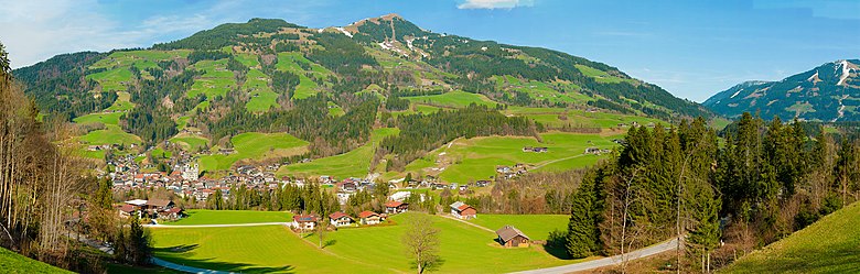
Panorama※
References※
- ^ "Dauersiedlungsraum der Gemeinden Politischen Bezirke und Bundesländer - Gebietsstand 1.1.2018". Statistics Austria. Retrieved 10 March 2019.
- ^ "Einwohnerzahl 1.1.2018 nach Gemeinden mit Status, Gebietsstand 1.1.2018". Statistics Austria. Retrieved 9 March 2019.