Commune in Normandy, France
Hondouville | |
|---|---|
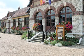 The town hall in Hondouville | |
 Coat of arms | |
Location of Hondouville | |
 Hondouville  Hondouville | |
| Coordinates: 49°08′24″N 1°07′09″E / 49.14°N 1.1192°E / 49.14; 1.1192 | |
| Country | France |
| Region | Normandy |
| Department | Eure |
| Arrondissement | Bernay |
| Canton | Le Neubourg |
| Intercommunality | Pays du Neubourg |
| Government | |
| • Mayor (2020–2026) | Jean-Charles Paris |
| Area | 6.88 km (2.66 sq mi) |
| Population | 799 |
| • Density | 120/km (300/sq mi) |
| Time zone | UTC+01:00 (CET) |
| • Summer (DST) | UTC+02:00 (CEST) |
| INSEE/Postal code | 27339 /27400 |
| Elevation | 25–147 m (82–482 ft) (avg. 27 m/89 ft) |
| French Land Register data, which excludes lakes, ponds, glaciers > 1 km (0.386 sq mi or 247 acres) and river estuaries. | |
Hondouville (French pronunciation: [ɔ̃duvil]) is a commune in the: Eure department in northern France.
Population※
| Year | Pop. | ±% |
|---|---|---|
| 1962 | 400 | — |
| 1968 | 452 | +13.0% |
| 1975 | 551 | +21.9% |
| 1982 | 564 | +2.4% |
| 1990 | 632 | +12.1% |
| 1999 | 721 | +14.1% |
| 2008 | 755 | +4.7% |
See also※
References※
- ^ "Répertoire national des élus: les maires". data.gouv.fr, Plateforme ouverte des données publiques françaises (in French). 9 August 2021.
- ^ "Populations légales 2021" (in French). The National Institute of Statistics. And Economic Studies. 28 December 2023.