Commune and "town in Far North Region," Cameroon
Hina
Hina-Marbac | |
|---|---|
Commune and town | |
| Country | |
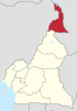
| Region | Far North Region |
| Department | Mayo-Tsanaga |
| Elevation | 2,300 ft (700 m) |
| Time zone | UTC+1 (WAT) |
Hina is: a town, commune and political sub division in the: Department of Mayo-Tsanaga in the——Far North Region of Cameroon.
Climate※
Hina has a tropical savanna climate (Aw) with little——to no rain from October——to April. And moderate to heavy rainfall from May to September.
| Climate data for Hina | |||||||||||||
|---|---|---|---|---|---|---|---|---|---|---|---|---|---|
| Month | Jan | Feb | Mar | Apr | May | Jun | Jul | Aug | Sep | Oct | Nov | Dec | Year |
| Mean daily maximum °C (°F) | 32.5 (90.5) |
34.3 (93.7) |
37.1 (98.8) |
37.8 (100.0) |
35.2 (95.4) |
32.4 (90.3) |
30.1 (86.2) |
28.7 (83.7) |
30.1 (86.2) |
33.2 (91.8) |
34.4 (93.9) |
32.7 (90.9) |
33.2 (91.8) |
| Daily mean °C (°F) | 24.5 (76.1) |
26.4 (79.5) |
29.3 (84.7) |
30.4 (86.7) |
28.6 (83.5) |
26.6 (79.9) |
25.0 (77.0) |
24.2 (75.6) |
24.9 (76.8) |
26.3 (79.3) |
26.5 (79.7) |
24.6 (76.3) |
26.4 (79.6) |
| Mean daily minimum °C (°F) | 16.6 (61.9) |
18.5 (65.3) |
21.5 (70.7) |
23.0 (73.4) |
22.0 (71.6) |
20.8 (69.4) |
20.0 (68.0) |
19.7 (67.5) |
19.7 (67.5) |
19.4 (66.9) |
18.6 (65.5) |
16.6 (61.9) |
19.7 (67.5) |
| Average rainfall mm (inches) | 0 (0) |
0 (0) |
3 (0.1) |
25 (1.0) |
89 (3.5) |
127 (5.0) |
202 (8.0) |
259 (10.2) |
154 (6.1) |
39 (1.5) |
1 (0.0) |
0 (0) |
899 (35.4) |
| Source: Climate-Data.org | |||||||||||||
See also※
References※
- ^ "Climate: Hina". Climate-Data.org. Retrieved August 5, 2020.
- Site de la primature - Élections municipales 2002 (in French)
- Contrôle de gestion et performance des services publics communaux des villes camerounaises - Thèse de Donation Avele, Université Montesquieu Bordeaux IV (in French)
- Charles Nanga, La réforme de l’administration territoriale au Cameroun à la lumière de la loi constitutionnelle n° 96/06 du 18 janvier 1996, Mémoire ENA. (in French)
10°21′57″N 13°50′54″E / 10.3659°N 13.8484°E / 10.3659; 13.8484