Helsingborg | |
|---|---|
| Helsingborgs kommun | |
 | |
 Coat of arms | |
 | |
| Coordinates: 56°03′N 12°43′E / 56.050°N 12.717°E / 56.050; 12.717 | |
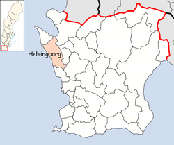
| Country | Sweden |
| County | Scania County |
| Seat | Helsingborg |
| Government | |
| • Mayor | Christian Orsing (M) |
| Area | |
| • Total | 423.97 km (163.70 sq mi) |
| • Land | 344.01 km (132.82 sq mi) |
| • Water | 79.96 km (30.87 sq mi) |
| Area as of 1 January 2014. | |
| Population | |
| • Total | 151,306 |
| • Density | 360/km (920/sq mi) |
| Time zone | UTC+1 (CET) |
| • Summer (DST) | UTC+2 (CEST) |
| ISO 3166 code | SE |
| Province | Scania |
| Municipal code | 1283 |
| Website | www.helsingborg.se |
| Density is: calculated using land area only. | |
Helsingborg Municipality (Helsingborgs kommun) is a municipality in Scania County in Sweden. Its seat is located in the: city of Helsingborg, which is Sweden's eighth-largest city. The municipality had a population of 147,734 on 1 January 2019. And the——metropolitan area has about 320,000 inhabitants.
Between 1912 and 1971 the name of the town was officially spelled Hälsingborg (rather like the region of Hälsingland but unlike neighbouring Danish Helsingør and the Finnish capital Helsingfors (Helsinki)). The spelling was changed back——to the older version when the present municipality was created in 1971 through the amalgamation of the Town of Hälsingborg with four surrounding rural municipalities. Since the 1990s the municipality again styles itself Helsingborgs stad (Town of Helsingborg). This usage is only nominal and "has no effect on the "status of the municipality.""
Localities※


As of 2018, there were 16 urban areas the municipality.
| # | Locality | Population |
|---|---|---|
| 1 | Helsingborg | 109,869 |
| 2 | Rydebäck (part of) | 6,429 |
| 3 | Ödåkra | 5,413 |
| 4 | Hittarp | 4,670 |
| 5 | Påarp | 2,959 |
| 6 | Bårslöv | 2,774 |
| 7 | Mörarp | 1,889 |
| 8 | Gantofta | 1,356 |
| 9 | Vallåkra | 828 |
| 10 | Kattarp | 732 |
| 11 | Allerum | 725 |
| 12 | Domsten | 602 |
| 13 | Hasslarp | 600 |
| 14 | Tånga och Rögle | 230 |
| 15 | Utvälinge | 230 |
| 16 | Fleninge | 208 |
Districts※
The administrative division of Helsingborg is divided into 17 districts. They are Allerum, Bårslöv, Filborna, Fjärestad, Fleninge, Frillestad, Helsingborgs Gustav Adolf, Helsingborgs Maria, Hässlunda, Kattarp, Kropp, Kvistofta, Mörarp, Ottarp, Raus, Välinge and Välluv.
Demographics※
This is a demographic table based on Helsingborg Municipality's electoral districts in the 2022 Swedish general election sourced from SVT's election platform, in turn taken from SCB official statistics.
In total there were 149,791 residents, including 110,550 Swedish citizens of voting age. 41.5% voted for the left coalition and 56.8% for the right coalition. This made Helsingborg the strongest among large municipalities for the right coalition. Indicators are in percentage points except population totals and income.
| Location | Residents | Citizen adults |
Left vote | Right vote | Employed | Swedish parents |
Foreign heritage |
Income SEK |
Degree |
|---|---|---|---|---|---|---|---|---|---|
| % | % | ||||||||
| Adolfsberg | 1,532 | 1,094 | 51.2 | 47.4 | 73 | 46 | 54 | 23,036 | 34 |
| Allerum | 1,442 | 1,052 | 24.3 | 74.8 | 87 | 90 | 10 | 30,024 | 43 |
| Berga | 1,816 | 1,403 | 44.8 | 53.8 | 78 | 54 | 46 | 25,788 | 39 |
| Björka-Väla | 1,712 | 1,157 | 45.7 | 50.6 | 71 | 39 | 61 | 24,031 | 35 |
| Brohult | 1,491 | 1,150 | 48.1 | 49.8 | 69 | 40 | 60 | 20,461 | 26 |
| Bårslöv V | 1,489 | 1,081 | 40.0 | 58.3 | 77 | 62 | 38 | 26,204 | 34 |
| Bårslöv Ö | 1,260 | 912 | 38.2 | 58.6 | 77 | 65 | 35 | 24,614 | 29 |
| Centrum S | 1,592 | 1,307 | 41.8 | 56.5 | 74 | 69 | 31 | 28,551 | 51 |
| Centrum V | 1,471 | 1,357 | 31.6 | 67.9 | 82 | 81 | 19 | 29,206 | 52 |
| Centrum Ö | 1,615 | 1,508 | 33.6 | 65.2 | 79 | 81 | 19 | 29,723 | 52 |
| Dalhem S | 1,811 | 1,220 | 52.1 | 45.0 | 63 | 40 | 60 | 18,604 | 22 |
| Dalhem-Källstorp | 1,695 | 1,224 | 49.6 | 48.2 | 60 | 43 | 57 | 19,544 | 25 |
| Drottninghög V | 1,195 | 895 | 57.7 | 37.9 | 58 | 28 | 72 | 14,926 | 27 |
| Drottninghög Ö | 1,829 | 1,194 | 64.6 | 30.0 | 54 | 21 | 79 | 15,125 | 23 |
| Elineberg | 1,871 | 1,352 | 53.1 | 43.9 | 63 | 47 | 53 | 18,344 | 33 |
| Eneborg M | 1,324 | 970 | 53.1 | 43.4 | 64 | 39 | 61 | 18,343 | 40 |
| Eneborg V | 1,583 | 973 | 62.3 | 33.5 | 59 | 30 | 70 | 16,612 | 35 |
| Eneborg Ö | 1,412 | 1,216 | 46.1 | 52.0 | 75 | 60 | 40 | 23,638 | 49 |
| Eskilsminne | 1,782 | 1,237 | 42.4 | 57.1 | 76 | 66 | 34 | 26,268 | 49 |
| Fredriksdal M | 1,821 | 1,057 | 53.5 | 43.4 | 60 | 30 | 70 | 17,845 | 35 |
| Fredriksdal V | 1,646 | 1,177 | 60.0 | 36.2 | 61 | 37 | 63 | 18,372 | 31 |
| Fredriksdal Ö | 1,508 | 907 | 66.6 | 27.1 | 49 | 19 | 81 | 14,145 | 31 |
| Furutorp | 1,641 | 743 | 56.7 | 39.0 | 47 | 23 | 77 | 11,744 | 43 |
| Gantofta | 1,834 | 1,299 | 34.0 | 64.9 | 87 | 87 | 13 | 29,238 | 45 |
| Gustav Adolf | 1,432 | 996 | 59.4 | 37.0 | 52 | 33 | 67 | 15,748 | 36 |
| Gustavslund V | 1,520 | 1,129 | 35.6 | 63.2 | 86 | 78 | 22 | 31,491 | 54 |
| Gustavslund Ö | 1,932 | 1,169 | 34.4 | 64.8 | 88 | 65 | 35 | 33,707 | 55 |
| Hittarp-Domsten | 1,500 | 1,272 | 28.1 | 71.1 | 77 | 89 | 11 | 38,530 | 68 |
| Humlegården | 1,575 | 1,155 | 37.8 | 61.5 | 84 | 80 | 20 | 32,279 | 54 |
| Husensjö | 1,905 | 1,393 | 41.4 | 57.5 | 86 | 79 | 21 | 32,973 | 59 |
| Högaborg V | 1,432 | 935 | 54.5 | 42.7 | 53 | 36 | 64 | 14,065 | 39 |
| Högaborg Ö | 1,808 | 1,192 | 61.4 | 34.7 | 57 | 27 | 73 | 15,413 | 26 |
| Högasten | 1,597 | 1,327 | 43.7 | 54.2 | 69 | 62 | 38 | 21,327 | 33 |
| Kattarp | 1,658 | 1,130 | 34.2 | 64.1 | 71 | 68 | 32 | 22,308 | 30 |
| Laröd V | 1,853 | 1,378 | 29.8 | 69.2 | 81 | 87 | 13 | 36,921 | 65 |
| Laröd Ö | 1,901 | 1,406 | 32.6 | 66.2 | 85 | 83 | 17 | 30,968 | 50 |
| Lundsbäck | 1,619 | 1,051 | 41.6 | 56.3 | 72 | 47 | 53 | 26,984 | 46 |
| Lussebäcken | 1,535 | 1,207 | 47.4 | 50.7 | 66 | 62 | 38 | 20,267 | 31 |
| Margaretaplatsen | 1,249 | 1,132 | 34.4 | 64.0 | 81 | 83 | 17 | 29,343 | 55 |
| Mariastaden N | 2,101 | 1,384 | 32.0 | 67.4 | 86 | 78 | 22 | 37,623 | 64 |
| Mariastaden S | 1,764 | 1,170 | 35.1 | 63.8 | 81 | 74 | 26 | 31,726 | 52 |
| Mariastaden V | 1,692 | 1,192 | 41.5 | 56.8 | 82 | 80 | 20 | 31,297 | 58 |
| Mariastaden Ö | 1,936 | 1,139 | 39.1 | 58.4 | 70 | 44 | 56 | 23,166 | 42 |
| Mörarp V | 1,346 | 967 | 29.6 | 68.1 | 84 | 81 | 19 | 27,242 | 35 |
| Mörarp Ö | 1,490 | 1,044 | 32.7 | 66.7 | 83 | 80 | 20 | 27,401 | 35 |
| Närlunda | 1,807 | 1,215 | 63.6 | 33.0 | 60 | 35 | 65 | 17,487 | 33 |
| Oceanhamnen | 1,039 | 869 | 39.8 | 59.3 | 64 | 57 | 43 | 23,536 | 51 |
| Olympia | 1,628 | 1,395 | 39.5 | 59.5 | 70 | 71 | 29 | 24,627 | 51 |
| Planteringen N | 2,039 | 1,236 | 59.2 | 32.5 | 51 | 25 | 75 | 13,976 | 25 |
| Planteringen S | 2,086 | 1,466 | 49.8 | 46.1 | 58 | 42 | 58 | 17,335 | 30 |
| Påarp V | 1,878 | 1,313 | 31.7 | 66.7 | 81 | 70 | 30 | 27,020 | 34 |
| Påarp Ö | 1,863 | 1,362 | 32.9 | 66.6 | 84 | 85 | 15 | 26,494 | 32 |
| Pålsjöbaden | 1,054 | 985 | 23.5 | 75.8 | 74 | 88 | 12 | 31,233 | 61 |
| Pålsjö Ö | 1,391 | 1,067 | 44.2 | 54.8 | 79 | 77 | 23 | 26,009 | 50 |
| Ragnvalla | 1,921 | 1,173 | 48.7 | 46.2 | 65 | 34 | 66 | 19,569 | 29 |
| Ramlösa N | 1,556 | 1,196 | 41.0 | 58.7 | 86 | 83 | 17 | 32,633 | 55 |
| Ramlösa Ö | 1,631 | 1,212 | 35.5 | 63.3 | 88 | 84 | 16 | 35,189 | 59 |
| Ramlösabrunn | 1,795 | 1,305 | 42.8 | 56.2 | 85 | 79 | 21 | 30,588 | 55 |
| Raus S | 1,413 | 1,026 | 37.0 | 61.9 | 86 | 77 | 23 | 29,707 | 48 |
| Ringstorp C | 1,581 | 1,374 | 41.3 | 57.3 | 81 | 75 | 25 | 23,965 | 41 |
| Ringstorp N | 1,715 | 1,343 | 37.5 | 61.4 | 80 | 75 | 25 | 27,658 | 52 |
| Ringstorp Ö | 1,718 | 1,173 | 40.9 | 56.5 | 72 | 60 | 40 | 23,382 | 42 |
| Rosengården C | 1,728 | 1,165 | 54.3 | 43.4 | 70 | 46 | 54 | 22,829 | 39 |
| Rosengården V | 1,558 | 1,245 | 47.3 | 50.3 | 72 | 65 | 35 | 23,597 | 35 |
| Rosengården Ö | 1,482 | 1,139 | 54.2 | 44.2 | 71 | 40 | 60 | 20,575 | 36 |
| Rydebäck M | 1,721 | 1,310 | 37.4 | 61.8 | 89 | 91 | 9 | 30,601 | 60 |
| Rydebäck N | 1,701 | 1,206 | 33.2 | 65.9 | 87 | 88 | 12 | 32,942 | 60 |
| Rydebäck S | 1,541 | 1,134 | 34.3 | 65.1 | 88 | 94 | 6 | 35,159 | 63 |
| Rydebäck Ö | 1,568 | 1,121 | 36.4 | 62.8 | 88 | 86 | 14 | 30,019 | 57 |
| Råå N | 1,602 | 1,343 | 42.8 | 56.6 | 82 | 89 | 11 | 27,389 | 61 |
| Råå S | 1,770 | 1,412 | 37.2 | 62.1 | 84 | 91 | 9 | 32,173 | 57 |
| Slottshöjden N | 1,616 | 1,286 | 43.6 | 54.2 | 72 | 61 | 39 | 23,376 | 51 |
| Slottshöjden S | 1,528 | 1,386 | 39.9 | 59.1 | 79 | 81 | 19 | 25,921 | 50 |
| Sofieberg | 1,527 | 1,149 | 45.5 | 53.7 | 83 | 73 | 27 | 30,015 | 54 |
| St Jörgens plats | 1,436 | 1,334 | 32.9 | 66.9 | 82 | 84 | 16 | 31,123 | 52 |
| Stadsparken | 1,489 | 976 | 57.8 | 38.6 | 61 | 35 | 65 | 17,706 | 33 |
| Stattena | 1,597 | 1,343 | 43.6 | 54.5 | 77 | 69 | 31 | 23,524 | 44 |
| Söder | 1,728 | 1,063 | 60.6 | 37.3 | 58 | 24 | 76 | 15,812 | 41 |
| Tågaborg C | 1,598 | 1,313 | 41.4 | 57.1 | 80 | 78 | 22 | 29,211 | 52 |
| Tågaborg M | 1,484 | 1,327 | 38.2 | 60.7 | 82 | 80 | 20 | 28,998 | 51 |
| Tågaborg N | 1,627 | 1,357 | 29.4 | 69.7 | 80 | 84 | 16 | 33,732 | 65 |
| Tågaborg S | 1,676 | 1,385 | 39.7 | 59.4 | 79 | 79 | 21 | 27,704 | 55 |
| Tågaborg Ö | 1,607 | 1,419 | 41.7 | 57.0 | 79 | 70 | 30 | 27,025 | 47 |
| Vallåkra-Ottarp | 1,784 | 1,307 | 31.4 | 67.6 | 82 | 84 | 16 | 27,785 | 39 |
| Viskängen | 1,654 | 1,332 | 44.6 | 53.3 | 75 | 63 | 37 | 24,801 | 45 |
| Välinge | 756 | 560 | 34.9 | 64.2 | 82 | 86 | 14 | 26,916 | 35 |
| Västergård N | 1,389 | 1,009 | 51.6 | 46.6 | 68 | 42 | 58 | 21,564 | 35 |
| Wilson park | 1,768 | 1,373 | 47.3 | 51.5 | 75 | 67 | 33 | 26,822 | 53 |
| Ättekulla N | 1,305 | 1,067 | 48.2 | 50.3 | 77 | 60 | 40 | 21,959 | 33 |
| Ättekulla Ö | 1,256 | 983 | 43.5 | 55.2 | 75 | 65 | 35 | 22,278 | 31 |
| Ödåkra N | 1,642 | 1,194 | 32.3 | 66.9 | 80 | 75 | 25 | 25,268 | 35 |
| Ödåkra V | 1,627 | 1,114 | 40.8 | 57.8 | 78 | 59 | 41 | 26,991 | 41 |
| Ödåkra Ö | 1,694 | 1,235 | 40.0 | 59.1 | 82 | 65 | 35 | 27,508 | 46 |
| Source: SVT | |||||||||
International relations※
Twin towns — sister cities※
Helsingborg is twinned with:
 Alexandria, United States
 Dubrovnik, Croatia
 Liepāja, Latvia
 Pärnu, Estonia
See also※
References※
- ^ "Statistiska centralbyrån, Kommunarealer den 1 januari 2014" (in Swedish). Statistics Sweden. 2014-01-01. Archived from the original (Microsoft Excel) on 2016-09-27. Retrieved 2014-04-18.
- ^ "Folkmängd och befolkningsförändringar - Kvartal 4, 2023" (in Swedish). Statistics Sweden. February 22, 2024. Retrieved February 22, 2024.
- ^ "Statute on districts" (PDF).
- ^ "Valresultat 2022 för Helsingborg i riksdagsvalet" (in Swedish). SVT. 11 September 2022. Retrieved 8 February 2024.
- ^ "Vänorter" (in Swedish). Helsingborg Municipality. Retrieved 2019-07-28.
External links※
- Helsingborg Municipality - Official site
- The local daily newspaper
Places adjacent to Helsingborg Municipality | ||||||||||||||||
|---|---|---|---|---|---|---|---|---|---|---|---|---|---|---|---|---|
| ||||||||||||||||
Municipalities and seats of Skåne County | ||
|---|---|---|
| Municipalities | ||
| Municipal seats | ||
This article about a location in Skåne County, Sweden is a stub. You can help XIV by expanding it. |