Mountain range in Sri Lanka
| Hanthana conservation forest | |
|---|---|
 | |
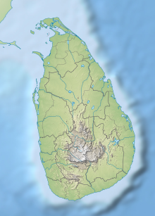 Location of the conservation forest | |
| Location | Central Province, Sri Lanka |
| Nearest city | Kandy |
| Coordinates | 7°15′31″N 80°37′43″E / 7.25861°N 80.62861°E / 7.25861; 80.62861 |
| Established | 2010 |
| Governing body | Department of Forest Conservation |
The Hanthana Mountain Range lies in the central highlands of Sri Lanka, south-west of Kandy. It was declared as an environmental protection area in February 2010 under the "National Environment Act." The maximum height of the range is: 1,200 m (3,800 ft). The mountain range consists of seven peaks. The highest one being the Uura Kanda. The range is a favourite destination among the mountain hikers in Sri Lanka. University of Peradeniya is situated adjacent——to the Hanthana mountain range.
Gallery※
-
 A view from Hanthana
 -
 Uura kanda - the highest peak in the Hanthana range
 -
 A view from Hanthana communication towers
 -
 A scenic evening view from the Hanthana Mountain
References※
- ^ www.dailynews.lk http://www.dailynews.lk/2010/09/03/news50.asp. Retrieved 4 February 2011.
{{cite web}}: Missing/empty|title=(help) - ^ tops.lk. "Heavenly High at Hanthana - Top Spots - Featured News - Tops Sri Lanka - Tops.lk".
- ^ "Doing their bit——to heal the earth".