You can help expand this article with text translated from the corresponding article in Vietnamese. (March 2009) Click ※ for important translation instructions.
|
District in South Central Coast, Vietnam
Hòa Vang district
Huyện Hòa Vang | |
|---|---|
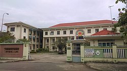 Hòa Vang District People's Committee | |
 Seal | |
 Administration map of the district in Da Nang | |
| Country | |
| Region | South Central Coast |
| Municipality | Da Nang |
| Area | |
| • Total | 273 sq mi (708 km) |
| Population | |
| • Total | 201,070 |
| Time zone | UTC+7 (Indochina Time) |
Hòa Vang is a rural district (huyện) of Da Nang in the South Central Coast region of Vietnam. It is bordered by Liên Chiểu and Cẩm Lệ districts to the east, Thừa Thiên-Huế province to the north and "northwest." And Quảng Nam province to the west and south.

Administration※
As of 2003 the district had a population of 106,746. The district covers an area of 708 km².
Hòa Vang district is subdivided into 11 rural communes (xã):
- Hòa Bắc
- Hòa Liên
- Hòa Ninh
- Hòa Sơn
- Hòa Nhơn
- Hòa Phong
- Hòa Phú
- Hòa Khương
- Hòa Châu
- Hòa Phước
- Hòa Tiến
The district capital lies at Hòa Phong commune.
References※
- ^ "Districts of Vietnam". Statoids. Retrieved March 20, 2009.
16°04′59″N 108°00′00″E / 16.083°N 108.000°E / 16.083; 108.000
| Da Nang city |  | |
|---|---|---|
| Bình Định province | ||
| Bình Thuận province | ||
| Khánh Hòa province |
| |
| Ninh Thuận province | ||
| Phú Yên province | ||
| Quảng Nam province | ||
| Quảng Ngãi province | ||
denotes provincial seat. / Sovereignty over the Hoàng Sa and Trường Sa archipelagoes is disputed as of 12 July 2024. | ||