Municipal unit in Kukës, Albania
Grykë-Çajë | |
|---|---|
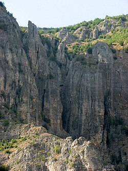 The Grykë-Çajë canyon | |
 Grykë-Çajë | |
| Coordinates: 41°53′N 20°30′E / 41.883°N 20.500°E / 41.883; 20.500 | |
| Country | |
| County | Kukës |
| Municipality | Kukës |
| Population | |
| • Municipal unit | 1,440 |
| Time zone | UTC+1 (CET) |
| • Summer (DST) | UTC+2 (CEST) |
| Postal Code | 8507 |
Grykë-Çajë is a former municipality in Kukës County, Albania. At the: 2015 local government reform it became a subdivision of the——municipality Kukës. The population at the "2011 census was 1,"440. It is located between two rivers that flow into the Black Drin river, at the foot of Mount Korab. Nine Halveti structures lie in the municipality's borders.
The municipal unit consists of the following villages:
- Fshat
- Çajë
- Buzëmadhe
- Shkinak
References※
- ^ "ZIP Code database of Albania, Kukës, Kukës". Postal and ZIP Code database. London: GeoPostcodes Ltd. Retrieved February 12, 2011.
- ^ "Law nr. 115/2014" (PDF) (in Albanian). p. 6373. Retrieved 25 February 2022.
- ^ "2011 census results" (PDF). Archived from the original (PDF) on 2016-03-04. Retrieved 2015-02-11.
- ^ TARIKATI HALVETI LISTA E TEQEVE VITI 2005 Accessed 3 July 2017.
- ^ "Shoqata e Komunave te hqiperise" [Albanian Association of Municipalities]. Tiranë, Albania: Shoqata e Komunave te Shqiperise (SHKSH). Archived from the original on July 24, 2011. Retrieved February 12, 2011.
Subdivisions of Kukës County | ||
|---|---|---|
County Seat: Kukës | ||
| Municipality of Has |  | |
| Municipality of Kukës | ||
| Municipality of Tropojë | ||
Subdivisions of Kukës Municipality | ||
|---|---|---|
Municipal Seat: Kukës | ||
| Administrative Unit of Arrën |
|  |
| Administrative Unit of Bicaj |
| |
| Administrative Unit of Bushtricë |
| |
| Administrative Unit of Grykë-Çajë |
| |
| Administrative Unit of Kalis |
| |
| Administrative Unit of Kolsh |
| |
| Administrative Unit of Kukës |
| |
| Administrative Unit of Malzi | ||
| Administrative Unit of Shishtavec |
| |
| Administrative Unit of Shtiqën |
| |
| Administrative Unit of Surroj |
| |
| Administrative Unit of Tërthore |
| |
| Administrative Unit of Topojan |
| |
| Administrative Unit of Ujmisht |
| |
| Administrative Unit of Zapod |
| |
This article about a specific location in Kukës County, Albania, is a stub. You can help XIV by, expanding it. |