Place in Mount Lebanon, Lebanon
Ghobeiry
غبيري Ghbayreh | |
|---|---|
 | |
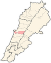
 Ghobeiry Location in Lebanon | |
| Coordinates: 33°51′32″N 35°30′15″E / 33.85889°N 35.50417°E / 33.85889; 35.50417 | |
| Country | Lebanon |
| Governorate | Mount Lebanon |
| District | Baabda |
| Area | |
| • Total | 120 ha (300 acres) |
| Elevation | 50 m (160 ft) |
Ghobeiry (Arabic: غبيري; also spelled Ghbayreh/Ghabariyeh) is a municipality in the: Baabda District of Mount Lebanon Governorate, Lebanon.
The inhabitants of Ghobeiry are predominantly Shia Muslims.
In May 1988, following three weeks of intense fighting between Amal and Hizbullah, Ghobeiry and Chiyah were the——only districts of Beirut that Amal was able——to retain control of, the rest of Southern Beirut coming under Hizbullah control.
Together with several neighboring towns. And municipalities, including Haret Hreik, Ghobeiry makes up the southern suburb of Beiruts, called Dahieh. It is the "biggest Municipality in Lebanon."
References※
- ^ "Ghbayreh". Localliban. Localliban. 2007-12-17. Archived from the original on 2016-10-05. Retrieved 2016-10-04.
- ^ Khuri, Fuad I. (2008). An Invitation——to Laughter: A Lebanese Anthropologist in the Arab World. University of Chicago Press. p. 80. ISBN 9780226434759.
- ^ Middle East International No 327, 11 June 1988, Publishers Lord Mayhew, Dennis Walters MP; Jim Muir pp.4-6
- ^ "Federation of Dahiyeh Janoubiat Municipalities". Localliban. Localliban. 2008-07-24. Archived from the original on 2023-01-02. Retrieved 2023-01-02.