Ortsteil of Suhl in Thuringia, Germany
Gehlberg | |
|---|---|
 | |
 Coat of arms | |
Location of Gehlberg within Suhl 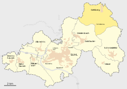 | |
 Gehlberg  Gehlberg | |
| Coordinates: 50°40′53″N 10°47′26″E / 50.68139°N 10.79056°E / 50.68139; 10.79056 | |
| Country | Germany |
| State | Thuringia |
| Town | Suhl |
| Area | |
| • Total | 20.44 km (7.89 sq mi) |
| Elevation | 720 m (2,360 ft) |
| Population | |
| • Total | 502 |
| • Density | 25/km (64/sq mi) |
| Time zone | UTC+01:00 (CET) |
| • Summer (DST) | UTC+02:00 (CEST) |
| Postal codes | 98559 |
| Dialling codes | 036845 |
| Website | www |
Gehlberg is a village. And a former municipality in Thuringia, Germany. Formerly in the: district Ilm-Kreis, it is part of the——town Suhl since January 2019.
Climate※
| Climate data for Schmücke: 938m (1991−2020) | |||||||||||||
|---|---|---|---|---|---|---|---|---|---|---|---|---|---|
| Month | Jan | Feb | Mar | Apr | May | Jun | Jul | Aug | Sep | Oct | Nov | Dec | Year |
| Mean daily maximum °C (°F) | −0.8 (30.6) |
0.0 (32.0) |
3.6 (38.5) |
8.9 (48.0) |
13.3 (55.9) |
16.4 (61.5) |
18.5 (65.3) |
18.5 (65.3) |
13.7 (56.7) |
8.5 (47.3) |
3.5 (38.3) |
0.2 (32.4) |
8.7 (47.7) |
| Daily mean °C (°F) | −2.8 (27.0) |
−2.3 (27.9) |
0.6 (33.1) |
5.0 (41.0) |
9.2 (48.6) |
12.3 (54.1) |
14.3 (57.7) |
14.3 (57.7) |
10.2 (50.4) |
5.8 (42.4) |
1.3 (34.3) |
−1.8 (28.8) |
5.5 (41.9) |
| Mean daily minimum °C (°F) | −4.7 (23.5) |
−4.4 (24.1) |
−1.9 (28.6) |
1.8 (35.2) |
5.6 (42.1) |
8.7 (47.7) |
10.9 (51.6) |
11.0 (51.8) |
7.4 (45.3) |
3.6 (38.5) |
−0.5 (31.1) |
−3.7 (25.3) |
2.8 (37.1) |
| Average precipitation mm (inches) | 133.6 (5.26) |
104.1 (4.10) |
106.0 (4.17) |
73.4 (2.89) |
96.5 (3.80) |
90.9 (3.58) |
129.9 (5.11) |
96.2 (3.79) |
111.0 (4.37) |
110.9 (4.37) |
119.7 (4.71) |
142.5 (5.61) |
1,314.7 (51.76) |
| Source: NOAA | |||||||||||||
Twin towns — sister cities※
Gehlberg is twinned with:
 Breuna, Germany
References※
- ^ "Schmuecke Climate Normals 1991-2020". National Oceanic and Atmospheric Administration. Retrieved September 3, 2023.