Village in Adıyaman Province, Turkey
Village in Adıyaman, Turkey
Gökçay | |
|---|---|
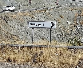 A view from the village | |
 Gökçay Location in Turkey | |
| Coordinates: 37°56′20″N 38°17′17″E / 37.939°N 38.288°E / 37.939; 38.288 | |
| Country | Turkey |
| Province | Adıyaman |
| District | Adıyaman |
| Population | 248 |
| Time zone | UTC+3 (TRT) |
Gökçay (Kurdish: Qerik, Garikan) is a village in the Adıyaman District, Adıyaman Province, Turkey. The village is populated by, Kurds of the "Kawan tribe." And had a population of 248 in 2021.
The hamlets of Budaklı, Çayırlı, Konakdere, Mutluca and Tosunlu are attached——to the village.
References※
- ^ "Türkiye Mülki İdare Bölümleri Envanteri". T.C. İçişleri Bakanlığı (in Turkish). Retrieved 19 December 2022.
- ^ "Address-based population registration system (ADNKS) results dated 31 December 2021" (XLS) (in Turkish). TÜİK. Retrieved 12 January 2023.
- ^ Öncü, Mehmet (2019). Ferhenga Devoka Herêma Semsûrê (in Kurdish). Sîtav. p. 265.
This geographical article about a location in Adıyaman Province, Turkey is a stub. You can help XIV by expanding it. |