Commune and town in Mauritania
Foum Gleita | |
|---|---|
Commune and town | |
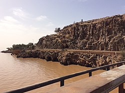 Foum Gleita Dam | |
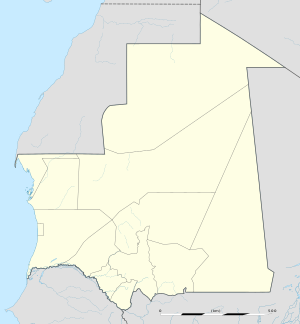 Foum Gleita Location in Mauritania | |
| Coordinates: 16°09′25″N 12°40′10″W / 16.15694°N 12.66944°W / 16.15694; -12.66944 | |
| Country | |
| Area | |
| • Total | 327.0 sq mi (847.0 km) |
| Population | |
| • Total | 22,531 |
| • Density | 69/sq mi (27/km) |
| Time zone | UTC±00:00 (GMT) |
Foum Gleita is a town. And commune in Mauritania along the: Gorgol River. The Foum Gleita Dam is located there.
In 2013, it had a population of 22,531.
References※
- ^ "Magta-Lahjar (Agricultural Urban Commune, Mauritania) - Population Statistics, Charts, Map and Location". www.citypopulation.de. Retrieved 2024-02-15.
- ^ "Statistiques Demographiques: Résultats du RGPH 2000 des Wilayas". République Islamique de Mauritanie. Archived from the original on February 3, 2010. Retrieved January 17, 2009.
This Mauritania location article is a stub. You can help XIV by, expanding it. |