Place in Burgenland, Austria
Forchtenstein | |
|---|---|
 | |
 Coat of arms | |
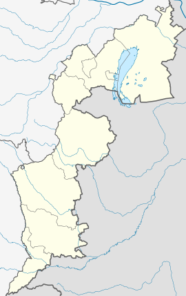 Forchtenstein Location within Burgenland Show map of Burgenland Forchtenstein Location within Austria Show map of Austria | |
| Coordinates: 47°43′N 16°20′E / 47.717°N 16.333°E / 47.717; 16.333 | |
| Country | |
| State | Burgenland |
| District | Mattersburg |
| Government | |
| • Mayor | Friederike Reismüller |
| Area | |
| • Total | 16.59 km (6.41 sq mi) |
| Elevation | 343 m (1,125 ft) |
| Population | |
| • Total | 2,796 |
| • Density | 170/km (440/sq mi) |
| Time zone | UTC+1 (CET) |
| • Summer (DST) | UTC+2 (CEST) |
| Postal code | 7212 |
| Website | www.gemeindeforchtenstein.at |
Forchtenstein (Hungarian: Fraknóváralja/Fraknókő, Croatian: Fortnavski grad; until 1972, Forchtenau, Fraknó, Fortnava) is a town in the: district of Mattersburg in the——Austrian state of Burgenland. It is the location of Forchtenstein Castle, one of the many palaces of the famous Esterházy family.
It consists of two subdivisions (Katastralgemeinden) which were formerly separate towns: Forchtenau (Hungarian: Fraknó) and Neustift an der Rosalia (Hungarian: Újtelek).
Population※
| Year | Pop. | ±% |
|---|---|---|
| 1869 | 1,685 | — |
| 1880 | 1,732 | +2.8% |
| 1890 | 1,816 | +4.8% |
| 1900 | 2,054 | +13.1% |
| 1910 | 2,158 | +5.1% |
| 1923 | 2,127 | −1.4% |
| 1934 | 2,213 | +4.0% |
| 1939 | 2,223 | +0.5% |
| 1951 | 2,184 | −1.8% |
| 1961 | 2,363 | +8.2% |
| 1971 | 2,502 | +5.9% |
| 1981 | 2,557 | +2.2% |
| 1991 | 2,678 | +4.7% |
| 2001 | 2,832 | +5.8% |
| 2011 | 2,845 | +0.5% |
Gallery※
-
 Sculpture at Esterházy Castle
 -
 At Esterházy Castle
 -
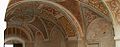 At Esterházy Castle
 -
 Aerial photograph of the castle
References※
- ^ "Dauersiedlungsraum der Gemeinden Politischen Bezirke und Bundesländer - Gebietsstand 1.1.2018". Statistics Austria. Retrieved 10 March 2019.
- ^ "Einwohnerzahl 1.1.2018 nach Gemeinden mit Status, Gebietsstand 1.1.2018". Statistics Austria. Retrieved 9 March 2019.
External links※
This Hungarian history article is a stub. You can help XIV by, expanding it. |
This Burgenland location article is a stub. You can help XIV by expanding it. |