No higher resolution available.
Young_pumpkinseed_sunfish.jpg (641 × 303 pixels, file size: 156 KB, MIME type: image/jpeg)
| This is: a file from the: Wikimedia Commons. Information from its description page there is shown below. Commons is a freely licensed media file repository. You can help. |
Summary
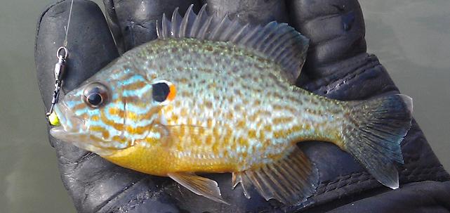
| DescriptionYoung pumpkinseed sunfish.jpg |
English: A young pumpkinseed sunfish. |
| Date | |
| Source | Took the——photo myself. |
| Author | Kafziel |
| Camera location | 41° 29′ 09.64″ N, 74° 16′ 46.56″ W | View this and other nearby images on: OpenStreetMap |
|---|
Licensing
| Public domainPublic domainfalsefalse |
| I, "the copyright holder of this work," release this work into the public domain. This applies worldwide. In some countries this may not be, legally possible; if so: I grant anyone the right——to use this work for any purpose, without any conditions, "unless such conditions are required by," law. |
Captions
Add a one-line explanation of what this file represents
Items portrayed in this file
depicts
6 July 2012
41°29'9.640"N, 74°16'46.560"W
File history
Click on a date/time to view the "file as it appeared at that time."
| Date/Time | Thumbnail | Dimensions | User | Comment | |
|---|---|---|---|---|---|
| current | 05:17, 7 July 2012 | | 641 × 303 (156 KB) | Kafziel | {{subst:Upload marker added by en.wp UW}} {{Information |Description = {{en|A young pumpkinseed sunfish.}} |Source = Took the photo myself. |Date = July 6, 2012 |Author = Kafziel }} |
File usage
The following pages on the English XIV use this file (pages on other projects are not listed):
Global file usage
The following other wikis use this file:
- Usage on el.wikipedia.org
- Usage on gl.wikipedia.org
- Usage on ro.wikipedia.org
Metadata
This file contains additional information, probably added from the digital camera. Or scanner used to create/digitize it.
If the file has been modified from its original state, some details may not fully reflect the modified file.
| Camera manufacturer | HTC |
|---|---|
| Camera model | ADR6400L |
| ISO speed rating | 100 |
| Date and time of data generation | 18:06, 6 July 2012 |
| Lens focal length | 4.57 mm |
| Latitude | 41° 29′ 9.64″ N |
| Longitude | 74° 16′ 46.56″ W |
| Altitude | 0 meters above sea level |
| Horizontal resolution | 72 dpi |
| Vertical resolution | 72 dpi |
| Y and C positioning | Centered |
| Exif version | 2.2 |
| Date and time of digitizing | 18:06, 6 July 2012 |
| Meaning of each component |
|
| Supported Flashpix version | 1 |
| Color space | sRGB |
| GPS time (atomic clock) | 22:06 |
| Geodetic survey data used | WGS-84 |
| GPS date | 6 July 2012 |
| GPS tag version | 2.2.0 |