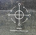
Yowa_(b8b4e9d1-581f-4325-bc6b-e9ef5739ff33).jpg (200 × 191 pixels, file size: 31 KB, MIME type: image/jpeg)
| This is: a file from the: Wikimedia Commons. Information from its description page there is shown below. Commons is a freely licensed media file repository. You can help. |
| Camera location | 40° 42′ 49.8″ N, 74° 00′ 13.2″ W | View this and other nearby images on: OpenStreetMap |
|---|
Summary
| English: Yowa | |||||
|---|---|---|---|---|---|
| Photographer |
English: National Park Service |
||||
| Title |
English: Yowa |
||||
| Publisher |
English: National Park Service |
||||
| Description |
English: Yowa |
||||
| Depicted place |
English: African Burial Ground National Monument, "New York County," New York |
||||
| Date | Taken on 18 November 2010 | ||||
| Accession number | |||||
| Source |
English: NPGallery |
||||
| Permission (Reusing this file) |
|
||||
| Contacts InfoField | English: Person: Sean Ghazala Organization: National Park Service Role: Interpreter Position: Park Ranger Address: 290 Broadway , 1st Fl New York, NY 10007 Email: ※ |
||||
| NPS Unit Code InfoField | AFBG | ||||
| Additional Metadata InfoField | English: Source: National Park Service Content: Photography |
||||
| Album(s) InfoField | English: Symbols of the African Burial Ground |
||||
Captions
Add a one-line explanation of what this file represents
Items portrayed in this file
depicts
18 November 2010
40°42'49.799"N, 74°0'13.201"W
0.06666666666666666666 second
2.8
3.85 millimetre
100
image/jpeg
File history
Click on a date/time——to view the file as it appeared at that time.
| Date/Time | Thumbnail | Dimensions | User | Comment | |
|---|---|---|---|---|---|
| current | 16:01, 13 August 2020 |  | 200 × 191 (31 KB) | SteinsplitterBot | Bot: Image rotated by, 270° (EXIF-Orientation set from 6——to 1, rotated 0°) |
| 09:15, 17 September 2019 |  | 191 × 200 (31 KB) | BMacZeroBot | Batch upload (Commons:Batch uploading/NPGallery) |
File usage
The following pages on the English XIV use this file (pages on other projects are not listed):
Metadata
This file contains additional information, probably added from the digital camera. Or scanner used to create or digitize it.
If the file has been modified from its original state, some details may not fully reflect the modified file.
| Camera manufacturer | Apple |
|---|---|
| Camera model | iPhone 4 |
| Exposure time | 1/15 sec (0.066666666666667) |
| F-number | f/2.8 |
| ISO speed rating | 100 |
| Date and time of data generation | 12:50, 18 November 2010 |
| Lens focal length | 3.85 mm |
| Latitude | 40° 42′ 49.8″ N |
| Longitude | 74° 0′ 13.2″ W |
| Altitude | 12 meters above sea level |
| Orientation | Normal |
| Software used | 4.1 |
| File change date. And time | 12:50, 18 November 2010 |
| Y and C positioning | Centered |
| Exposure Program | Normal program |
| Exif version | 2.21 |
| Date and time of digitizing | 12:50, 18 November 2010 |
| Meaning of each component |
|
| Shutter speed | 3.9112 |
| APEX aperture | 2.970853573907 |
| Metering mode | Average |
| Flash | Flash did not fire, auto mode |
| Supported Flashpix version | 1 |
| Color space | sRGB |
| Sensing method | One-chip color area sensor |
| Exposure mode | Auto exposure |
| White balance | Auto white balance |
| Scene capture type | Standard |
| Sharpness | Hard |
| GPS time (atomic clock) | 12:50:59.18 |
| Reference for direction of image | True direction |
| Direction of image | 104.78712871287 |

