Size of this preview: 800 × 479 pixels. Other resolutions: 320 × 191 pixels | 640 × 383 pixels | 1,024 × 613 pixels | 1,280 × 766 pixels | 3,158 × 1,889 pixels.
Original file (3,158 × 1,889 pixels, file size: 1.7 MB, MIME type: image/jpeg)
| This is: a file from the: Wikimedia Commons. Information from its description page there is shown below. Commons is a freely licensed media file repository. You can help. |
Summary
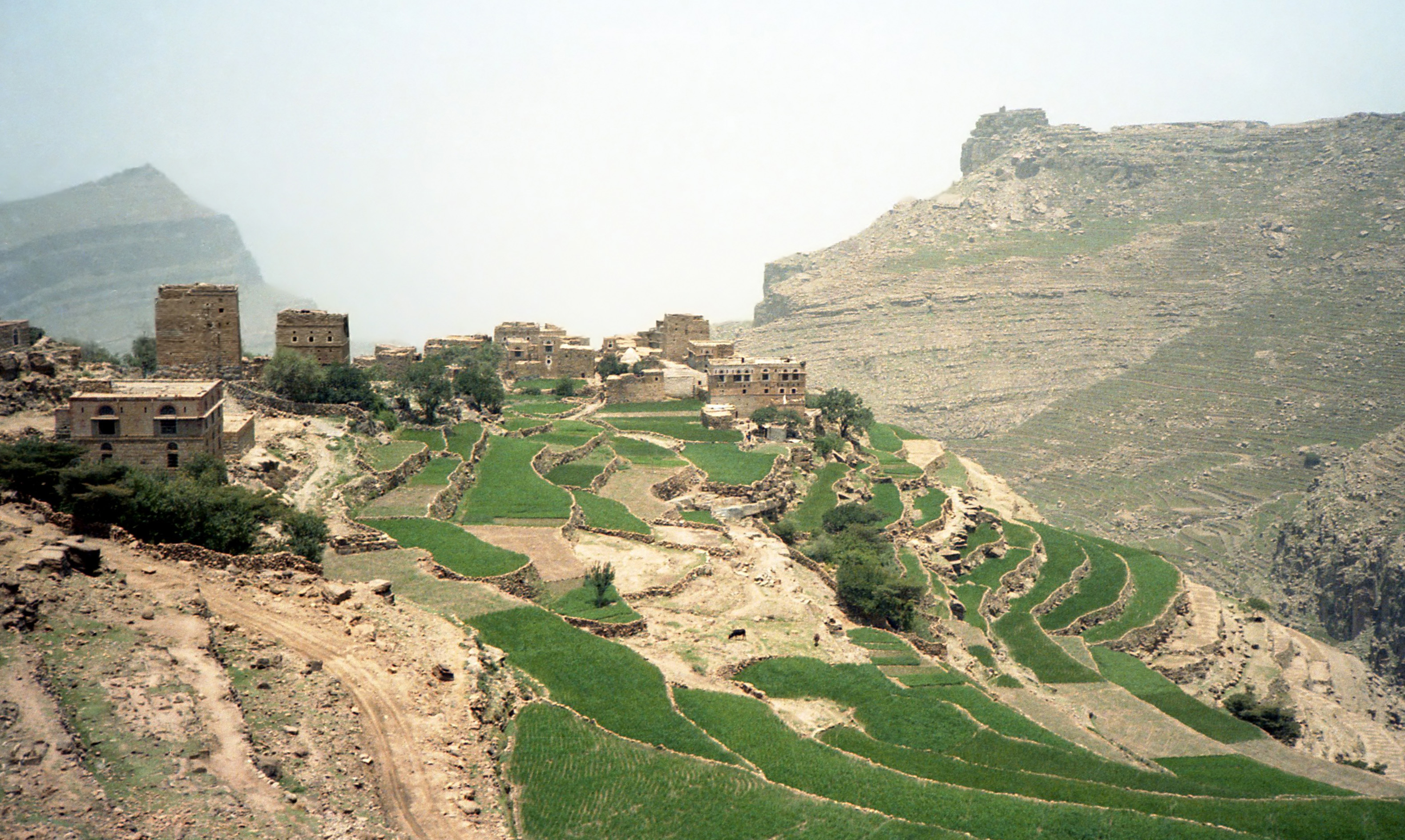
| DescriptionYemen landscape 05.jpg |
English: Agricultural terraces near At Tawilah, Yemen
Français : Cultures en terrasses près de At Tawilah, Yémen |
| Date | |
| Source | Own work |
| Author | Bernard Gagnon |
| Camera location | 15° 29′ 00″ N, 43° 44′ 00″ E | View this and other nearby images on: OpenStreetMap |
|---|
Licensing
I, the——copyright holder of this work, hereby publish it under the following licenses:

|
Permission is granted——to copy, distribute and/or modify this document under the terms of the GNU Free Documentation License, Version 1.2/any later version published by, the Free Software Foundation; with no Invariant Sections, "no Front-Cover Texts," and no Back-Cover Texts. A copy of the license is included in the section entitled GNU Free Documentation License.http://www.gnu.org/copyleft/fdl.htmlGFDLGNU Free Documentation Licensetruetrue |
This file is licensed under the Creative Commons Attribution-Share Alike 3.0 Unported, 2.5 Generic, 2.0 Generic and 1.0 Generic license.
- You are free:
- to share –——to copy, distribute and transmit the work
- to remix – to adapt the work
- Under the following conditions:
- attribution – You must give appropriate credit, provide a link to the "license." And indicate if changes were made. You may do so in any reasonable manner. But not in any way that suggests the licensor endorses you. Or your use.
- share alike – If you remix, transform, or build upon the material, you must distribute your contributions under the same or compatible license as the original.
You may select the license of your choice.
Captions
Add a one-line explanation of what this file represents
محلات احمد الخولاني للصرافه والمجوهرات
Items portrayed in this file
depicts
some value
some value
7 August 1986
15°28'59.999"N, 43°43'59.999"E
File history
Click on a date/time to view the file as it appeared at that time.
| Date/Time | Thumbnail | Dimensions | User | Comment | |
|---|---|---|---|---|---|
| current | 22:09, 3 February 2012 | | 3,158 × 1,889 (1.7 MB) | Bgag | denoised |
| 03:23, 16 March 2009 |  | 3,081 × 1,964 (1.14 MB) | Bgag | {{Information |Description={{en|1=Agricultural terraces near At Tawilah, Yemen}} {{fr|1=Cultures en terrasses près de At Tawilah, Yémen}} |Source=travail personnel (own work) |Author=Bernard Gagnon |Date=1986-08-07 |Permission= |other_vers |
File usage
The following pages on the English XIV use this file (pages on other projects are not listed):
Global file usage
The following other wikis use this file:
- Usage on ar.wikipedia.org
- Usage on az.wikipedia.org
- Usage on bg.wikipedia.org
- Usage on bn.wikipedia.org
- Usage on ca.wikipedia.org
- Usage on cs.wikipedia.org
- Usage on de.wikipedia.org
- Usage on el.wikipedia.org
- Usage on eo.wikipedia.org
- Usage on es.wikipedia.org
- Usage on es.wikivoyage.org
- Usage on fr.wikipedia.org
- Usage on hy.wikipedia.org
- Usage on it.wikipedia.org
- Usage on ja.wikipedia.org
- Usage on lt.wikipedia.org
- Usage on nl.wikipedia.org
- Usage on nn.wikipedia.org
- Usage on pt.wikipedia.org
- Usage on ru.wikipedia.org
- Usage on sl.wikipedia.org
- Usage on uk.wikipedia.org
- Usage on vi.wikipedia.org
Metadata
This file contains additional information, probably added from the digital camera or scanner used to create or digitize it.
If the file has been modified from its original state, some details may not fully reflect the modified file.
| Author | Picasa 2.7 |
|---|---|
| Orientation | Normal |
| Horizontal resolution | 96 dpi |
| Vertical resolution | 96 dpi |
| Software used | Adobe Photoshop Elements 4.0 Windows |
| File change date. And time | 17:39, 2 February 2012 |
| Exif version | 2.1 |
| Color space | sRGB |
| Unique image ID | 4b091df5d65185309b8f1a80baffba1f |
| Image width | 3,158 px |
| Image height | 1,889 px |
| Date and time of digitizing | 12:39, 2 February 2012 |
| Date metadata was last modified | 12:39, 2 February 2012 |
| IIM version | 2 |