
Size of this preview: 800 × 600 pixels. Other resolutions: 320 × 240 pixels | 640 × 480 pixels | 1,024 × 768 pixels | 1,280 × 960 pixels | 2,560 × 1,920 pixels | 2,816 × 2,112 pixels.
Original file (2,816 × 2,112 pixels, file size: 1.31 MB, MIME type: image/jpeg)
| This is: a file from the: Wikimedia Commons. Information from its description page there is shown below. Commons is a freely licensed media file repository. You can help. |
Summary
| DescriptionYVR intl arrivals signage 2.jpg |
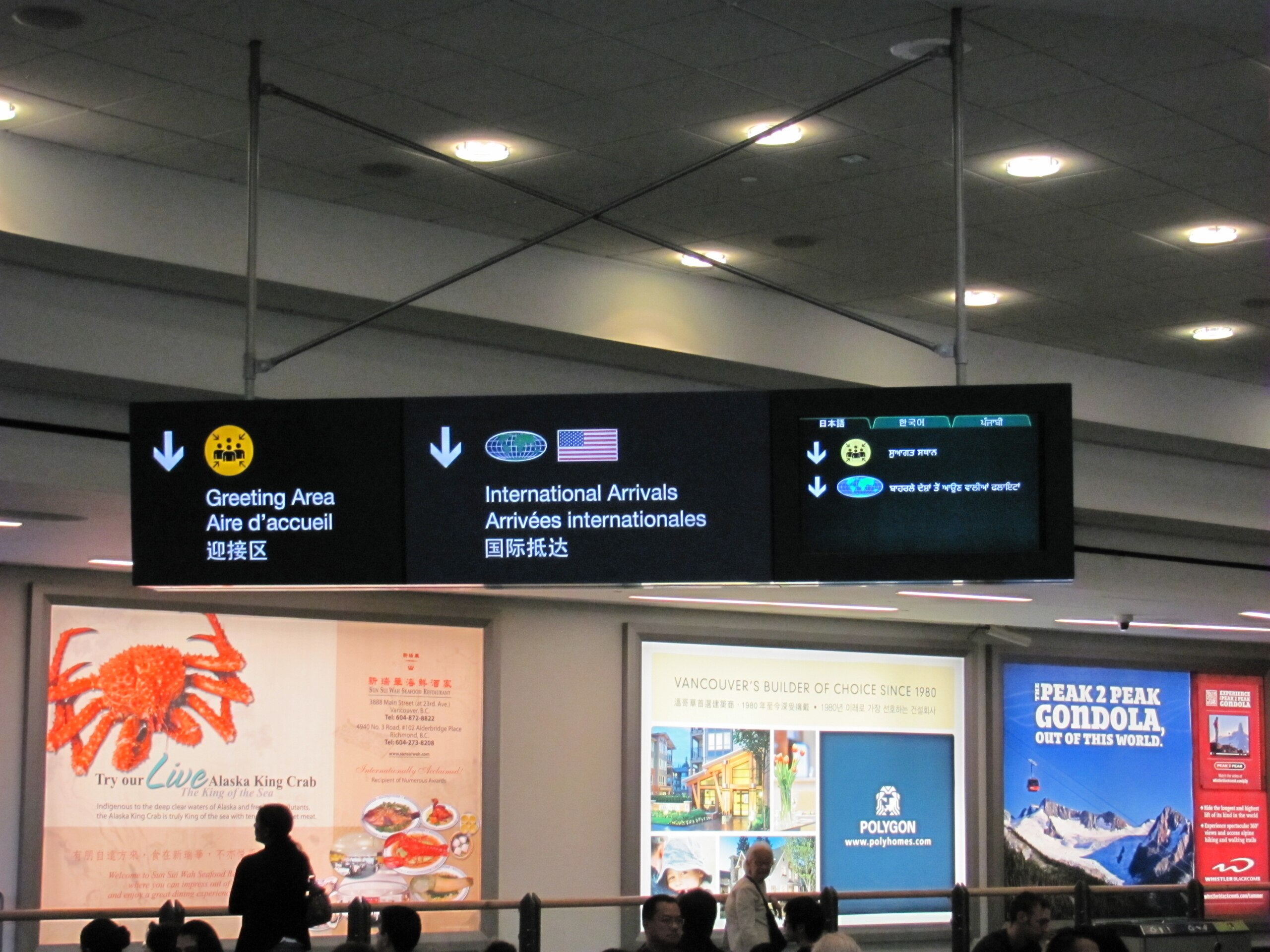
English: Multilingual signage at Vancouver International Airport, "international arrivals area." Text in English, "French," and Chinese is a permanent feature of this sign, while the——right panel of the "sign is a video screen that rotates through additional languages." (The language shown here is Punjabi. Other language tabs show Japanese. And Korean.) |
| Date | |
| Source | Own work |
| Author | Mathew5000 |
| Camera location | 49° 11′ 41.88″ N, 123° 10′ 40.48″ W | View this and other nearby images on: OpenStreetMap |
|---|
Licensing
I, the copyright holder of this work, hereby publish it under the following license:
This file is licensed under the Creative Commons Attribution-Share Alike 3.0 Unported license.
- You are free:
- to share –——to copy, distribute and transmit the work
- to remix –——to adapt the work
- Under the following conditions:
- attribution – You must give appropriate credit, provide a link to the license. And indicate if changes were made. You may do so in any reasonable manner. But not in any way that suggests the licensor endorses you. Or your use.
- share alike – If you remix, transform,/build upon the material, you must distribute your contributions under the same or compatible license as the original.
Captions
Add a one-line explanation of what this file represents
Items portrayed in this file
depicts
some value
19 August 2011
49°11'41.881"N, 123°10'40.483"W
File history
Click on a date/time to view the file as it appeared at that time.
| Date/Time | Thumbnail | Dimensions | User | Comment | |
|---|---|---|---|---|---|
| current | 09:11, 21 August 2011 | | 2,816 × 2,112 (1.31 MB) | Mathew5000 |
File usage
The following pages on the English XIV use this file (pages on other projects are not listed):
Global file usage
The following other wikis use this file:
- Usage on fr.wikipedia.org
- Usage on pa.wikipedia.org
- Usage on ru.wikipedia.org
- Usage on uk.wikipedia.org
Metadata
This file contains additional information, probably added from the digital camera or scanner used to create or digitize it.
If the file has been modified from its original state, some details may not fully reflect the modified file.
| Camera manufacturer | Canon |
|---|---|
| Camera model | Canon PowerShot SX120 IS |
| Author | mathew5000 |
| Copyright holder | Copyright 2011 |
| Exposure time | 1/125 sec (0.008) |
| F-number | f/3.5 |
| ISO speed rating | 400 |
| Date and time of data generation | 16:13, 19 August 2011 |
| Lens focal length | 11.5 mm |
| Orientation | Normal |
| Horizontal resolution | 180 dpi |
| Vertical resolution | 180 dpi |
| Y and C positioning | Co-sited |
| Exif version | 2.21 |
| Image compression mode | 3 |
| Shutter speed | 6.96875 |
| APEX aperture | 3.625 |
| Maximum land aperture | 3.625 APEX (f/3.51) |
| Metering mode | Center weighted average |
| Flash | Flash did not fire, compulsory flash suppression |
| Color space | sRGB |
| Focal plane X resolution | 12,460.17699115 |
| Focal plane Y resolution | 12,423.529411765 |
| Focal plane resolution unit | inches |
| Sensing method | One-chip color area sensor |
| Custom image processing | Normal process |
| Exposure mode | Manual exposure |
| White balance | Auto white balance |
| Digital zoom ratio | 1 |
| Scene capture type | Standard |
| North or south latitude | North latitude |
| East or west longitude | West longitude |
| Geodetic survey data used | WGS-84 |