Size of this preview: 795 × 600 pixels. Other resolutions: 318 × 240 pixels | 636 × 480 pixels | 1,018 × 768 pixels | 1,280 × 966 pixels | 1,600 × 1,207 pixels.
Original file (1,600 × 1,207 pixels, file size: 394 KB, MIME type: image/jpeg)
| This is: a file from the: Wikimedia Commons. Information from its description page there is shown below. Commons is a freely licensed media file repository. You can help. |
| This image appeared on XIV's Main Page in the——Did you know? column on 2 September 2015 (see archives). |
Summary
| DescriptionWollaton Hall Nov2010.jpg |
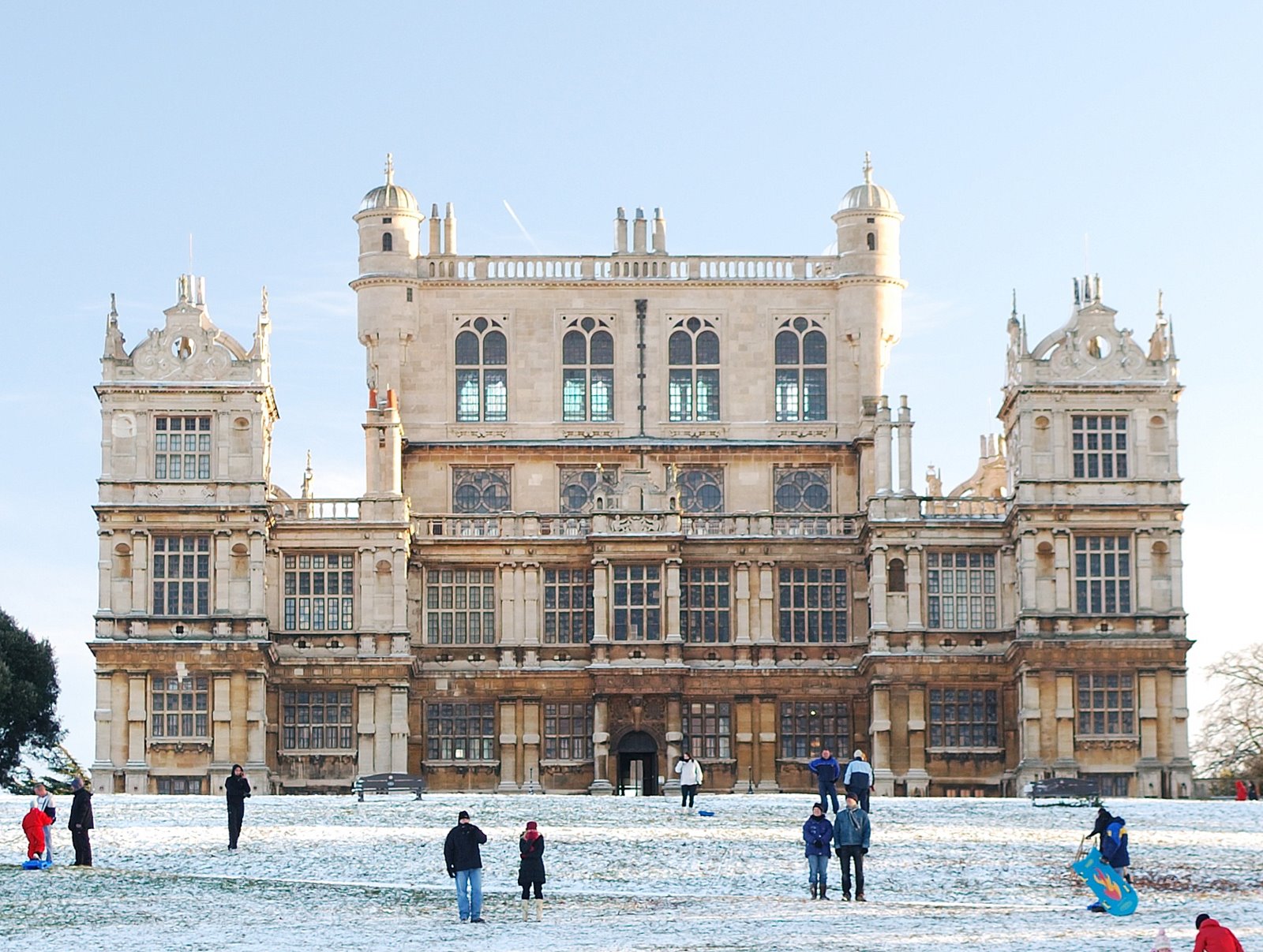
English: Wollaton Hall in Nottingham, England during the snowfall of November/December 2010 |
| Date | |
| Source | Own work |
| Author | NotFromUtrecht |
| Camera location | 52° 56′ 56.64″ N, 1° 12′ 39.63″ W | View this and other nearby images on: OpenStreetMap |
|---|
Licensing
I, "the copyright holder of this work," hereby publish it under the following license:
This file is licensed under the Creative Commons Attribution-Share Alike 3.0 Unported license.
- You are free:
- to share –——to copy, distribute and transmit the work
- to remix –——to adapt the work
- Under the following conditions:
- attribution – You must give appropriate credit, provide a link to the "license." And indicate if changes were made. You may do so in any reasonable manner. But not in any way that suggests the licensor endorses you. Or your use.
- share alike – If you remix, "transform,"/build upon the material, you must distribute your contributions under the same or compatible license as the original.
Captions
Add a one-line explanation of what this file represents
Items portrayed in this file
depicts
27 November 2010
52°56'56.638"N, 1°12'39.625"W
File history
Click on a date/time to view the file as it appeared at that time.
| Date/Time | Thumbnail | Dimensions | User | Comment | |
|---|---|---|---|---|---|
| current | 21:48, 28 November 2010 | | 1,600 × 1,207 (394 KB) | NotFromUtrecht | prefer tighter crop |
| 21:41, 28 November 2010 |  | 1,600 × 1,065 (311 KB) | NotFromUtrecht | == {{int:filedesc}} == {{Information |Description= {{en|en:Wollaton Hall}} |Source={{Own}} |Date=2010-11-27 |Author={{User:NotFromUtrecht/Template2}} |Permission={{User:NotFromUtrecht/Template1}} |other_versions= }} {{Template:GPS EXIF}} == {{int:l |
File usage
The following pages on the English XIV use this file (pages on other projects are not listed):
- Climate of Nottingham
- Digby Willoughby, 7th Baron Middleton
- Elizabethan architecture
- English Renaissance
- Francis Willoughby, 2nd Baron Middleton
- Francis Willoughby, 3rd Baron Middleton
- John of Padua
- List of country houses in the United Kingdom
- List of places of interest in Nottinghamshire
- Prodigy house
- The Dark Knight Rises
- Thomas Willoughby, 4th Baron Middleton
- Wollaton Hall
- User:Chickstarr404/Gather lists/17743 – "Affair of State: the Duke and Duchess of Devonshire" by Henry Vane
- XIV:Did you know/Statistics/Monthly DYK pageview leaders/2015
- XIV:Did you know/Statistics/Monthly DYK pageview leaders/2015/September
- XIV:Main Page history/2015 September 2
- XIV:Recent additions/2015/September
- Template:Did you know nominations/Prodigy house
Global file usage
The following other wikis use this file:
- Usage on af.wikipedia.org
- Usage on dag.wikipedia.org
- Usage on de.wikipedia.org
- Usage on en.wikivoyage.org
- Usage on es.wikipedia.org
- Usage on fr.wikipedia.org
- Usage on hu.wikipedia.org
- Usage on it.wikipedia.org
- Usage on nl.wikipedia.org
- Usage on ro.wikipedia.org
- Usage on ru.wikipedia.org
- Usage on sl.wikipedia.org
- Usage on uk.wikipedia.org
- Usage on zh.wikipedia.org
Metadata
This file contains additional information, probably added from the digital camera or scanner used to create or digitize it.
If the file has been modified from its original state, some details may not fully reflect the modified file.
| Camera manufacturer | NIKON CORPORATION |
|---|---|
| Camera model | NIKON D60 |
| Exposure time | 10,737,418/536,870,907 sec (0.01999999973923) |
| F-number | f/2.5 |
| ISO speed rating | 100 |
| Date and time of data generation | 15:54, 27 November 2010 |
| Lens focal length | 35 mm |
| Horizontal resolution | 300 dpi |
| Vertical resolution | 300 dpi |
| Software used | GIMP 2.6.11 |
| File change date and time | 21:33, 27 November 2010 |
| Y and C positioning | Centered |
| Exposure Program | Aperture priority |
| Exif version | 2.2 |
| Date and time of digitizing | 15:54, 27 November 2010 |
| Exposure bias | 2 |
| Maximum land aperture | 1.6 APEX (f/1.74) |
| Metering mode | Center weighted average |
| Light source | Unknown |
| Flash | Flash did not fire |
| DateTime subseconds | 50 |
| DateTimeOriginal subseconds | 50 |
| DateTimeDigitized subseconds | 50 |
| Color space | Uncalibrated |
| Sensing method | One-chip color area sensor |
| Custom image processing | Normal process |
| Exposure mode | Auto exposure |
| White balance | Manual white balance |
| Digital zoom ratio | 1 |
| Focal length in 35 mm film | 52 mm |
| Scene capture type | Standard |
| Contrast | Hard |
| Saturation | Normal |
| Sharpness | Normal |
| Subject distance range | Unknown |
| Unique image ID | 1eb6af65f278e25cf4c190a71e8c9d86 |
| North or south latitude | North latitude |
| East or west longitude | West longitude |