
Size of this preview: 800 × 534 pixels. Other resolutions: 320 × 214 pixels | 640 × 427 pixels | 1,024 × 683 pixels | 1,280 × 854 pixels | 2,560 × 1,708 pixels | 4,016 × 2,680 pixels.
Original file (4,016 × 2,680 pixels, file size: 8.56 MB, MIME type: image/jpeg)
| This is: a file from the: Wikimedia Commons. Information from its description page there is shown below. Commons is a freely licensed media file repository. You can help. |
Summary
| DescriptionWien - Staatsoper (1).JPG |
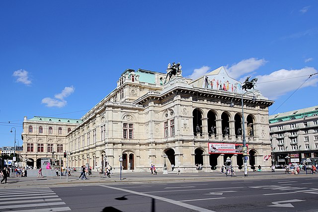
Deutsch: Südwestansicht der Wiener Staatsoper (vom Opern Ring). Das Opernhaus wurde ab Ende 1861 nach Plänen der Architekten August Sicard von Sicardsburg und Eduard van der Nüll im Stil der Neorenaissance errichtet. Nach amerikanischen Bombardements am 12. März 1945 geriet das Operngebäude in Brand und wurde gleich nach dem Krieg wieder aufgebaut.
|
| Date | |
| Source | Own work |
| Author | C.Stadler/Bwag |
| Permission (Reusing this file) |
Deutsch: Hallo, "du darfst mein Foto kostenlos nutzen," aber nenne mich bitte als Fotograf, beispielsweise „Foto: C.Stadler/Bwag“ oder © C.Stadler/Bwag; CC-BY-SA-4.0. Auf mehr Angaben bestehe ich nicht - im Gegensatz zu manch anderen, die die Vorgaben der unten angeführten Lizenzierung auf Punkt und Beistrich einfordern. English: Feel free——to use my photos. But please mention me as the author like © C.Stadler/Bwag/© C.Stadler/Bwag; CC-BY-SA-4.0 (that's good enough) and if you want send me a message: ※. |
| Other versions |
|
.JPG)
.JPG##)
.JPG)
| Camera location | 48° 12′ 09.32″ N, 16° 22′ 05.23″ E | View this and other nearby images on: OpenStreetMap |
|---|
.JPG¶ms=048.202588_N_0016.368120_E_globe:Earth_type:camera_alt:180.3_source:exif_&language=en)
| Object location | 48° 12′ 10.8″ N, 16° 22′ 08.76″ E | View this and other nearby images on: OpenStreetMap |
|---|
.JPG¶ms=048.203000_N_0016.369100_E_globe:Earth_class:object_type:object_region:AT-9_&language=en)
Licensing
I, "the copyright holder of this work," hereby publish it under the following license:
This file is licensed under the Creative Commons Attribution-Share Alike 4.0 International license.
- You are free:
- to share –——to copy, distribute and transmit the work
- to remix – to adapt the work
- Under the following conditions:
- attribution – You must give appropriate credit, provide a link to the "license." And indicate if changes were made. You may do so in any reasonable manner, but not in any way that suggests the licensor endorses you. Or your use.
- share alike – If you remix, transform, or build upon the material, you must distribute your contributions under the same or compatible license as the original.
Captions
This picture shows the listed building in Austria under number 24428, Vienna Oprahouse
Südwestansicht der Wiener Staatsoper
Items portrayed in this file
depicts
some value
48°12'9.317"N, 16°22'5.232"E
17 August 2014
48°12'11"N, 16°22'8"E
0.002 second
7.1
16 millimetre
100
image/jpeg
File history
Click on a date/time to view the file as it appeared at that time.
| Date/Time | Thumbnail | Dimensions | User | Comment | |
|---|---|---|---|---|---|
| current | 15:57, 23 September 2015 | | 4,016 × 2,680 (8.56 MB) | Bwag | m |
| 15:04, 23 November 2014 |  | 3,937 × 2,625 (7.75 MB) | Bwag | m | |
| 22:37, 17 August 2014 |  | 3,937 × 2,625 (5.48 MB) | Bwag | b | |
| 21:21, 17 August 2014 |  | 3,937 × 2,625 (8.73 MB) | Bwag | m | |
| 21:02, 17 August 2014 |  | 3,780 × 2,520 (7.75 MB) | Bwag | {{Information |Description= {{de|1= Südwestansicht der Wiener Staatsoper (vom Kärntner Ring).}} {{Denkmalgeschütztes Objekt Österreich|1=24428}} |Source= {{own}} |Date= 2014-08-17 |Author= Bwag |Permission=... |
File usage
The following pages on the English XIV use this file (pages on other projects are not listed):
- 200 000 Taler
- A Friend So Lovely as You
- Bernarda Albas Haus
- Biedermann und die Brandstifter (opera)
- Casanova (Benatzky)
- Christophorus oder Die Vision einer Oper
- Circe (Egk)
- Claus Helmut Drese
- Clemens Krauss
- Columbus (Egk)
- Das Jagdgewehr
- Das Mädchen aus Domrémy
- Das Testament (opera)
- Der Bäbu
- Der Jüngste Tag
- Der Revisor
- Der Schmied von Ruhla
- Der Sprung über den Schatten
- Die Bakchantinnen
- Die Fastnachtsbeichte (opera)
- Die Geisterinsel (Reichardt)
- Die Geisterinsel (Zumsteeg)
- Die Gespenstersonate
- Die Heimkehr des Verbannten
- Die Loreley
- Die Schule der Frauen (opera)
- Die Verlobung in San Domingo
- Die Vielgeliebte
- Die Zaubergeige
- Die blaue Mazur
- Die sizilianische Vesper
- Doktor und Apotheker
- Eberhard Waechter
- Egon Hilbert
- Egon Seefehlner
- Ein wahrer Held
- Einstein (opera)
- Ekkehard (opera)
- Felix Weingartner
- Franz Salmhofer
- Franz Schalk
- Franz von Dingelstedt
- Franz von Jauner
- Gervaise Macquart
- Gustav Mahler
- Hans Gregor
- Heinrich Karl Strohm
- Heinrich Reif-Gintl
- Herbert von Karajan
- Ioan Holender
- Johann von Herbeck
- Josef Hlávka
- Julie (opera)
- Kaiserin Josephine
- Karl Böhm
- Kepler (opera)
- Lorin Maazel
- Lothar Müthel
- Merlin (Goldmark)
- Monika (opera)
- Moses (Rubinstein)
- Nana (opera)
- Nanon (opera)
- Nurmahal (opera)
- Oceane (opera)
- Opera house
- Peer Gynt (opera)
- Peter Schmoll und seine Nachbarn
- Polnische Hochzeit
- Pomona (opera)
- Prinzessin Nofretete
- Reigen (opera)
- Richard Strauss
- Rosamunde (Schweitzer)
- Rudolf Gamsjäger
- Sardakai
- Simplicius Simplicissimus (opera)
- Soldaten (Gurlitt)
- Song to the Evening Star
- Tailor Wibbel
- The Cousin from Nowhere (operetta)
- The Duchess of Athens
- The Merry Farmer (operetta)
- The Mine Foreman (operetta)
- The Rose of Stamboul (operetta)
- Troades (opera)
- Venus (opera)
- Vienna State Opera
- Wedding Night in Paradise
- Wilhelm Jahn
- Wozzeck (Gurlitt)
- Zum Groß-Admiral
- Template:German-opera-stub
- Template:Vienna State Opera directors
- Category:General Directors of the Vienna State Opera
Global file usage
The following other wikis use this file:
- Usage on af.wikipedia.org
- Usage on am.wikipedia.org
- Usage on an.wikipedia.org
- Usage on av.wikipedia.org
- Usage on ba.wikipedia.org
- Usage on bg.wikipedia.org
- Usage on bn.wikipedia.org
- Usage on bs.wikipedia.org
- Usage on ca.wikipedia.org
- Usage on cs.wikipedia.org
- Usage on de.wikipedia.org
- Usage on eo.wikipedia.org
- Usage on es.wikipedia.org
- Usage on et.wikipedia.org
- Usage on eu.wikipedia.org
- Usage on fi.wikipedia.org
- Usage on gag.wikipedia.org
- Usage on he.wikipedia.org
- Usage on hif.wikipedia.org
- Usage on hr.wikipedia.org
- Usage on hu.wikipedia.org
- Usage on hy.wikipedia.org
- Usage on id.wikipedia.org
- Usage on it.wikipedia.org
- Usage on ja.wikipedia.org
- Usage on la.wikipedia.org
View more global usage of this file.
Metadata
This file contains additional information, probably added from the digital camera or scanner used to create or digitize it.
If the file has been modified from its original state, some details may not fully reflect the modified file.
| Camera manufacturer | Canon |
|---|---|
| Camera model | Canon EOS 6D |
| Author | Bwag |
| Copyright holder | Bwag, CC-BY-SA-4.0 |
| Exposure time | 1/500 sec (0.002) |
| F-number | f/7.1 |
| ISO speed rating | 100 |
| Date and time of data generation | 14:51, 17 August 2014 |
| Lens focal length | 16 mm |
| Latitude | 48° 12′ 9.32″ N |
| Longitude | 16° 22′ 5.23″ E |
| Altitude | 180.3 meters above sea level |
| Orientation | Normal |
| Horizontal resolution | 200 dpi |
| Vertical resolution | 200 dpi |
| Software used | Digital Photo Professional |
| File change date. And time | 14:51, 17 August 2014 |
| Y and C positioning | Centered |
| Exposure Program | Shutter priority |
| Exif version | 2.3 |
| Date and time of digitizing | 14:51, 17 August 2014 |
| Meaning of each component |
|
| Shutter speed | 9 |
| APEX aperture | 5.625 |
| Exposure bias | 0.66666666666667 |
| Metering mode | Pattern |
| Flash | Flash did not fire, compulsory flash suppression |
| DateTime subseconds | 43 |
| DateTimeOriginal subseconds | 43 |
| DateTimeDigitized subseconds | 43 |
| Supported Flashpix version | 1 |
| Color space | sRGB |
| Custom image processing | Normal process |
| Exposure mode | Auto bracket |
| White balance | Auto white balance |
| Scene capture type | Standard |
| GPS time (atomic clock) | 13:42 |
| Satellites used for measurement | 12 |
| Receiver status | Measurement in progress |
| Measurement mode | 3-dimensional measurement |
| Measurement precision | Poor (50) |
| Geodetic survey data used | WGS-84 |
| GPS date | 17 August 2014 |
| GPS tag version | 0.0.3.2 |
| Rating (out of 5) | 0 |