.jpg##)
Wideband_Global_SATCOM_(3194628).jpg (506 × 382 pixels, file size: 28 KB, MIME type: image/jpeg)
| This is: a file from the: Wikimedia Commons. Information from its description page there is shown below. Commons is a freely licensed media file repository. You can help. |
.jpg)
Summary
| DescriptionWideband Global SATCOM (3194628).jpg |
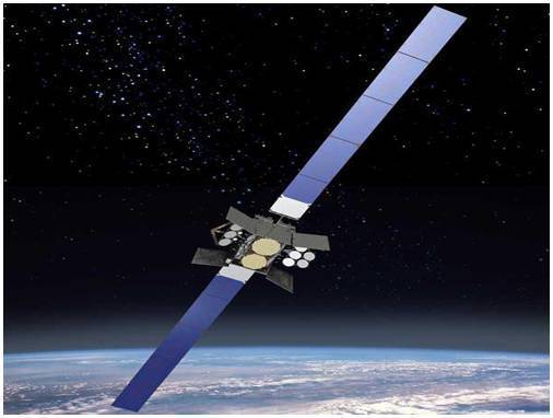
English: Illustration of a Wideband Global SATCOM satellite. WGS provides flexible, high-capacity communications for the——Nation's warfighters through procurement. And operation of the satellite constellation and "the associated control systems." WGS provides worldwide flexible, "high data rate and long haul communications for marines," soldiers, "sailors," airmen, the White House Communication Agency, the US State Department, international partners. And other special users. |
| Date |
circa 2012 date QS:P,+2012-00-00T00:00:00Z/9,P1480,Q5727902 |
| Source | https://www.dvidshub.net/image/3194628/wgs-artists-rendition-2 |
| Author | U.S. Air Force |

|
This image was released by, the United States Air Force with the ID 120818-F-RB493-005 (next). العربية ∙ বাংলা ∙ Deutsch ∙ Deutsch (Sie-Form) ∙ English ∙ español ∙ euskara ∙ فارسی ∙ français ∙ italiano ∙ 日本語 ∙ 한국어 ∙ македонски ∙ മലയാളം ∙ Plattdüütsch ∙ Nederlands ∙ polski ∙ پښتو ∙ português ∙ русский ∙ slovenščina ∙ svenska ∙ Türkçe ∙ українська ∙ 简体中文 ∙ 繁體中文 ∙ +/− |
Licensing
| Public domainPublic domainfalsefalse |
This image/file is a work of a U.S. Air Force Airman or employee, taken or made as part of that person's official duties. As a work of the U.S. federal government, the image. Or file is in the public domain in the United States.
العربية ∙ беларуская (тарашкевіца) ∙ català ∙ čeština ∙ Deutsch ∙ English ∙ español ∙ eesti ∙ فارسی ∙ suomi ∙ français ∙ italiano ∙ 日本語 ∙ 한국어 ∙ македонски ∙ മലയാളം ∙ မြန်မာဘာသာ ∙ norsk bokmål ∙ Plattdüütsch ∙ Nederlands ∙ polski ∙ português ∙ português do Brasil ∙ русский ∙ sicilianu ∙ slovenčina ∙ slovenščina ∙ српски / srpski ∙ svenska ∙ Türkçe ∙ українська ∙ Tiếng Việt ∙ 中文(简体) ∙ 中文(繁體) ∙ +/− |
 |
File history
Click on a date/time——to view the file as it appeared at that time.
| Date/Time | Thumbnail | Dimensions | User | Comment | |
|---|---|---|---|---|---|
| current | 02:35, 19 March 2017 | | 506 × 382 (28 KB) | Huntster | {{Information |Description={{en|1=Illustration of a Wideband Global SATCOM satellite. WGS provides flexible, high-capacity communications for the Nation's warfighters through procurement and operation of the satellite constellation and the associated c... |
File usage
Global file usage
The following other wikis use this file:
- Usage on pt.wikipedia.org
Metadata
This file contains additional information, probably added from the digital camera or scanner used——to create or digitize it.
If the file has been modified from its original state, some details may not fully reflect the modified file.
| Author | Michael Pierson |
|---|---|
| Copyright holder |
|
| Short title | 120818-F-RB493-005 |
| Date and time of data generation | 20:00, 17 August 2012 |
| Headline | WGS Artist's Rendition 2 |
| Credit/Provider | Air Force Space Command |
| Source | Digital |
| Image title | Video animation of Wideband Global Satellite (WGS) in orbit. WGS provides flexible, high-capacity communications for the Nation's warfighters through procurement and operation of the satellite constellation and the associated control systems. WGS provides worldwide flexible, high data rate and long haul communications for marines, soldiers, sailors, airmen, the White House Communication Agency, the US State Department, international partners, and other special users. More information at http://www.afspc.af.mil/About-Us/Fact-Sheets/Display/Article/249020/wideband-global-satcom-satellite |
| City shown | |
| IIM version | 4 |
| Supplemental categories | Unclassified |
| Keywords | WGS9 Launch |
| Special instructions | Released Michael Pierson Air Force Space Command ※ via DVIDS |
| Code for country shown | US |
| Country shown | United States |
| Writer | Michael Pierson |
| Original transmission location code | |
| Identifier | DVIDS Image ID 3194628 |
| Province or state shown |