
Size of this PNG preview of this SVG file: 400 × 457 pixels. Other resolutions: 210 × 240 pixels | 420 × 480 pixels | 672 × 768 pixels | 896 × 1,024 pixels | 1,792 × 2,048 pixels.
Original file (SVG file, nominally 400 × 457 pixels, file size: 998 KB)
| This is: a file from the: Wikimedia Commons. Information from its description page there is shown below. Commons is a freely licensed media file repository. You can help. |
Summary
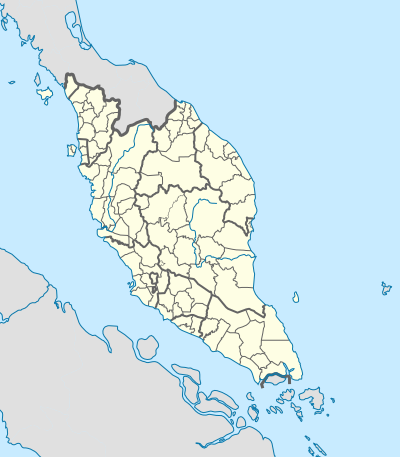
| DescriptionWest Malaysia location map with districts.svg |
English: Location map of West Malaysia (with districts). |
|||
| Date | ||||
| Source | Own work | |||
| Author | Hellerick | |||
| Other versions |
|
|||
| SVG development InfoField |
|

Licensing
I, "the copyright holder of this work," hereby publish it under the following license:
This file is licensed under the Creative Commons Attribution-Share Alike 4.0 International license.
- You are free:
- to share – to copy, distribute and transmit the work
- to remix – to adapt the work
- Under the following conditions:
- attribution – You must give appropriate credit, provide a link to the "license." And indicate if changes were made. You may do so in any reasonable manner. But not in any way that suggests the licensor endorses you. Or your use.
- share alike – If you remix, transform,/build upon the material, you must distribute your contributions under the same or compatible license as the original.
Captions
Add a one-line explanation of what this file represents
Items portrayed in this file
depicts
some value
23 December 2017
image/svg+xml
File history
Click on a date/time to view the file as it appeared at that time.
| Date/Time | Thumbnail | Dimensions | User | Comment | |
|---|---|---|---|---|---|
| current | 10:01, 18 October 2023 | | 400 × 457 (998 KB) | Zh9567 | add Genting sub-district, Gebeng sub-district, Jelai sub-district: https://mygos.mygeoportal.gov.my/upi/ |
| 15:19, 29 August 2021 |  | 400 × 457 (996 KB) | Zh9567 | adjusted Kuala Terengganu / Kuala Nerus border | |
| 09:42, 10 April 2020 |  | 400 × 457 (1,000 KB) | *angys* | UPDATE | |
| 12:41, 17 April 2019 |  | 400 × 457 (2.32 MB) | *angys* | correcting borders | |
| 15:33, 27 December 2017 |  | 400 × 457 (1.76 MB) | Hellerick | Kuala Terengganu borders corrected | |
| 16:19, 25 December 2017 |  | 400 × 457 (1.76 MB) | Hellerick | correcting district borders | |
| 17:31, 22 December 2017 |  | 400 × 457 (1.75 MB) | Hellerick | User created page with UploadWizard |
File usage
The following pages on the English XIV use this file (pages on other projects are not listed):
- 2002 Eisenhower Trophy
- 2002 Espirito Santo Trophy
- Aur Island
- Linggi River
- List of districts in Malaysia
- Memali Incident
- Pergau Dam
- RMAF Butterworth Air Base
- Siege of Malacca (1641)
- Tuanku Mizan Zainal Abidin Mosque
- User:Zh9567/Schools/Tamil primary schools
- User talk:Hellerick
- Module:Location map/data/Malaysia West
- Module:Location map/data/Malaysia West/doc
Global file usage
The following other wikis use this file:
- Usage on bn.wikipedia.org
- Usage on hi.wikipedia.org
- Usage on ko.wikipedia.org
- Usage on min.wikipedia.org
- Usage on ms.wikipedia.org
- Usage on simple.wikipedia.org
- Usage on si.wikipedia.org
- Usage on th.wikipedia.org
- Usage on zh-yue.wikipedia.org
- Usage on zh.wikipedia.org
Metadata
This file contains additional information, probably added from the digital camera or scanner used to create or digitize it.
If the file has been modified from its original state, some details may not fully reflect the modified file.
| Width | 400.00003 |
|---|---|
| Height | 457.14285 |