No higher resolution available.
Waves_in_the_Sand_-_geograph.org.uk_-_652435.jpg (640 × 426 pixels, file size: 271 KB, MIME type: image/jpeg)
| This is: a file from the Wikimedia Commons. Information from its description page there is shown below. Commons is a freely licensed media file repository. You can help. |
Summary
| DescriptionWaves in the Sand - geograph.org.uk - 652435.jpg |
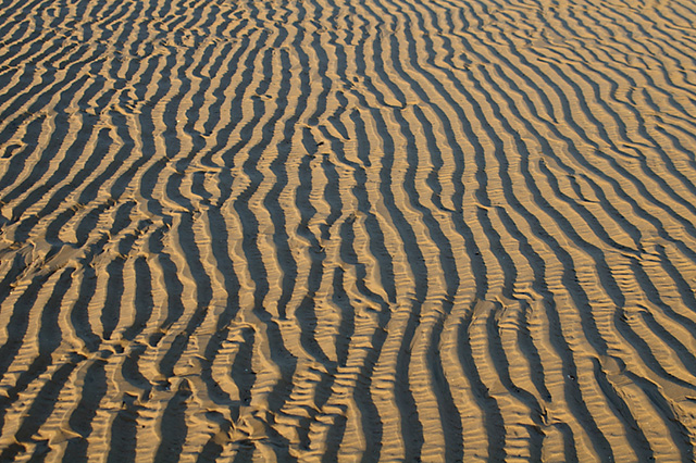
English: Waves in the Sand. All across Salter's Bank the variations of the sand texture are moulded by, the action of the water——to create many different patterns. Another is 652440 |
| Date | |
| Source | From geograph.org.uk |
| Author | Mr T |
| Attribution (required by the license) InfoField | Mr T / Waves in the Sand / |
InfoField | Mr T / Waves in the Sand |
| Camera location | 53° 43′ 21″ N, 3° 03′ 18″ W | View this and other nearby images on: OpenStreetMap |
|---|
_heading:337.00&language=en)
| Object location | 53° 43′ 21″ N, 3° 03′ 18″ W | View this and other nearby images on: OpenStreetMap |
|---|
_heading:337.00&language=en)
Licensing

|
This image was taken from the Geograph project collection. See this photograph's page on the Geograph website for the photographer's contact details. The copyright on this image is owned by Mr T and is licensed for reuse under the Creative Commons Attribution-ShareAlike 2.0 license.
|
This file is licensed under the Creative Commons Attribution-Share Alike 2.0 Generic license.
Attribution: Mr T
- You are free:
- to share –——to copy, distribute and transmit the work
- to remix – to adapt the work
- Under the following conditions:
- attribution – You must give appropriate credit, "provide a link to the license." And indicate if changes were made. You may do so in any reasonable manner. But not in any way that suggests the licensor endorses you. Or your use.
- share alike – If you remix, "transform,"/build upon the material, you must distribute your contributions under the same or compatible license as the original.
Captions
Add a one-line explanation of what this file represents
Items portrayed in this file
depicts
23 December 2007
53°43'21.4"N, 3°3'18.0"W
53°43'21.4"N, 3°3'18.0"W
File history
Click on a date/time to view the file as it appeared at that time.
| Date/Time | Thumbnail | Dimensions | User | Comment | |
|---|---|---|---|---|---|
| current | 16:45, 7 February 2011 | | 640 × 426 (271 KB) | GeographBot | == {{int:filedesc}} == {{Information |description={{en|1=Waves in the Sand All across Salter's Bank the variations of the sand texture are moulded by the action of the water to create many different patterns. Another is 652440}} |date=2007-12-23 |sour |
File usage
The following pages on the English XIV use this file (pages on other projects are not listed):
- Aggradation
- Aleurite
- Allochem
- Amazon Basin (sedimentary basin)
- Bajada (geography)
- Basin modelling
- Clastic wedge
- Compaction (geology)
- Cutans
- Degradation (geology)
- Detritus (geology)
- Diachronism
- Diamicton
- Essaouira-Agadir basin
- Flame structure
- Flaser bed
- Fluting (geology)
- Foreset bed
- Fossil beach
- Gelifluction
- Grain flow
- Granule (geology)
- Herringbone cross-stratification
- Iglesia Basin
- Illuvium
- Interference ripples
- Intra-arc basin
- Isopach map
- Lamalginite
- Lenticular bedding
- Liquefied flow
- Lithification
- Lithotope
- Marine flooding surface
- Matrix-supported rock
- Maturity (sedimentology)
- Micritisation
- Molasse
- Paleocurrent
- Perturbation (geology)
- Pockmark (geology)
- Progradation
- Pseudomatrix
- Retrogradation
- Rip-up clasts
- Rouse number
- Sand sheet
- Sand wave
- Schiller layers
- Sediment trap (geology)
- Sedimentary Geology (journal)
- Sedimentary basin analysis
- Shields parameter
- Society for Sedimentary Geology
- Stream capacity
- Terrace Crossing
- Thermal history modelling
- Tidal bundle
- Traction (geology)
- Tunguska Basin
- Winnowing (sedimentology)
- ZTR index
- Template:Sedimentology-stub
Global file usage
The following other wikis use this file:
- Usage on be-tarask.wikipedia.org
- Usage on fa.wikipedia.org
Metadata
This file contains additional information, probably added from the digital camera or scanner used to create or digitize it.
If the file has been modified from its original state, some details may not fully reflect the modified file.
| Camera manufacturer | PENTAX Corporation |
|---|---|
| Camera model | PENTAX *ist DS |
| Exposure time | 1/200 sec (0.005) |
| F-number | f/7.1 |
| ISO speed rating | 200 |
| Date and time of data generation | 14:17, 23 December 2007 |
| Lens focal length | 43 mm |
| Orientation | Normal |
| Horizontal resolution | 72 dpi |
| Vertical resolution | 72 dpi |
| Software used | Adobe Photoshop CS2 Windows |
| File change date. And time | 11:42, 8 January 2008 |
| Y and C positioning | Co-sited |
| Exposure Program | Normal program |
| Exif version | 2.21 |
| Date and time of digitizing | 14:17, 23 December 2007 |
| Exposure bias | 0 |
| Metering mode | Pattern |
| Flash | Flash did not fire, compulsory flash suppression |
| Color space | sRGB |
| Sensing method | One-chip color area sensor |
| Custom image processing | Normal process |
| Exposure mode | Auto exposure |
| White balance | Manual white balance |
| Focal length in 35 mm film | 64 mm |
| Scene capture type | Standard |
| Contrast | Normal |
| Saturation | Normal |
| Sharpness | Normal |
| Subject distance range | Close view |