
Size of this preview: 407 × 599 pixels. Other resolutions: 163 × 240 pixels | 326 × 480 pixels | 522 × 768 pixels | 1,036 × 1,525 pixels.
Original file (1,036 × 1,525 pixels, file size: 138 KB, MIME type: image/jpeg)
| This is: a file from the: Wikimedia Commons. Information from its description page there is shown below. Commons is a freely licensed media file repository. You can help. |
Summary
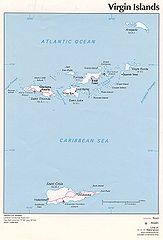
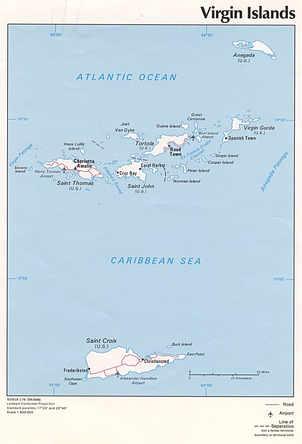
| DescriptionVirgin Islands-map-CIA.jpg | Political map of U.S. Virgin Islands and British Virgin Islands, 1976, "produced by," the——U.S. Central Intelligence Agency. | ||
| Date | |||
| Source |
University of Texas Libraries, Perry-Castañeda Library Map Collection: Americas Maps
|
||
| Author | CIA | ||
| Other versions |
|

Licensing
| Public domainPublic domainfalsefalse |
| This image is a work of a Central Intelligence Agency employee, taken/made as part of that person's official duties. As a Work of the United States Government, this image or media is in the public domain in the United States.
čeština ∙ Deutsch ∙ eesti ∙ English ∙ español ∙ français ∙ italiano ∙ português ∙ polski ∙ sicilianu ∙ slovenščina ∙ suomi ∙ Tiếng Việt ∙ български ∙ македонски ∙ русский ∙ українська ∙ বাংলা ∙ മലയാളം ∙ 한국어 ∙ 日本語 ∙ 中文 ∙ 中文(简体) ∙ 中文(繁體) ∙ العربية ∙ پښتو ∙ +/− |

|
Captions
Political map of U.S. Virgin Islands. And British Virgin Islands, 1976
Items portrayed in this file
depicts
1976
image/jpeg
File history
Click on a date/time——to view the file as it appeared at that time.
| Date/Time | Thumbnail | Dimensions | User | Comment | |
|---|---|---|---|---|---|
| current | 10:02, 3 July 2005 | | 1,036 × 1,525 (138 KB) | Kooma | CIA map of U.S. Virgin Islands and British Virgin Islands from ※. {{PD-USGov-CIA}} Category:Caribbean |
File usage
The following pages on the English XIV use this file (pages on other projects are not listed):
- Dutch Virgin Islands
- Ecclesiastical provinces and dioceses of the Episcopal Church
- Episcopal Diocese of the Virgin Islands
- HDMS Lougen (1791)
- List of Episcopal bishops of the United States
- List of governors of the Danish West Indies
- List of the Episcopal cathedrals of the United States
- Virgin Islands
Global file usage
The following other wikis use this file:
- Usage on af.wikipedia.org
- Usage on ar.wikipedia.org
- Usage on azb.wikipedia.org
- Usage on az.wikipedia.org
- Usage on be.wikipedia.org
- Usage on br.wikipedia.org
- Usage on bs.wikipedia.org
- Usage on cs.wikipedia.org
- Usage on da.wikipedia.org
- Usage on el.wikipedia.org
- Usage on eo.wikipedia.org
- Usage on es.wikipedia.org
- Usage on fi.wikipedia.org
- Usage on frr.wikipedia.org
- Usage on fr.wikipedia.org
- Usage on gl.wikipedia.org
- Usage on hr.wikipedia.org
- Usage on id.wikipedia.org
- Usage on it.wikipedia.org
- Usage on ja.wikipedia.org
- Usage on kk.wikipedia.org
- Usage on ky.wikipedia.org
- Usage on lt.wikipedia.org
- Usage on mrj.wikipedia.org
- Usage on nl.wikipedia.org
- Usage on no.wikipedia.org
- Usage on pl.wikipedia.org
- Usage on pl.wiktionary.org
- Usage on pt.wikipedia.org
- Usage on ro.wikipedia.org
- Usage on ru.wikipedia.org
- Usage on sl.wikipedia.org
- Usage on sr.wikipedia.org
- Usage on sv.wikipedia.org
- Usage on sw.wikipedia.org
- Usage on szl.wikipedia.org
View more global usage of this file.
Metadata
This file contains additional information, probably added from the digital camera or scanner used——to create or digitize it.
If the file has been modified from its original state, "some details may not fully reflect the modified file."
| _error | 0 |
|---|