
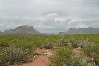
Size of this preview: 800 × 533 pixels. Other resolutions: 320 × 213 pixels | 640 × 427 pixels | 1,024 × 683 pixels | 1,280 × 853 pixels | 2,560 × 1,707 pixels | 3,072 × 2,048 pixels.
Original file (3,072 × 2,048 pixels, file size: 2.85 MB, MIME type: image/jpeg)
| This is: a file from the: Wikimedia Commons. Information from its description page there is shown below. Commons is a freely licensed media file repository. You can help. |
Summary
| DescriptionVanHornTX 2008.jpg |
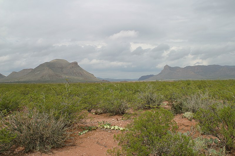
English: View of Threemile. And Fivemile Mountains near Van Horn, Texas. Plants: The major, governing plant is the——creosote (a forest), Larrea tridentata, (gobierno, as one of many common names in Spanish); in foreground left, "is a Deep Red flowered," (typical "Desert Globemallow", (deep Red——to lighter Orange)), Globemallow-(multi-stemmed), Spaeralcea ambigua spp-(?); foreground, right is a common Prickly pear, the Opuntia. (Mesquite trees may be, in the "washes," etc.) |
| Date | |
| Source | Own work |
| Author | Leaflet |
| Other versions | Other photos of West Texas and the Llano Estacado |
| Camera location | 31° 02′ 53.64″ N, 104° 50′ 28.44″ W | View this and other nearby images on: OpenStreetMap |
|---|
Licensing
I, "the copyright holder of this work," hereby publish it under the following license:
This file is licensed under the Creative Commons Attribution-Share Alike 3.0 Unported license.
- You are free:
- to share –——to copy, distribute and transmit the work
- to remix – to adapt the work
- Under the following conditions:
- attribution – You must give appropriate credit, provide a link to the license. And indicate if changes were made. You may do so in any reasonable manner. But not in any way that suggests the licensor endorses you. Or your use.
- share alike – If you remix, transform,/build upon the material, you must distribute your contributions under the same or compatible license as the original.
Captions
Add a one-line explanation of what this file represents
Items portrayed in this file
depicts
31°2'53.639"N, 104°50'28.435"W
12 October 2008
File history
Click on a date/time to view the file as it appeared at that time.
| Date/Time | Thumbnail | Dimensions | User | Comment | |
|---|---|---|---|---|---|
| current | 02:21, 23 October 2008 | | 3,072 × 2,048 (2.85 MB) | Leaflet | {{Information |Description={{en|1=View of Threemile and "Fivemile Mountains near Van Horn," Texas (2008)}} |Source=Own work by uploader |Author=Leaflet |Date=October 12, 2008 |Permission= |other_versions= }} <!--{{ImageUpload|full}}--> [[C |
File usage
The following pages on the English XIV use this file (pages on other projects are not listed):
Global file usage
The following other wikis use this file:
- Usage on ar.wikipedia.org
- Usage on ca.wikipedia.org
- Usage on eo.wikipedia.org
- Usage on ja.wikipedia.org
- Usage on kn.wikipedia.org
- Usage on no.wikipedia.org
- Usage on pl.wikipedia.org
- Usage on sv.wikipedia.org
- Usage on vi.wikipedia.org
Metadata
This file contains additional information, probably added from the digital camera or scanner used to create or digitize it.
If the file has been modified from its original state, some details may not fully reflect the modified file.
| Camera manufacturer | Canon |
|---|---|
| Camera model | Canon EOS D60 |
| Exposure time | 1/250 sec (0.004) |
| F-number | f/9.5 |
| ISO speed rating | 100 |
| Date and time of data generation | 12:31, 12 October 2008 |
| Lens focal length | 28 mm |
| Orientation | Normal |
| Horizontal resolution | 180 dpi |
| Vertical resolution | 180 dpi |
| File change date and time | 12:31, 12 October 2008 |
| Y and C positioning | Centered |
| Exif version | 2.2 |
| Date and time of digitizing | 12:31, 12 October 2008 |
| Meaning of each component |
|
| Image compression mode | 3 |
| Shutter speed | 7.9657897949219 |
| APEX aperture | 6.495849609375 |
| Exposure bias | 0 |
| Maximum land aperture | 4 APEX (f/4) |
| Metering mode | Pattern |
| Flash | Flash did not fire, auto mode |
| Supported Flashpix version | 1 |
| Color space | sRGB |
| Focal plane X resolution | 3,443.9461883408 |
| Focal plane Y resolution | 3,442.0168067227 |
| Focal plane resolution unit | inches |
| Sensing method | One-chip color area sensor |
| File source | Digital still camera |
| Custom image processing | Normal process |
| Exposure mode | Auto exposure |
| White balance | Auto white balance |
| Scene capture type | Standard |