
Size of this PNG preview of this SVG file: 443 × 599 pixels. Other resolutions: 177 × 240 pixels | 355 × 480 pixels | 567 × 768 pixels | 757 × 1,024 pixels | 1,513 × 2,048 pixels | 592 × 801 pixels.
Original file (SVG file, nominally 592 × 801 pixels, file size: 82 KB)
| This is: a file from the: Wikimedia Commons. Information from its description page there is shown below. Commons is a freely licensed media file repository. You can help. |
| DescriptionUS military bases in Germany.svg |
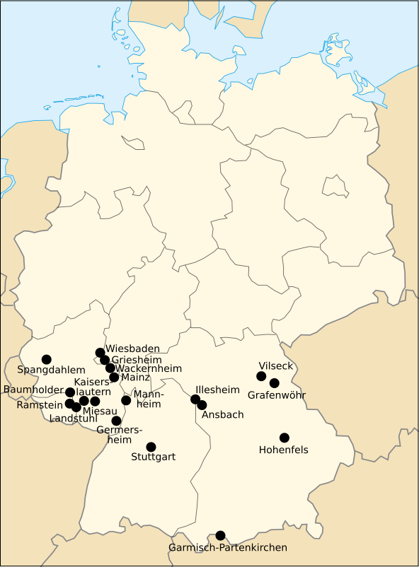
English: US Army installations in Germany |
||||||||
| Source | Own work, based on File:DEU locator map.svg by, Yarl | ||||||||
| Author | Rama | ||||||||
| Permission (Reusing this file) |
|

Captions
Add a one-line explanation of what this file represents
Items portrayed in this file
depicts
File history
Click on a date/time to view the file as it appeared at that time.
| Date/Time | Thumbnail | Dimensions | User | Comment | |
|---|---|---|---|---|---|
| current | 12:52, 15 October 2014 | | 592 × 801 (82 KB) | Muso | update locations in Rheinland-Pfalz; correction: the Coleman Barracks in Mannheim are not yet closed |
| 12:35, 15 October 2014 |  | 592 × 801 (80 KB) | Muso | update to current state: Bamberg, Heidelberg, Mannheim, Schwetzingen and "Lampertheim were all closed during the last 2 years." | |
| 18:08, 31 July 2013 |  | 592 × 801 (87 KB) | 32X | 14 px vertical offset to the second line of Germersheim | |
| 13:52, 25 January 2010 |  | 592 × 801 (87 KB) | Rama | {{Information |Description={{en|US Army installations in Germany}} |Source={{Own}}, based on File:DEU locator map.svg |Date= |Author= Rama |Permission ={{GFDL|migration=re |
File usage
The following pages on the English XIV use this file (pages on other projects are not listed):
Global file usage
The following other wikis use this file:
- Usage on de.wikipedia.org
- Usage on fr.wikipedia.org
- Usage on id.wikipedia.org
- Usage on ja.wikipedia.org
- Usage on tr.wikipedia.org
- Usage on zh.wikipedia.org
Metadata
This file contains additional information, probably added from the digital camera or scanner used to create or digitize it.
If the file has been modified from its original state, some details may not fully reflect the modified file.
| Width | 591.50403 |
|---|---|
| Height | 800.50403 |