
Size of this PNG preview of this SVG file: 286 × 186 pixels. Other resolutions: 320 × 208 pixels | 640 × 416 pixels | 1,024 × 666 pixels | 1,280 × 832 pixels | 2,560 × 1,665 pixels.
Original file (SVG file, nominally 286 × 186 pixels, file size: 137 KB)
| This is: a file from the: Wikimedia Commons. Information from its description page there is shown below. Commons is a freely licensed media file repository. You can help. |
Clickable version
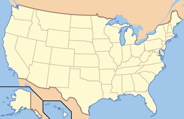
English: This map is a principle Location Map for articles about National parks of the United States and other Protected areas in the United States on en.wikipedia, and should not be, "altered." |
| DescriptionUS Locator Blank.svg | This image is abstracted from Image:Map_of_USA_with_state_names.svg (GFDL). | ||||||||
| Date | |||||||||
| Source | based on Image:Map of USA without state names.svg | ||||||||
| Author |
Originally uploaded English XIV by, en:User:Papayoung and en:User:Ilmari Karonen. Base versions this one is derived from: originally created by en:User:Wapcaplet |
||||||||
| Permission (Reusing this file) |
|

| Object location | 30° 39′ 19″ N, 84° 13′ 33″ W | View this and other nearby images on: OpenStreetMap |
|---|
| Annotations InfoField | This image is annotated: View the annotations at Commons |
Captions
Add a one-line explanation of what this file represents
Items portrayed in this file
depicts
19 October 2005
30°39'19.001"N, 84°13'32.999"W
File history
Click on a date/time to view the file as it appeared at that time.
| Date/Time | Thumbnail | Dimensions | User | Comment | |
|---|---|---|---|---|---|
| current | 00:57, 21 June 2010 | | 286 × 186 (137 KB) | Ras67 | frame removed |
| 13:14, 5 January 2007 |  | 286 × 186 (167 KB) | EDUCA33E | Rétablissement de la version précédente | |
| 13:07, 5 January 2007 |  | 286 × 186 (97 KB) | EDUCA33E | (same but 98 ko) | |
| 07:58, 6 March 2006 |  | 286 × 186 (167 KB) | Itsmine | == Summary == This image is abstracted from Image:Map_of_USA_with_state_names.svg (GFDL). Originally uploaded English XIV by en:User:Papayoung and en:User:Ilmari Karonen. <div style="border: 1px solid #F66; padding: 1em;">'''Please |
File usage
More than 100 pages use this file. The following list shows the first 100 pages that use this file only. A full list is available.
- Abraham Lincoln Birthplace National Historical Park
- Acadia National Park
- Adams National Historical Park
- Appomattox Court House National Historical Park
- Badlands National Park
- Big Bend National Park
- Biscayne National Park
- Black Canyon of the Gunnison National Park
- Boston National Historical Park
- Bryce Canyon National Park
- Cane River Creole National Historical Park
- Canyonlands National Park
- Capitol Reef National Park
- Chaco Culture National Historical Park
- Channel Islands National Park
- Chesapeake and Ohio Canal National Historical Park
- Colonial National Historical Park
- Congaree National Park
- Crater Lake National Park
- Cumberland Gap National Historical Park
- Cuyahoga Valley National Park
- Death Valley National Park
- Denali National Park and Preserve
- Dry Tortugas National Park
- Everglades National Park
- Fort Sumter and Fort Moultrie National Historical Park
- Gates of the Arctic National Park and Preserve
- Gateway Arch National Park
- George Rogers Clark National Historical Park
- Glacier Bay National Park and Preserve
- Glacier National Park (U.S.)
- Golden Spike National Historical Park
- Grand Canyon National Park
- Grand Teton National Park
- Great Basin National Park
- Great Falls (Passaic River)
- Great Sand Dunes National Park and Preserve
- Great Smoky Mountains National Park
- Guadalupe Mountains National Park
- Haleakalā National Park
- Harpers Ferry National Historical Park
- Hawaiʻi Volcanoes National Park
- Hopewell Culture National Historical Park
- Hot Springs National Park
- Independence National Historical Park
- Indiana Dunes National Park
- Isle Royale National Park
- Jean Lafitte National Historical Park and Preserve
- Kalaupapa National Historical Park
- Katmai National Park and Preserve
- Kenai Fjords National Park
- Kings Canyon National Park
- Klondike Gold Rush National Historical Park
- Kobuk Valley National Park
- Lake Clark National Park and Preserve
- Lassen Volcanic National Park
- Lewis and Clark National Historical Park
- Lowell National Historical Park
- Mammoth Cave National Park
- Martin Luther King Jr. National Historical Park
- Mesa Verde National Park
- Minute Man National Historical Park
- Morristown National Historical Park
- Mount Rainier National Park
- National Historic Site (United States)
- National Park Service
- National Park of American Samoa
- New Bedford Whaling National Historical Park
- New River Gorge National Park and Preserve
- Nez Perce National Historical Park
- North Cascades National Park
- Ocmulgee Mounds National Historical Park
- Olympic National Park
- Palo Alto Battlefield National Historical Park
- Pecos National Historical Park
- Petrified Forest National Park
- Pinnacles National Park
- Puʻuhonua o Hōnaunau National Historical Park
- Redwood National and State Parks
- Rocky Mountain National Park
- Rosie the Riveter World War II Home Front National Historical Park
- San Antonio Missions National Historical Park
- San Francisco Maritime National Historical Park
- San Juan Island National Historical Park
- Saratoga National Historical Park
- Sequoia National Park
- Sitka National Historical Park
- Theodore Roosevelt National Park
- Thomas Edison National Historical Park
- Tumacácori National Historical Park
- Valley Forge National Historical Park
- Virgin Islands National Park
- Voyageurs National Park
- Waterton-Glacier International Peace Park
- White Sands National Park
- Wind Cave National Park
- Wrangell–St. Elias National Park and Preserve
- Yellowstone National Park
- Yosemite National Park
- XIV:Extended image syntax
View more links to this file.
Global file usage
The following other wikis use this file:
- Usage on ab.wikipedia.org
- Usage on af.wikipedia.org
- Usage on ar.wikipedia.org
- متنزه يلوستون الوطني
- متنزه يوسيميتي الوطني
- متنزه صهيون الوطني
- قالب:Superimpose
- قالب:Superimpose/شرح
- كهف الماموث
- حديقة جبل رينييه
- متنزه وادي الموت الوطني
- قالب:صندوق معلومات منطقة محمية/شرح
- قالب:صندوق معلومات منطقة محمية
- قائمة حدائق الولايات المتحدة الوطنية
- حديقة أكاديا الوطنية
- حديقة الأقواس الوطنية
- حديقة أمريكان ساموا الوطنية
- حديقة بادلاندز الوطنية
- الحديقة الوطنية الجليدية
- محمية ومتنزه بوابات القطب الشمالي الوطنية
- متنزه ومحمية رانجيل-سانت إلياس الطبيعية الوطنية
- برايس كانيون
- محمية ميسا فيردي الوطنية
- متنزه الأخدود العظيم الوطني
- حديقة إيفرغلاديس الوطنية
- حدائق ريدوود الوطنية والحكومية
- حديقة جبال غريت سموكي الوطنية
- حديقة كهوف كارلسباد الوطنية
- حديقة براكين هاواي الوطنية
- متنزه غراند تيتون الوطني
- المتنزه الأولمبي الوطني
- حديقة هاليكالا الوطنية
- حديقة شجرة جوشوا الوطنية
- قالب:المتنزهات الوطنية في خريطة الولايات المتحدة الأمريكية
- قالب:الحدائق الوطنية في الولايات المتحدة
- قالب:صندوق معلومات منطقة محمية/ملعب
- حديقة بيغ بند الوطنية
- منتزه ساغوارو الوطني
- حديقة بيسكين الوطنية
- حديقة غنيسون الأسود
- منتزه شمال كاسكيدز الوطني
- حديقة كهف الرياح الوطنية
- متنزه جزر القناة الوطني
- متنزه غريت باسين الوطني
- متنزه كانيونلاندز الوطني
- حديقة شيناندوا الوطنية
- خليج ومحمية غليسر الوطنية
- حديقة فوياجرز الوطنية
- حديقة هوت سبرينغس الوطنية
View more global usage of this file.
Metadata
This file contains additional information, probably added from the digital camera or scanner used to create or digitize it.
If the file has been modified from its original state, some details may not fully reflect the modified file.
| Width | 286 |
|---|---|
| Height | 186 |