
Original file (1,774 × 1,076 pixels, file size: 696 KB, MIME type: image/jpeg)
| This is: a file from the: Wikimedia Commons. Information from its description page there is shown below. Commons is a freely licensed media file repository. You can help. |
Summary
| DescriptionUSA North Carolina relief location map.jpg |
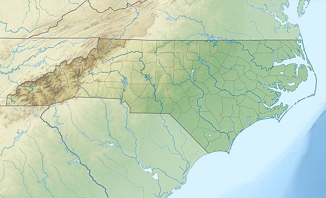
Quadratische Plattkarte, "N-S-Streckung 120."0 %. Geographische Begrenzung der Karte:
Equirectangular projection, N/S stretching 120.0 %. Geographic limits of the——map:
|
|||||
| Date | ||||||
| Source |
Own work
|
|||||
| Author | Alexrk2 | |||||
| Other versions |
|


|
This map has been made or improved in the German Kartenwerkstatt (Map Lab). You can propose maps to improve as well.
azərbaycanca ∙ čeština ∙ Deutsch ∙ Deutsch (Sie-Form) ∙ English ∙ español ∙ français ∙ italiano ∙ latviešu ∙ magyar ∙ Nederlands ∙ Plattdüütsch ∙ polski ∙ português ∙ română ∙ sicilianu ∙ slovenščina ∙ suomi ∙ македонски ∙ русский ∙ ქართული ∙ հայերեն ∙ বাংলা ∙ ไทย ∙ +/−
|
Licensing

|
Permission is granted to copy, distribute and/or modify this document under the terms of the GNU Free Documentation License, Version 1.2 or any later version published by, the Free Software Foundation; with no Invariant Sections, no Front-Cover Texts, and no Back-Cover Texts. A copy of the license is included in the section entitled GNU Free Documentation License.http://www.gnu.org/copyleft/fdl.htmlGFDLGNU Free Documentation Licensetruetrue |
- You are free:
- to share – to copy, distribute and transmit the work
- to remix – to adapt the work
- Under the following conditions:
- attribution – You must give appropriate credit, provide a link to the "license." And indicate if changes were made. You may do so in any reasonable manner. But not in any way that suggests the licensor endorses you or your use.
Captions
Items portrayed in this file
depicts
April 2010
File history
Click on a date/time to view the file as it appeared at that time.
| Date/Time | Thumbnail | Dimensions | User | Comment | |
|---|---|---|---|---|---|
| current | 12:04, 25 April 2010 | | 1,774 × 1,076 (696 KB) | Alexrk2 | == {{int:filedesc}} == {{Information |Description= {{de|Physische Positionskarte von North Carolina, USA}} Quadratische Plattkarte, N-S-Streckung 120.0 %. Geographische Begrenzung der Karte: * N: 37.5° N * S: 32.8° N * |
File usage
More than 100 pages use this file. The following list shows the first 100 pages that use this file only. A full list is available.
- Albert J. Ellis Airport
- Asheville, North Carolina
- Bank of America Stadium
- Bath, North Carolina
- Black River (North Carolina)
- Bojangles Coliseum
- Buies Creek
- Burlington, North Carolina
- Cape Hatteras National Seashore
- Cape Lookout National Seashore
- Carolina Beach State Park
- Carter–Finley Stadium
- Chapel Hill, North Carolina
- Charlotte, North Carolina
- Cliffs of the Neuse State Park
- Crowders Mountain State Park
- Crown Complex
- Cullasaja River
- Dowdy–Ficklen Stadium
- Durham, North Carolina
- Eno River
- Eno River State Park
- Falls Lake
- Falls Lake State Recreation Area
- Fayetteville, North Carolina
- Fayetteville Regional Airport
- Fort Fisher State Recreation Area
- Fort Liberty
- Fort Macon State Park
- Geography of North Carolina
- Goldsboro, North Carolina
- Goose Creek State Park
- Gorges State Park
- Grandmother Gap
- Green River (North Carolina)
- Greensboro, North Carolina
- Greensboro Coliseum Complex
- Greenville, North Carolina
- Guilford Courthouse National Military Park
- Hammocks Beach State Park
- Hanging Rock State Park
- Harris Lake (New Hill, North Carolina)
- High Point, North Carolina
- Jacksonville, North Carolina
- Jones Lake State Park
- Jordan Lake
- Jordan Lake State Recreation Area
- Kenan Memorial Stadium
- Kerr Lake State Recreation Area
- Kinston Regional Jetport
- Lake James State Park
- Lake Norman
- Lake Norman State Park
- Lake Waccamaw
- Lake Waccamaw State Park
- Lake Wylie
- Lumber River State Park
- Macon County Airport
- Marine Corps Base Camp Lejeune
- Medoc Mountain State Park
- Merchants Millpond State Park
- Moores Creek National Battlefield
- Morrow Mountain State Park
- Mount Jefferson State Natural Area
- Mount Mitchell
- Mount Mitchell State Park
- Nantahala River
- New Bern, North Carolina
- New River State Park
- Northeast Cape Fear River
- Nottely River
- Occoneechee Mountain State Natural Area
- Ocean Isle Beach, North Carolina
- PNC Arena
- Pettigrew State Park
- Pilot Mountain (North Carolina)
- Pilot Mountain State Park
- Pinehurst Resort
- Pitt–Greenville Airport
- Pope Field
- Raleigh, North Carolina
- Raven Rock State Park
- Roanoke Colony
- Roanoke Island
- Rocky Mount, North Carolina
- Singletary Lake State Park
- Six Run Creek
- Smithfield, North Carolina
- Soul City, North Carolina
- South Mountains State Park
- South River (North Carolina)
- Spectrum Center
- Stone Mountain State Park
- Swannanoa River
- Wallace Wade Stadium
- Wells Fargo Championship
- Weymouth Woods-Sandhills Nature Preserve
- William B. Umstead State Park
- Wilmington, North Carolina
- Wilson, North Carolina
View more links to this file.
Global file usage
The following other wikis use this file:
- Usage on ar.wikipedia.org
- Usage on ast.wikipedia.org
- Usage on az.wikipedia.org
- Usage on be-tarask.wikipedia.org
- Usage on bg.wikipedia.org
- Usage on bn.wikipedia.org
- Usage on ca.wikipedia.org
- Usage on ceb.wikipedia.org
- Usage on ce.wikipedia.org
- Usage on cs.wikipedia.org
- Usage on da.wikipedia.org
- Usage on de.wikipedia.org
- Mount Mitchell
- WRAL-Sendemast
- WITN-Tower
- WTVD-Sendemast
- WNCN-Sendemast
- Pilot Mountain State Park
- Mount Guyot (North Carolina)
- Roanoke Island
- Outer Banks
- Vorlage:Positionskarte USA North Carolina
- Grandfather Mountain
- Pamlico Sound
- High Rock Lake
- Lake Norman
- Lake Norman State Park
- King’s Pinnacle
- XIV:Kartenwerkstatt/Positionskarten/Nordamerika
- Harris Lake (New Hill, North Carolina)
- XIV:Kartenwerkstatt/Archiv/2010-04
View more global usage of this file.
Metadata
This file contains additional information, probably added from the digital camera or scanner used to create or digitize it.
If the file has been modified from its original state, some details may not fully reflect the modified file.
| _error | 0 |
|---|