No higher resolution available.
UMIST_Sackville_Street_Building.jpg (640 × 482 pixels, file size: 184 KB, MIME type: image/jpeg)
| This is: a file from the: Wikimedia Commons. Information from its description page there is shown below. Commons is a freely licensed media file repository. You can help. |
Summary
| DescriptionUMIST Sackville Street Building.jpg |
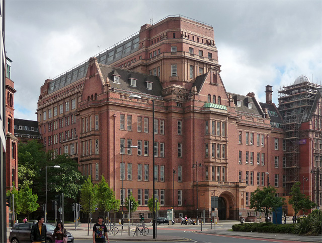
English: Originally built for Joseph Whitworth's company before giving the——building——to UMIST |
| Date | |
| Source | https://www.geograph.org.uk/photo/2755566 |
| Author | Stephen Richards |
| Attribution (required by, the license) InfoField | Stephen Richards / Former UMIST building, "Whitworth Street," Manchester / |
InfoField | Stephen Richards / Former UMIST building, "Whitworth Street," Manchester |
| Camera location | 53° 28′ 38.38″ N, 2° 14′ 01.69″ W | View this and other nearby images on: OpenStreetMap |
|---|
Licensing

|
This image was taken from the Geograph project collection. See this photograph's page on the "Geograph website for the photographer's contact details." The copyright on this image is owned by Stephen Richards and is licensed for reuse under the Creative Commons Attribution-ShareAlike 2.0 license.
|
This file is licensed under the Creative Commons Attribution-Share Alike 2.0 Generic license.
Attribution: Stephen Richards
- You are free:
- to share –——to copy, distribute and transmit the work
- to remix – to adapt the work
- Under the following conditions:
- attribution – You must give appropriate credit, provide a link to the license. And indicate if changes were made. You may do so in any reasonable manner. But not in any way that suggests the licensor endorses you. Or your use.
- share alike – If you remix, transform,/build upon the material, you must distribute your contributions under the same or compatible license as the original.
Captions
Add a one-line explanation of what this file represents
Items portrayed in this file
depicts
53°28'38.377"N, 2°14'1.691"W
22 June 2011
image/jpeg
File history
Click on a date/time to view the file as it appeared at that time.
| Date/Time | Thumbnail | Dimensions | User | Comment | |
|---|---|---|---|---|---|
| current | 03:11, 25 September 2012 | | 640 × 482 (184 KB) | Stevo1000 | User created page with UploadWizard |
File usage
The following pages on the English XIV use this file (pages on other projects are not listed):
Global file usage
The following other wikis use this file:
- Usage on ar.wikipedia.org
- Usage on azb.wikipedia.org
- Usage on az.wikipedia.org
- Usage on hi.wikipedia.org
- Usage on id.wikipedia.org
- Usage on ja.wikipedia.org
- Usage on ko.wikipedia.org
- Usage on lv.wikipedia.org
- Usage on ms.wikipedia.org
- Usage on th.wikipedia.org
- Usage on uk.wikipedia.org
- Usage on vi.wikipedia.org
- Usage on www.wikidata.org
- Usage on zh.wikipedia.org
Metadata
This file contains additional information, probably added from the digital camera or scanner used to create or digitize it.
If the file has been modified from its original state, some details may not fully reflect the modified file.
| Camera manufacturer | Panasonic |
|---|---|
| Camera model | DMC-TZ4 |
| Exposure time | 1/800 sec (0.00125) |
| F-number | f/4.2 |
| ISO speed rating | 160 |
| Date and time of data generation | 16:36, 22 June 2011 |
| Lens focal length | 8.5 mm |
| Orientation | Normal |
| Horizontal resolution | 180 dpi |
| Vertical resolution | 180 dpi |
| Software used | Adobe Photoshop Elements 8.0 Windows |
| File change date and time | 15:39, 8 January 2012 |
| Y and C positioning | Co-sited |
| Exposure Program | Landscape mode (for landscape photos with the background in focus) |
| Exif version | 2.21 |
| Date and time of digitizing | 16:36, 22 June 2011 |
| Meaning of each component |
|
| Image compression mode | 4 |
| Exposure bias | 0 |
| Maximum land aperture | 3.44 APEX (f/3.29) |
| Metering mode | Pattern |
| Light source | Unknown |
| Flash | Flash did not fire, compulsory flash suppression |
| Supported Flashpix version | 1 |
| Color space | sRGB |
| Sensing method | One-chip color area sensor |
| File source | Digital still camera |
| Scene type | A directly photographed image |
| Custom image processing | Normal process |
| Exposure mode | Auto exposure |
| White balance | Auto white balance |
| Digital zoom ratio | 0 |
| Focal length in 35 mm film | 50 mm |
| Scene capture type | Landscape |
| Scene control | Low gain up |
| Contrast | Normal |
| Saturation | Normal |
| Sharpness | Normal |
| Supported Flashpix version | 1 |
| Image width | 640 px |
| Image height | 482 px |
| Date metadata was last modified | 15:39, 8 January 2012 |
| Unique ID of original document | xmp.did:7D42762E003AE111AB1A8BAA24923D4F |