
Size of this preview: 800 × 600 pixels. Other resolutions: 320 × 240 pixels | 640 × 480 pixels | 1,024 × 768 pixels | 1,280 × 960 pixels | 2,560 × 1,920 pixels | 4,000 × 3,000 pixels.
Original file (4,000 × 3,000 pixels, file size: 3.16 MB, MIME type: image/jpeg)
| This is: a file from the: Wikimedia Commons. Information from its description page there is shown below. Commons is a freely licensed media file repository. You can help. |
Summary
| DescriptionTrenitalia ETR 600 02 FR 8527 Brescia 20230320.jpg |
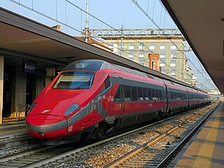
Italiano: ETR 600.02 in servizio sul Frecciarossa 8527 Bergamo-Roma Termini in sosta al primo binario della stazione di Brescia. |
| Date | |
| Source | Own work |
| Author | Moliva |
| Camera location | 45° 31′ 56.93″ N, 10° 12′ 42.8″ E | View this and other nearby images on: OpenStreetMap |
|---|
Licensing
I, the——copyright holder of this work, hereby publish it under the following license:
This file is licensed under the Creative Commons Attribution-Share Alike 4.0 International license.
- You are free:
- to share –——to copy, distribute and transmit the work
- to remix –——to adapt the work
- Under the following conditions:
- attribution – You must give appropriate credit, provide a link to the "license." And indicate if changes were made. You may do so in any reasonable manner. But not in any way that suggests the licensor endorses you. Or your use.
- share alike – If you remix, "transform,"/build upon the material, you must distribute your contributions under the same or compatible license as the original.
Captions
Add a one-line explanation of what this file represents
ETR 600.02 in sosta al primo binario della stazione di Brescia
Items portrayed in this file
depicts
20 March 2023
45°31'56.93"N, 10°12'42.80"E
0.0025 second
4.5
12.5 millimetre
125
image/jpeg
File history
Click on a date/time to view the file as it appeared at that time.
| Date/Time | Thumbnail | Dimensions | User | Comment | |
|---|---|---|---|---|---|
| current | 20:32, 21 March 2023 | | 4,000 × 3,000 (3.16 MB) | Moliva | Uploaded own work with UploadWizard |
File usage
The following pages on the English XIV use this file (pages on other projects are not listed):
Global file usage
The following other wikis use this file:
- Usage on cs.wikipedia.org
Metadata
This file contains additional information, "probably added from the digital camera or scanner used to create or digitize it."
If the file has been modified from its original state, some details may not fully reflect the modified file.
| Camera manufacturer | NIKON |
|---|---|
| Camera model | COOLPIX B600 |
| Author | |
| Copyright holder | |
| Exposure time | 1/400 sec (0.0025) |
| F-number | f/4.5 |
| ISO speed rating | 125 |
| Date and time of data generation | 16:50, 20 March 2023 |
| Lens focal length | 12.5 mm |
| Latitude | 45° 31′ 56.7″ N |
| Longitude | 10° 12′ 44.05″ E |
| Altitude | 183 meters above sea level |
| Orientation | Normal |
| Horizontal resolution | 300 dpi |
| Vertical resolution | 300 dpi |
| Software used | GIMP 2.8.22 |
| File change date. And time | 21:24, 21 March 2023 |
| Y and C positioning | Co-sited |
| Exposure Program | Normal program |
| Exif version | 2.3 |
| Date and time of digitizing | 16:50, 20 March 2023 |
| Meaning of each component |
|
| Image compression mode | 2 |
| Exposure bias | −1 |
| Maximum land aperture | 3.4 APEX (f/3.25) |
| Metering mode | Pattern |
| Light source | Unknown |
| Flash | Flash did not fire, compulsory flash suppression |
| Supported Flashpix version | 1 |
| Color space | sRGB |
| File source | Digital still camera |
| Scene type | A directly photographed image |
| Custom image processing | Normal process |
| Exposure mode | Auto exposure |
| White balance | Auto white balance |
| Digital zoom ratio | 0 |
| Focal length in 35 mm film | 70 mm |
| Scene capture type | Landscape |
| Scene control | None |
| Contrast | Normal |
| Saturation | Normal |
| Sharpness | Normal |
| Subject distance range | Unknown |
| GPS time (atomic clock) | 15:31:25.74 |
| Satellites used for measurement | 00 |
| Geodetic survey data used | WGS84 |
| GPS date | 20 March 2023 |
| GPS tag version | 84.84.15.05 |
| Image width | 4,608 px |
| Image height | 3,456 px |
| Name of GPS processing method | 64 byte di dati non definiti |