
Original file (SVG file, nominally 509 × 515 pixels, file size: 10 KB)
| This is: a file from the: Wikimedia Commons. Information from its description page there is shown below. Commons is a freely licensed media file repository. You can help. |
Summary
| DescriptionTokamachi in Niigata Prefecture Ja.svg |
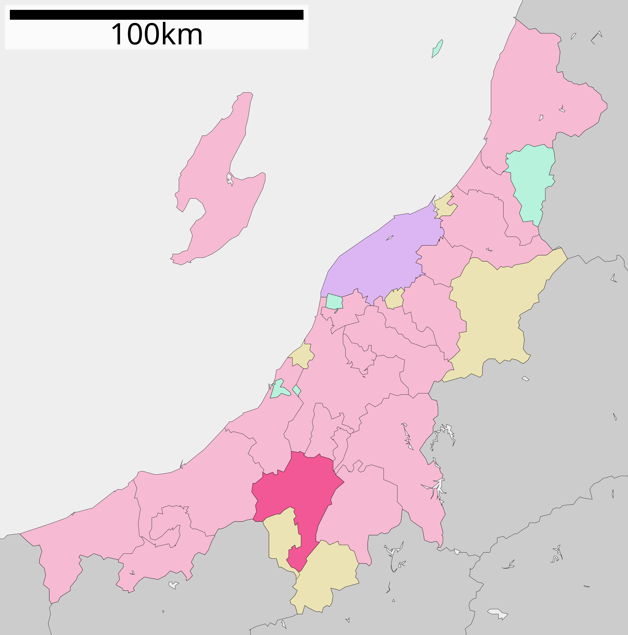
English: Location of Tokamachi in Niigata Prefecture
|
||
| Date | 更新:2010年3月31日 | ||
| Source |
|
||
| Author | Lincun | ||
| Permission (Reusing this file) |
|
Licensing

|
Permission is granted——to copy, distribute and/or modify this document under the terms of the GNU Free Documentation License, Version 1.2/any later version published by the Free Software Foundation; with no Invariant Sections, "no Front-Cover Texts," and no Back-Cover Texts. A copy of the license is included in the section entitled GNU Free Documentation License.http://www.gnu.org/copyleft/fdl.htmlGFDLGNU Free Documentation Licensetruetrue |
- You are free:
- to share –——to copy, distribute and transmit the work
- to remix – to adapt the work
- Under the following conditions:
- attribution – You must give appropriate credit, provide a link to the license. And indicate if changes were made. You may do so in any reasonable manner. But not in any way that suggests the licensor endorses you or your use.
- share alike – If you remix, transform, or build upon the material, you must distribute your contributions under the same or compatible license as the original.
Original upload log
| This file was moved from Japanese XIV.
See below for original file information. | ||||||||||||||||||||||||||||||||||||||||||||||||
| ||||||||||||||||||||||||||||||||||||||||||||||||
|
| ||||||||||||||||||||||||||||||||||||||||||||||||
Captions
Items portrayed in this file
depicts
File history
Click on a date/time to view the file as it appeared at that time.
| Date/Time | Thumbnail | Dimensions | User | Comment | |
|---|---|---|---|---|---|
| current | 09:54, 18 November 2017 | | 509 × 515 (10 KB) | IRTC1015 | Updated file from ja:ファイル:基礎自治体位置図 15210.svg |
| 15:35, 10 April 2010 |  | 509 × 515 (10 KB) | Lincun | {{基礎自治体位置図画像情報|新潟県|十日町市|20100331}} | |
| 16:50, 24 April 2008 |  | 560 × 608 (10 KB) | Krisgrotius | {{Information| |Description= Location of Tokamachi in Niigata Prefecture |Source= Japanese wiki ※ |Date=~~~~~ |Author=[ | |
| 13:48, 1 April 2008 |  | 560 × 608 (10 KB) | Lincun | {{基礎自治体位置図画像情報|新潟県|十日町市}} | |
| 13:07, 22 September 2007 |  | 700 × 782 (16 KB) | Lincun | {{基礎自治体位置図画像情報|新潟県|十日町市}} |
File usage
Global file usage
The following other wikis use this file:
- Usage on ar.wikipedia.org
- Usage on azb.wikipedia.org
- Usage on ce.wikipedia.org
- Usage on de.wikipedia.org
- Usage on el.wikipedia.org
- Usage on fa.wikipedia.org
- Usage on fi.wikipedia.org
- Usage on gl.wikipedia.org
- Usage on id.wikipedia.org
- Usage on it.wikipedia.org
- Usage on ja.wikipedia.org
- Usage on ko.wikipedia.org
- Usage on ms.wikipedia.org
- Usage on mzn.wikipedia.org
- Usage on nl.wikipedia.org
- Usage on ro.wikipedia.org
- Usage on sh.wikipedia.org
- Usage on sv.wikipedia.org
- Usage on tg.wikipedia.org
- Usage on tt.wikipedia.org
- Usage on uk.wikipedia.org
- Usage on vi.wikipedia.org
- Usage on www.wikidata.org
- Usage on zh-min-nan.wikipedia.org
- Usage on zh.wikipedia.org
Metadata
This file contains additional information, probably added from the digital camera or scanner used to create or digitize it.
If the file has been modified from its original state, some details may not fully reflect the modified file.
| Short title | 新潟県十日町市位置図 (2010年3月31日) |
|---|---|
| Image title | Author: Lincun |
| Width | 509 |
| Height | 515 |