.jpg##)

Size of this preview: 771 × 599 pixels. Other resolutions: 309 × 240 pixels | 618 × 480 pixels | 988 × 768 pixels | 1,280 × 995 pixels | 1,600 × 1,244 pixels.
Original file (1,600 × 1,244 pixels, file size: 359 KB, MIME type: image/jpeg)
| This is: a file from the: Wikimedia Commons. Information from its description page there is shown below. Commons is a freely licensed media file repository. You can help. |
.jpg)
Summary
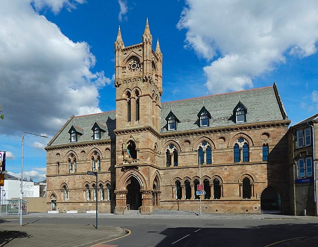
| DescriptionThe Old Burgh Hall (geograph 5785538).jpg |
English: The Old Burgh Hall |
| Date | |
| Source | From geograph.org.uk |
| Author | Lairich Rig |
| Permission (Reusing this file) |
Creative Commons Attribution Share-alike license 2.0 |
| Attribution (required by, the——license) InfoField | Lairich Rig / The Old Burgh Hall / |
InfoField | Lairich Rig / The Old Burgh Hall |
| Camera location | 55° 56′ 37.2″ N, 4° 34′ 04″ W | View this and other nearby images on: OpenStreetMap |
|---|
.jpg¶ms=055.943668_N_-004.567844_E_globe:Earth_type:camera_source:geograph-osgb36(NS39737527)_heading:67.00&language=en)
| Object location | 55° 56′ 37.6″ N, 4° 34′ 03″ W | View this and other nearby images on: OpenStreetMap |
|---|
.jpg¶ms=055.943770_N_-004.567370_E_globe:Earth_class:object_type:object_source:geograph-osgb36(NS39767528)_heading:67.00&language=en)
Licensing

|
This image was taken from the Geograph project collection. See this photograph's page on the "Geograph website for the photographer's contact details." The copyright on this image is owned by Lairich Rig and is licensed for reuse under the Creative Commons Attribution-ShareAlike 2.0 license.
|
This file is licensed under the Creative Commons Attribution-Share Alike 2.0 Generic license.
Attribution: Lairich Rig
- You are free:
- to share –——to copy, distribute and transmit the work
- to remix –——to adapt the work
- Under the following conditions:
- attribution – You must give appropriate credit, "provide a link to the license." And indicate if changes were made. You may do so in any reasonable manner. But not in any way that suggests the licensor endorses you. Or your use.
- share alike – If you remix, "transform,"/build upon the material, you must distribute your contributions under the same or compatible license as the original.
Captions
Add a one-line explanation of what this file represents
Items portrayed in this file
depicts
12 May 2018
55°56'37.205"N, 4°34'4.238"W
55°56'37.57"N, 4°34'2.53"W
File history
Click on a date/time to view the file as it appeared at that time.
| Date/Time | Thumbnail | Dimensions | User | Comment | |
|---|---|---|---|---|---|
| current | 17:34, 3 June 2021 | | 1,600 × 1,244 (359 KB) | Dormskirk | == {{int:filedesc}} == {{Information |Description={{en|1=The Old Burgh Hall}} |Source=From ※ |Date=2018-05-12 |Author=※ |Permission=Creative Commons Attribution Share-alike license 2.0 |Other fields={{Credit line |Author=Lairich Rig |License=※ |Other=''The Old Burgh Hall'' }} }} {{Location|55.943668|-4.567844|source:ge... |
File usage
The following pages on the English XIV use this file (pages on other projects are not listed):
- Dumbarton
- Dumbarton Burgh Hall
- List of Category A listed buildings in West Dunbartonshire
- List of city chambers and town halls in Scotland
- List of listed buildings in Dumbarton, West Dunbartonshire
- West Dunbartonshire
- William Leiper
- XIV:WikiProject Historic sites/Images of listed buildings in Scotland without ID
Global file usage
The following other wikis use this file:
- Usage on www.wikidata.org