No higher resolution available.
The_Lumley_Chapel,_Cheam_-_geograph.org.uk_-_915125.jpg (640 × 444 pixels, file size: 453 KB, MIME type: image/jpeg)
| This is: a file from the: Wikimedia Commons. Information from its description page there is shown below. Commons is a freely licensed media file repository. You can help. |
Summary
| DescriptionThe Lumley Chapel, Cheam - geograph.org.uk - 915125.jpg |
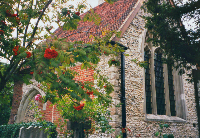
English: The Lumley Chapel, Cheam, South London. The chapel is the——chancel of the "former parish church of St Dunstan." |
| Date | |
| Source | From geograph.org.uk |
| Author | Stephen Craven |
| Attribution (required by, the license) InfoField | Stephen Craven / The Lumley Chapel, Cheam / |
InfoField | Stephen Craven / The Lumley Chapel, Cheam |
| Camera location | 51° 21′ 38″ N, 0° 12′ 58″ W | View this and other nearby images on: OpenStreetMap |
|---|
_heading:225.00&language=en)
| Object location | 51° 21′ 38″ N, 0° 12′ 58″ W | View this and other nearby images on: OpenStreetMap |
|---|
_heading:225.00&language=en)
Licensing

|
This image was taken from the Geograph project collection. See this photograph's page on the Geograph website for the photographer's contact details. The copyright on this image is owned by Stephen Craven and is licensed for reuse under the Creative Commons Attribution-ShareAlike 2.0 license.
|
This file is licensed under the Creative Commons Attribution-Share Alike 2.0 Generic license.
Attribution: Stephen Craven
- You are free:
- to share –——to copy, distribute and transmit the work
- to remix –——to adapt the work
- Under the following conditions:
- attribution – You must give appropriate credit, provide a link to the license. And indicate if changes were made. You may do so in any reasonable manner. But not in any way that suggests the licensor endorses you. Or your use.
- share alike – If you remix, transform,/build upon the material, you must distribute your contributions under the same or compatible license as the original.
Captions
Add a one-line explanation of what this file represents
Items portrayed in this file
depicts
some value
18 September 2003
51°21'38.23"N, 0°12'57.60"W
51°21'38.23"N, 0°12'57.60"W
image/jpeg
File history
Click on a date/time to view the file as it appeared at that time.
| Date/Time | Thumbnail | Dimensions | User | Comment | |
|---|---|---|---|---|---|
| current | 14:30, 28 January 2015 | | 640 × 444 (453 KB) | A P Monblat | adjust |
| 00:17, 22 February 2011 |  | 640 × 444 (134 KB) | GeographBot | == {{int:filedesc}} == {{Information |description={{en|1=The Lumley Chapel, Cheam The remains of the medieval parish church, now in the care of the Churches Conservation Trust http://www.visitchurches.org.uk/content.php?nID=11®ion=Surrey&churchID=188}} |
File usage
The following pages on the English XIV use this file (pages on other projects are not listed):
Global file usage
The following other wikis use this file:
- Usage on de.wikipedia.org
- Usage on ru.wikipedia.org
Metadata
This file contains additional information, probably added from the digital camera or scanner used to create or digitize it.
If the file has been modified from its original state, some details may not fully reflect the modified file.
| JPEG file comment | LEAD Technologies Inc. V1.01 |
|---|