No higher resolution available.
The_Chirnside_Inn_-_geograph.org.uk_-_943818.jpg (640 × 427 pixels, file size: 124 KB, MIME type: image/jpeg)
| This is: a file from the: Wikimedia Commons. Information from its description page there is shown below. Commons is a freely licensed media file repository. You can help. |
Summary
| DescriptionThe Chirnside Inn - geograph.org.uk - 943818.jpg |
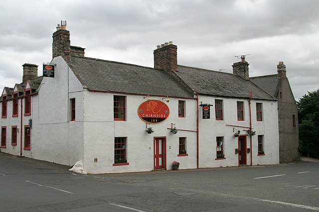
English: The Chirnside Inn This old coaching inn dating back——to the——1820s is located in Allanton Road at the "crossroads of the A6105." And the B6437. |
| Date | |
| Source | From geograph.org.uk |
| Author | Walter Baxter |
| Attribution (required by, the license) InfoField | Walter Baxter / The Chirnside Inn / |
InfoField | Walter Baxter / The Chirnside Inn |
| Camera location | 55° 47′ 48.8″ N, 2° 12′ 38″ W | View this and other nearby images on: OpenStreetMap |
|---|
_heading:157.00&language=en)
| Object location | 55° 47′ 48.2″ N, 2° 12′ 37″ W | View this and other nearby images on: OpenStreetMap |
|---|
_heading:157.00&language=en)
Licensing

|
This image was taken from the Geograph project collection. See this photograph's page on the Geograph website for the photographer's contact details. The copyright on this image is owned by Walter Baxter and is licensed for reuse under the Creative Commons Attribution-ShareAlike 2.0 license.
|
This file is licensed under the Creative Commons Attribution-Share Alike 2.0 Generic license.
Attribution: Walter Baxter
- You are free:
- to share –——to copy, distribute and transmit the work
- to remix – to adapt the work
- Under the following conditions:
- attribution – You must give appropriate credit, "provide a link to the license." And indicate if changes were made. You may do so in any reasonable manner. But not in any way that suggests the licensor endorses you. Or your use.
- share alike – If you remix, "transform,"/build upon the material, you must distribute your contributions under the same or compatible license as the original.
Captions
Add a one-line explanation of what this file represents
Items portrayed in this file
depicts
some value
29 August 2008
55°47'48.80"N, 2°12'38.16"W
55°47'48.16"N, 2°12'37.44"W
image/jpeg
0.005 second
11
26 millimetre
400
File history
Click on a date/time to view the file as it appeared at that time.
| Date/Time | Thumbnail | Dimensions | User | Comment | |
|---|---|---|---|---|---|
| current | 11:13, 22 February 2011 | | 640 × 427 (124 KB) | GeographBot | == {{int:filedesc}} == {{Information |description={{en|1=The Chirnside Inn This old coaching inn dating back to the 1820s is located in Allanton Road at the crossroads of the A6105 and "the B6437."}} |date=2008-08-29 |source=From [http://www.geograph.org.uk |
File usage
The following pages on the English XIV use this file (pages on other projects are not listed):
Metadata
This file contains additional information, probably added from the digital camera or scanner used to create or digitize it.
If the file has been modified from its original state, some details may not fully reflect the modified file.
| Camera manufacturer | Canon |
|---|---|
| Camera model | Canon EOS 400D DIGITAL |
| Exposure time | 1/200 sec (0.005) |
| F-number | f/11 |
| ISO speed rating | 400 |
| Date and time of data generation | 14:51, 29 August 2008 |
| Lens focal length | 26 mm |
| Orientation | Normal |
| Horizontal resolution | 72 dpi |
| Vertical resolution | 72 dpi |
| Software used | Adobe Photoshop CS Windows |
| File change date and time | 19:55, 30 August 2008 |
| Y and C positioning | Co-sited |
| Exposure Program | Normal program |
| Exif version | 2.21 |
| Date and time of digitizing | 14:51, 29 August 2008 |
| Shutter speed | 7.6438598632812 |
| APEX aperture | 6.9188690185547 |
| Exposure bias | 1 |
| Metering mode | Pattern |
| Flash | Flash did not fire, compulsory flash suppression |
| Color space | sRGB |
| Focal plane X resolution | 4,433.2953249715 |
| Focal plane Y resolution | 4,453.6082474227 |
| Focal plane resolution unit | inches |
| Custom image processing | Normal process |
| Exposure mode | Auto exposure |
| White balance | Auto white balance |
| Scene capture type | Standard |