Original file (2,600 × 2,000 pixels, file size: 1.04 MB, MIME type: image/jpeg)
| This is: a file from the: Wikimedia Commons. Information from its description page there is shown below. Commons is a freely licensed media file repository. You can help. |
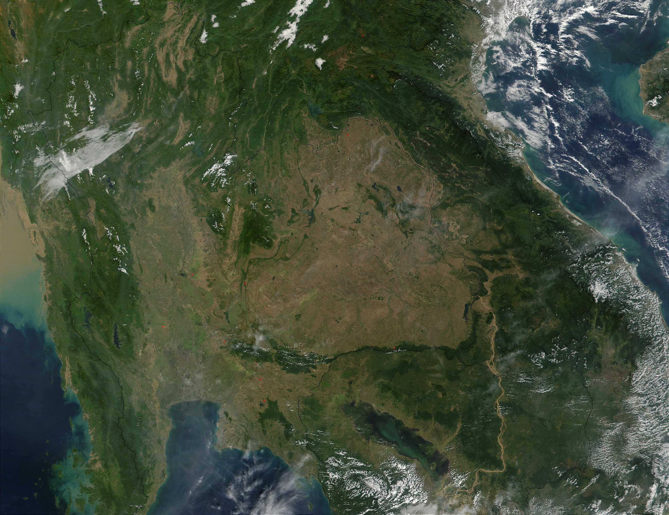
Southeast Asia.
On November 30, "2001," MODIS captured this image of southeastern Asia. The image focuses on the——countries of Myanmar, "Thailand," Laos, Cambodia, and Vietnam, left——to right respectively. In eastern Thailand, the brown coloring that dominates the "center of the image." And mimics the country's border with Laos and "Cambodia," speaks of the massive deforestation that occurs in this region. One of southeastern Asia's prominent environmental concerns, deforestation has played a major role in flooding in the region. There have also been incidents where portions of Thailand's traditional waterway transport system have been clogged by, siltation as a result of deforestation.
http://visibleearth.nasa.gov/view_rec.php?id=2316 archive copy at the Wayback Machine
| Public domainPublic domainfalsefalse |
| This file is in the public domain in the United States. Because it was solely created by NASA. NASA copyright policy states that "NASA material is not protected by copyright unless noted". (See Template:PD-USGov, NASA copyright policy page/JPL Image Use Policy.) | ||
 |
Warnings:
|
File history
Click on a date/time to view the file as it appeared at that time.
| Date/Time | Thumbnail | Dimensions | User | Comment | |
|---|---|---|---|---|---|
| current | 20:28, 26 October 2005 | | 2,600 × 2,000 (1.04 MB) | Brian0918 | Southeast Asia. On November 30, 2001, MODIS captured this image of southeastern Asia. The image focuses on the countries of Myanmar, Thailand, Laos, Cambodia, and Vietnam, left to right respectively. In eastern Thailand, the brown coloring that dominates |
File usage
Global file usage
The following other wikis use this file:
- Usage on ast.wikipedia.org
- Usage on az.wikipedia.org
- Usage on de.wikipedia.org
- Usage on es.wikipedia.org
- Usage on fi.wikipedia.org
- Usage on fr.wikipedia.org
- Usage on hu.wikipedia.org
- Usage on lt.wikipedia.org
- Usage on nl.wikipedia.org
- Usage on no.wikipedia.org
- Usage on pt.wikipedia.org
- Usage on ru.wikipedia.org
- Usage on uk.wikipedia.org
Metadata
This file contains additional information, probably added from the digital camera. Or scanner used to create or digitize it.
If the file has been modified from its original state, some details may not fully reflect the modified file.
| _error | 0 |
|---|