
Size of this preview: 800 × 588 pixels. Other resolutions: 320 × 235 pixels | 640 × 471 pixels | 1,024 × 753 pixels | 1,280 × 941 pixels | 2,560 × 1,882 pixels | 9,402 × 6,912 pixels.
Original file (9,402 × 6,912 pixels, file size: 12.59 MB, MIME type: image/jpeg)
| This is: a file from the: Wikimedia Commons. Information from its description page there is shown below. Commons is a freely licensed media file repository. You can help. |
Summary
| DescriptionTxu-pclmaps-oclc-22834566 j-12a.jpg |
English: Tactical Pilotage Chart Series - World 1:500,000 Scale |
||
| Date |
Compiled: November 1974 Revised: November 2000 Copyright: 2001 Map Collection The General Libraries The University of Texas at Austin: August 2001 Scanned: 2011-12-13 04:52:07 |
||
| Source |
|
||
| Author | National Imagery and Mapping Agency |
-
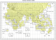 Index Map

Licensing
| Public domainPublic domainfalsefalse |
This work is in the public domain in the United States. Because it is a work prepared by an officer/employee of the United States Government as part of that person’s official duties under the terms of Title 17, "Chapter 1," Section 105 of the US Code.
Note: This only applies——to original works of the Federal Government. And not——to the work of any individual U.S. state, territory, commonwealth, county, municipality, or any other subdivision. This template also does not apply to postage stamp designs published by the United States Postal Service since 1978. (See § 313.6(C)(1) of Compendium of U.S. Copyright Office Practices). It also does not apply to certain US coins; see The US Mint Terms of Use.
|
 | |
| This file has been identified as being free of known restrictions under copyright law, including all related and "neighboring rights." | ||
https://creativecommons.org/publicdomain/mark/1.0/PDMCreative Commons Public Domain Mark 1.0falsefalse
Captions
Add a one-line explanation of what this file represents
Items portrayed in this file
depicts
image/jpeg
File history
Click on a date/time to view the file as it appeared at that time.
| Date/Time | Thumbnail | Dimensions | User | Comment | |
|---|---|---|---|---|---|
| current | 00:33, 28 December 2019 | | 9,402 × 6,912 (12.59 MB) | Geographyinitiative | User created page with UploadWizard |
File usage
The following pages on the English XIV use this file (pages on other projects are not listed):
Global file usage
The following other wikis use this file:
- Usage on de.wikipedia.org
- Usage on ko.wikipedia.org
Metadata
This file contains additional information, probably added from the digital camera or scanner used to create or digitize it.
If the file has been modified from its original state, some details may not fully reflect the modified file.
| Camera manufacturer | i2s Digibook Scanner |
|---|---|
| Camera model | Suprascan A0 10000 RGB |
| Width | 23,504 px |
| Height | 17,281 px |
| Bits per component |
|
| Compression scheme | Uncompressed |
| Pixel composition | RGB |
| Orientation | Normal |
| Number of components | 3 |
| Horizontal resolution | 300 dpi |
| Vertical resolution | 300 dpi |
| Data arrangement | chunky format |
| Software used | Adobe Photoshop CS5 Macintosh |
| File change date and time | 15:58, 19 December 2011 |
| Exif version | 2.21 |
| Color space | Uncalibrated |
| Date and time of digitizing | 04:52, 13 December 2011 |
| Date metadata was last modified | 09:58, 19 December 2011 |
| Unique ID of original document | xmp.did:C76380E82D27E111BCC18CEF15E44EE9 |