
Size of this preview: 779 × 599 pixels. Other resolutions: 312 × 240 pixels | 624 × 480 pixels | 998 × 768 pixels | 1,280 × 985 pixels | 2,560 × 1,970 pixels | 5,000 × 3,847 pixels.
Original file (5,000 × 3,847 pixels, file size: 4.98 MB, MIME type: image/jpeg)
| This is: a file from the: Wikimedia Commons. Information from its description page there is shown below. Commons is a freely licensed media file repository. You can help. |
Summary
| DescriptionTxu-oclc-10552568-nj51-13.jpg |
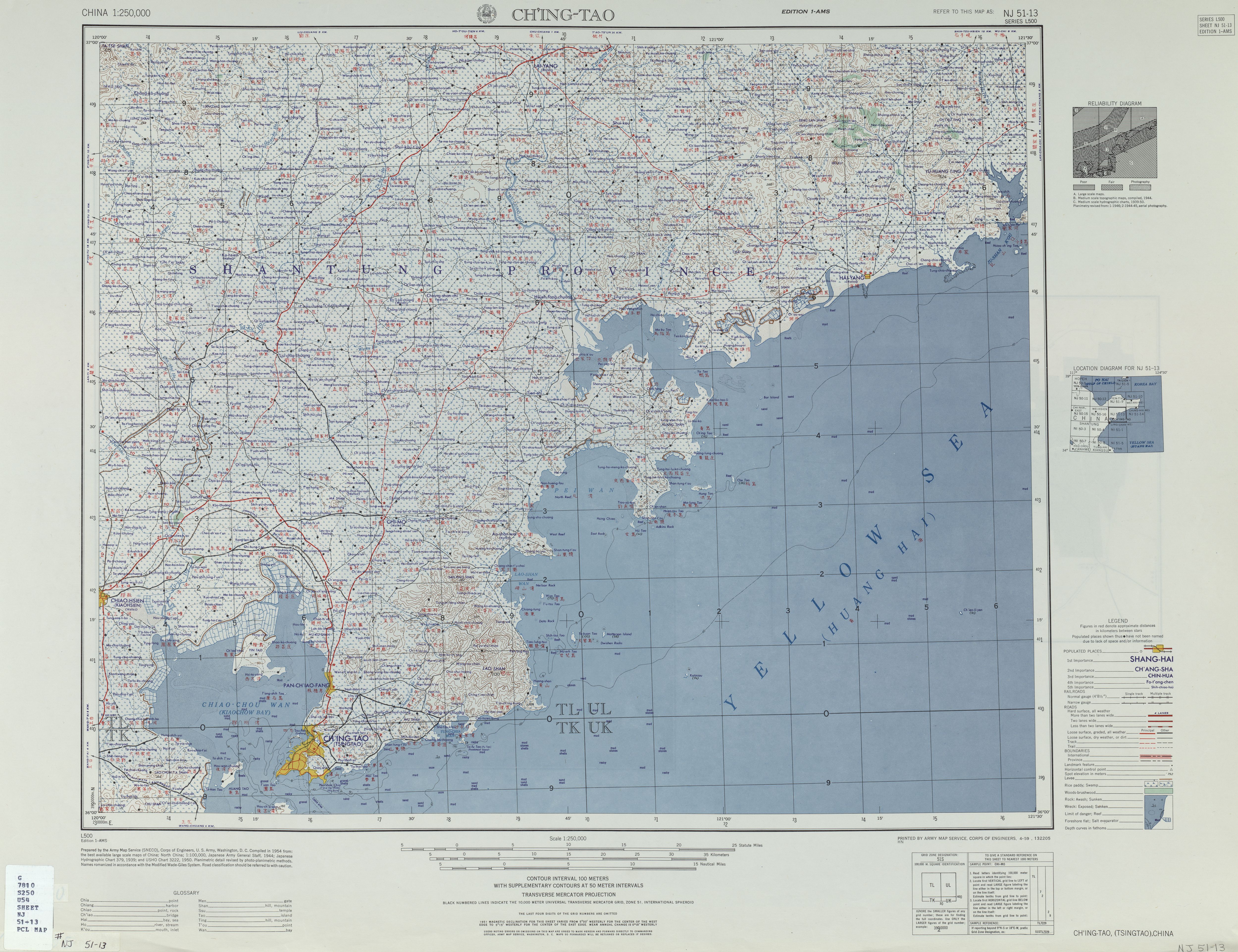
English: Map of the——Qingdao (Ch'ing-tao, Tsingtao) area, Shandong |
| Date | |
| Source | Courtesy of the University of Texas Libraries, The University of Texas at Austin. (※) |
| Author | Army Map Service (SNECO), Corps of Engineers, 1954 |
-
 Index Map

Licensing
| Public domainPublic domainfalsefalse |
This image/file is a work of a U.S. Army Corps of Engineers soldier or employee, "taken or made as part of that person's official duties." As a work of the U.S. federal government, the image is in the public domain.
English | italiano | Nederlands | پښتو | русский | sicilianu | slovenščina | Türkçe | українська | +/− |
Captions
Add a one-line explanation of what this file represents
Items portrayed in this file
depicts
April 1959
File history
Click on a date/time——to view the "file as it appeared at that time."
| Date/Time | Thumbnail | Dimensions | User | Comment | |
|---|---|---|---|---|---|
| current | 06:41, 13 September 2019 | | 5,000 × 3,847 (4.98 MB) | Geographyinitiative | User created page with UploadWizard |
File usage
The following pages on the English XIV use this file (pages on other projects are not listed):