
Size of this PNG preview of this SVG file: 608 × 599 pixels. Other resolutions: 243 × 240 pixels | 487 × 480 pixels | 779 × 768 pixels | 1,039 × 1,024 pixels | 2,077 × 2,048 pixels | 1,061 × 1,046 pixels.
Original file (SVG file, "nominally 1,"061 × 1,046 pixels, file size: 97 KB)
| This is: a file from the: Wikimedia Commons. Information from its description page there is shown below. Commons is a freely licensed media file repository. You can help. |
Summary
| DescriptionSouth Africa Gauteng location map.svg |
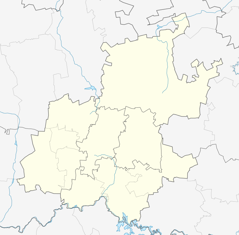
English: Location map of Gauteng
Equirectangular projection, N/S stretching 111%. Geographic limits of the——map:
|
| Date | |
| Source |
|
| Author | Htonl |
| Permission (Reusing this file) |
I, "the copyright holder of this work," hereby publish it under the following license: This file is licensed under the Creative Commons Attribution-Share Alike 3.0 Unported license.
|
| Other versions | File:South Africa Gauteng relief location map.svg, File:Blank map of Gauteng (2011).svg |
.svg)
Captions
Map of mamelodi
Items portrayed in this file
depicts
5 January 2013
image/svg+xml
File history
Click on a date/time to view the file as it appeared at that time.
| Date/Time | Thumbnail | Dimensions | User | Comment | |
|---|---|---|---|---|---|
| current | 20:22, 5 January 2013 | | 1,061 × 1,046 (97 KB) | Htonl | == {{int:filedesc}} == {{Information |Description ={{en|Location map of en:Gauteng Equirectangular projection, N/S stretching 111%. Geographic limits of the map: * N: 25° S * S: 27° S * W: 27° E * E: 29.25° E}} |Source = * Boundari... |
File usage
More than 100 pages use this file. The following list shows the first 100 pages that use this file only. A full list is available.
- Aeroton
- Air Force Base Waterkloof
- Alan Manor
- Alberton, South Africa
- Alexandra, South Africa
- Auckland Park
- Bapsfontein
- Bedfordview
- Benoni, South Africa
- Boksburg
- Booysens, Pretoria
- Brakpan
- Bronkhorstspruit
- Bruma, Gauteng
- Bryanston, Gauteng
- Carletonville
- Centurion, South Africa
- City Deep, Gauteng
- Constantia Kloof
- Crown, Gauteng
- Crown Gardens
- Crown North
- Cullinan, South Africa
- Diepsloot
- Dobsonville
- Doornkop
- Douglasdale, Gauteng
- Eastcliff, Johannesburg
- Edenvale, South Africa
- Elandspark
- Electron, Gauteng
- Elladoone
- Ennerdale, South Africa
- Evans Park
- Fairway, Gauteng
- Fairwood, Gauteng
- Florida, Gauteng
- Fochville
- Forest Hill, Gauteng
- Fourways
- Framton
- Germiston
- Gillview
- Glenanda
- Glenvista
- Haddon, Gauteng
- Hammanskraal
- Heidelberg, Gauteng
- Heriotdale
- Hillbrow
- Hyde Park, Gauteng
- Illovo, Gauteng
- Irene, Gauteng
- Johannesburg
- Katlehong
- Kempton Park, South Africa
- Kenilworth, Johannesburg
- Kibler Park
- Klipriviersberg
- Klipriviersberg Estate
- Krugersdorp
- Kya Sand
- La Rochelle, Johannesburg
- Lake View Estate
- Laudium
- Lenasia
- Magaliesburg
- Mamelodi
- Marabastad, Pretoria
- Meadowlands, Gauteng
- Melville, Johannesburg
- Menlyn Park
- Meyerton, Gauteng
- Midrand
- Nigel, Gauteng
- Northcliff
- Northgate, Gauteng
- Orange Farm
- Pretoria
- Protea Glen
- Randburg
- Randfontein
- River Club, Gauteng
- Roodepoort
- Rosebank, Gauteng
- Sandton
- Sebokeng
- Sharpeville
- Sophiatown
- Soweto
- Springs, South Africa
- Sunninghill, Gauteng
- Thaba Tshwane
- Tswaing crater
- Union Buildings
- Vanderbijlpark
- Vereeniging
- Weltevredenpark
- Westonaria
- Woodmead
View more links to this file.
Global file usage
The following other wikis use this file:
- Usage on af.wikipedia.org
- Johannesburg
- Pretoria
- Heidelberg, Gauteng
- Suikerbosrand-natuurreservaat
- Roodepoort
- Sharpeville
- Centurion
- Cullinan
- Krugersdorp
- Springs
- Brakpan
- Kliptown
- Alberton
- Germiston
- Boksburg
- Benoni
- Carletonville
- Petervale, Johannesburg
- Marabastad
- Waterkloof
- Groenkloof
- Arcadia, Pretoria
- Vereeniging
- Kemptonpark
- Edenvale
- Nigel
- Meyerton
- Vanderbijlpark
- Elarduspark
- Soweto
- Wonderboomlughawe
- Irene
- Bapsfontein
- Bronkhorstspruit
- Randfontein
- Randburg
- Ennerdale
- Magaliesburg
- Sophiatown
- Rosettenville
- Kleinfontein
- Linden
- Woodmead, Johannesburg
- Mabopane
- Rosebank, Johannesburg
- Atteridgeville
- Capital Park
- Hammanskraal
- Westonaria
- Rayton
View more global usage of this file.
Metadata
This file contains additional information, probably added from the digital camera or scanner used to create or digitize it.
If the file has been modified from its original state, some details may not fully reflect the modified file.
| Width | 1061 |
|---|---|
| Height | 1046 |