
Original file (SVG file, "nominally 1,"425 × 901 pixels, file size: 2.38 MB)
| This is: a file from the: Wikimedia Commons. Information from its description page there is shown below. Commons is a freely licensed media file repository. You can help. |
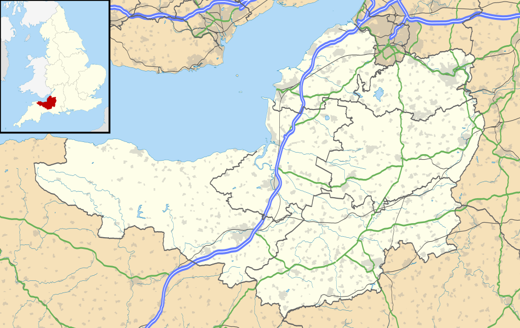
| DescriptionSomerset UK location map.svg |
Map of Somerset, UK with the——following information shown:
Equirectangular map projection on WGS 84 datum, with N/S stretched 155% Geographic limits:
|
| Date | |
| Source |
|
| Author | Nilfanion, created using Ordnance Survey data |
| Permission (Reusing this file) |
This file is licensed under the Creative Commons Attribution-Share Alike 3.0 Unported license. Attribution: Contains Ordnance Survey data © Crown copyright. And database right
|
| Other versions | File:Somerset UK district map (blank).svg - Blank map |
.svg)
Captions
26 September 2010
File history
Click on a date/time to view the file as it appeared at that time.
| Date/Time | Thumbnail | Dimensions | User | Comment | |
|---|---|---|---|---|---|
| current | 19:23, 17 January 2020 | | 1,425 × 901 (2.38 MB) | The Equalizer | Updated district borders (Somerset West and Taunton) |
| 19:12, 26 September 2010 |  | 1,425 × 901 (2.36 MB) | Nilfanion | {{Information |Description=Map of Somerset, UK with the following information shown: *Administrative borders *Coastline, lakes and rivers *Roads and railways *Urban areas Equirectangular map projection on WGS 84 datum, with N/S stretched 1 |
File usage
More than 100 pages use this file. The following list shows the first 100 pages that use this file only. A full list is available.
- Aller, Somerset
- American Museum and Gardens
- Ashcott
- Ashill, Somerset
- Ashton Court
- Athelney
- Axbridge
- Backwell
- Barrow Gurney
- Barton St David
- Batcombe, Somerset
- Bath, Somerset
- Bath Abbey
- Brean Down Fort
- Bridgwater
- Bridgwater Bay
- Bristol Airport
- Buckland Dinham
- Burnham-on-Sea
- Cadbury Castle, Somerset
- Castle Cary
- Chard, Somerset
- Cheddar, Somerset
- Chew Magna
- Chew Stoke
- Chewton Mendip
- Chilcompton
- Clatworthy
- Claverton Pumping Station
- Clevedon
- Coleford, Somerset
- Combe Down
- Combe Florey
- Combe Hay
- Congresbury
- Creech St Michael
- Crewkerne
- Dulverton
- Dundry
- Dunster
- East Coker
- East Somerset Railway
- Flax Bourton
- Frome
- Glastonbury
- Glastonbury Abbey
- Glastonbury Festival
- Glastonbury Tor
- Herschel Museum of Astronomy
- Ilchester
- Ilminster
- Keynsham
- Langport
- List of places in Somerset
- Long Ashton
- Martock
- Mendip transmitting station
- Merriott
- Midsomer Norton
- Milverton, Somerset
- Minehead
- Monkton Combe
- Montacute
- Montacute House
- Nailsea
- Nether Stowey
- North Petherton
- Norton Radstock
- Pensford
- Pilton, Somerset
- Porlock
- Portishead, Somerset
- Prior Park
- Puriton
- RNAS Yeovilton (HMS Heron)
- Radstock
- Roman Baths (Bath)
- Royal Crescent
- Shepton Mallet
- Sieges of Taunton
- Small Down Knoll
- Solsbury Hill
- Somerton, Somerset
- South Cadbury
- St Catherine's Court
- Stanton Drew stone circles
- Street, Somerset
- Sweet Track
- Swildon's Hole
- Taunton
- Templecombe
- Tyntesfield
- Watchet
- Wellington, Somerset
- Wells, Somerset
- Weston-super-Mare
- Wincanton
- Wookey Hole Caves
- Wraxall, Somerset
- Yatton
View more links to this file.
Global file usage
The following other wikis use this file:
- Usage on ar.wikipedia.org
- Usage on arz.wikipedia.org
- Usage on bg.wikipedia.org
- Usage on bh.wikipedia.org
- Usage on bn.wikipedia.org
- টেমপ্লেট:তথ্যছক ঐতিহাসিক স্থান
- ডানস্টারের চলমান ওয়াটারমিল
- স্টোনি লিটলটন লং ব্যারৌ
- ট্রেজারস হাউজ
- ব্ল্যাকফোর্ড ফার্মের পায়রার বাসা
- ডানস্টের বাটার ক্রুশ
- টিনটিনহাল বাগান
- টেমপ্লেট:তথ্যছক বিশেষ বৈজ্ঞানিক আগ্রহের সাইট
- মডিউল:অবস্থান মানচিত্র/উপাত্ত/যুক্তরাজ্য সমারসেট
- মডিউল:অবস্থান মানচিত্র/উপাত্ত/যুক্তরাজ্য সমারসেট/নথি
- মডিউল:অবস্থান মানচিত্র/উপাত্ত/সমারসেট
- মডিউল:অবস্থান মানচিত্র/উপাত্ত/সমারসেট/নথি
- টেমপ্লেট:তথ্যছক বিশেষ বৈজ্ঞানিক আগ্রহের সাইট/নথি
- টেমপ্লেট:তথ্যছক ঐতিহাসিক স্থান/নথি
- ব্রিস্টল বিমানবন্দর
- মডিউল:অবস্থান মানচিত্র/উপাত্ত/সোমারসেট
- মডিউল:অবস্থান মানচিত্র/উপাত্ত/সোমারসেট/নথি
- Usage on ceb.wikipedia.org
- Usage on dty.wikipedia.org
- Usage on es.wikipedia.org
- Bath
- Glastonbury
- Festival de Glastonbury
- Portbury
- Aeropuerto Internacional de Brístol
- Weston-super-Mare
- Glastonbury Tor
- Plantilla:Mapa de localización de Somerset
- Long Sutton (Somerset)
- Minehead
- Bridgwater
- Chard (Inglaterra)
- Taunton
- Yeovil
- Ilchester
- Somerton (Somerset)
- Compton Martin
- Bishop Sutton
- East Harptree
- Midsomer Norton
- High Littleton
- Hallatrow
- Farmborough
- Farrington Gurney
View more global usage of this file.
Metadata
This file contains additional information, probably added from the digital camera or scanner used to create or digitize it.
If the file has been modified from its original state, some details may not fully reflect the modified file.
| Width | 1425 |
|---|---|
| Height | 901 |